Agritrop
Accueil

Résultats pour : "télédétection"

Format d'export [feed] RSS 1.0 [feed] RSS 2.0
Grouper par : Année de publication | Type de document | Aucun
Aller à 2025 | 2024 | 2023 | 2022 | 2021 | 2020 | 2019 | 2018 | 2017 | 2016 | 2015 | 2014 | 2013 | 2012 | 2011 | 2010 | 2009 | 2008 | 2007 | 2006 | 2005 | 2004 | 2003 | 2002 | 2001 | 2000 | 1999 | 1998 | 1997 | 1996 | 1995 | 1994 | 1993 | 1992 | 1991 | 1990 | 1989 | 1988 | 1987 | 1986 | 1985 | 1984 | 1983 | 1982 | 1981 | 1980 | 1979 | 1977 | 1976 | 1974 | 1973 | 1967

Nombre de documents : 1047.

2025

Impact of Indonesia's forest management units on the reduction of forest loss and forest fires in Sulawesi. Chervier Colas, Atmadja Stibniati Soeria, Nofyanza Sandy, Nur Annisa Choiriatun, Nurfatriani Fitri, Kristiningrum Rochadi, Sahide Alif K. Sahide, Suhardiman Ali, Umar Syukur. 2025. Ecological Economics, 227:108418, 15 p.
[img]

2024

Approches spatiales de caractérisation de gisements forestiers en milieu tropical et contraint. Application à la valorisation en bois énergie d'Acacia mearnsii à la Réunion. Bley-Dalouman Hélène. 2024. Montpellier : Université de Montpellier, 190 p. Thèse de doctorat : Géomatique : Université de Montpellier
[img]

Combining UAV and sentinel-2 imagery for estimating millet FCover in an heterogeneous agricultural landscape of Senegal. Diack Ibrahima, Diene Serigne Mansour, Leroux Louise, Diouf Abdoul Aziz, Heuclin Benjamin, Roupsard Olivier, Letourmy Philippe, Audebert Alain, Sarr Idrissa, Diallo Moussa. 2024. IEEE Journal of Selected Topics in Applied Earth Observations and Remote Sensing, 17 : 7305-7322.
[img]
Prévisualisation

Design and performance of the Climate Change Initiative Biomass global retrieval algorithm. Santoro Maurizio, Cartus Olivier, Quegan Shaun, Kay Heather, Lucas Richard, Araza Arnan, Herold Martin, Labriere Nicolas, Chave Jérôme, Rosenqvist Ake, Tadono Takeo, Kobayashi Kazufumi, Kellndorfer Josef, Avitabile Valerio, Brown Hugh, Carreiras João M.B., Campbell Michael J., Cavlovic Jura, da Conceição Bispo Polyanna, Gilani Hammad, Latif Khan Mohammed, Kumar Amit, Lewis Simon L., Liang Jingjing, Mitchard Edward T.A., Pacheco-Pascagaza Ana Maria, Phillips Oliver L., Ryan Casey M., Saikia Purabi, Schepaschenko Dmitry, Sukhdeo Hansrajie, Verbeeck Hans, Vieilledent Ghislain, Wijaya Arief, Willcock Simon, Seifert Frank Martin. 2024. Science of Remote Sensing, 10:100169, 24 p.
[img]
Prévisualisation

Discriminating Robusta coffee (Coffea canephora) cropping systems using leaf-level hyperspectral data. Kebede Getachew, Mudereri Bester Tawona, Abdel-Rahman Elfatih M., Mutanga Onisimo, Landmann Tobias, Odindi John, Motisi Natacha, Pinard Fabrice, Tonnang Henri E.Z.. 2024. Journal of Applied Remote Sensing, 18 (4), 17 p.
[img]

Effects of Eucalyptus plantation characteristics and environmental factors on GEDI waveform metrics. Manizheh Rajab Pourrahmati, Le Maire Guerric, Baghdadi Nicolas, Ferraço Scolforo Henrique, Alcarde Alvares Clayton, Stape Jose Luiz, Fayad Ibrahim. 2024. International Journal of Remote Sensing, 45 (11) : 3737-3763.
[img]

Environmental factors associated to breeding areas of the South American locust Schistocerca cancellata on a regional scale. Scattolini Maria Celeste, Piou Cyril, Medina Héctor, Iglesias Rosario, Cerquetti Alina, Cigliano Maria Marta. 2024. Austral Ecology, 49 (8):e13568, 18 p.
[img]

Estimating herbaceous aboveground biomass using an indirect method based on the herbaceous layer characteristic. Diatta Ousmane, N'Goran Adjoua Ange-Jokébed, Fassinou Cofélas, Salgado Paulo, Ndiaye Ousmane, Diatta Sekouna, Ngom Daouda, Tagesson Torbern, Taugourdeau Simon. 2024. Biomass, 4 (4), n.spéc. Innovative Systems for Biomass Crop Production and Use : 1191-1199.
[img]
Prévisualisation

Exploring fine-scale urban landscapes using satellite data to predict the distribution of Aedes mosquito breeding sites. Teillet Claire, Devillers Rodolphe, Tran Annelise, Catry Thibault, Marti Renaud, Dessay Nadine, Rwagitinywa Joseph, Restrepo Johana, Roux Emmanuel. 2024. International Journal of Health Geographics, 23:18, 20 p.
[img]
Prévisualisation

Generating high-resolution land use and land cover maps for the greater Mariño watershed in 2019 with machine learning. Vallet Ameline, Dupuy Stéphane, Verlynde Matthieu, Gaetano Raffaele. 2024. Scientific Data, 11:915, 14 p.
[img]
Prévisualisation

Global observation gaps of peatland greenhouse gas balances: Needs and obstacles. Zhao Junbin, Weldon Simon, Barthelmes Alexandra, Swails Erin, Hergoualc'H Kristell Anaïk, Mander Ulo, Qiu Chunfang, Connolly John, Silver Whendee L., Campbell David I.. 2024. Biogeochemistry, 167 : 427-442.
[img]
Prévisualisation
[img]
Prévisualisation

Human degradation of tropical moist forests is greater than previously estimated. Bourgoin Clément, Ceccherini Guido, Girardello M., Vancutsem Christelle, Avitabile Valerio, Beck P.S.A., Beuchle R., Blanc Lilian, Duveiller G., Migliavacca Mirco, Vieilledent Ghislain, Cescatti Alessandro, Achard Frédéric. 2024. Nature, 631 : 570-576.
[img]
Prévisualisation

Insight into large-scale LULC changes and their drivers through breakpoint characterization. An application to Senegal. Ngadi Scarpetta Yasmine, Lebourgeois Valentine, Dieye Mohamadou, Laques Anne-Elisabeth, Begue Agnès. 2024. International Journal of Applied Earth Observation and Geoinformation, 132:104066, 21 p.
[img]
Prévisualisation

Integration of very high-resolution stereo satellite images and airborne or satellite Lidar for Eucalyptus canopy height estimation. Manizheh Rajab Pourrahmati, Baghdadi Nicolas, Ferraço Scolforo Henrique, Alcarde Alvares Clayton, Stape Jose Luiz, Fayad Ibrahim, Le Maire Guerric. 2024. Science of Remote Sensing, 10:100170, 12 p.
[img]
Prévisualisation

Linking intrinsic scales of ecological processes to characteristic scales of biodiversity and functioning patterns. Zelnik Yuval R., Barbier Matthieu, Shanafelt David W., Loreau Michel, Germain Rachel M.. 2024. Oikos, 2024 (3):e10514, 12 p.
[img]
Prévisualisation

Mapping and monitoring peatland conditions from global to field scale. Minasny Budiman, Adetsu Diana Vigah, Aitkenhead Matt, Artz Rebekka R. E., Baggaley Nikki, Barthelmes Alexandra, Beucher Amélie, Caron Jean, Conchedda Giulia, Connolly John, Deragon Raphaël, Evans Chris, Fadnes Kjetil, Fiantis Dian, Gagkas Zisis, Gilet Louis, Gimona Alessandro, Glatzel Stephan, Greve Mogens H., Habib Wahaj, Hergoualc'H Kristell Anaïk, Hermansen Cecilie, Kidd Darren B., Koganti Triven, Kopansky Dianna, Large David J., Larmola Tuula, Lilly Allan, Liu Haojie, Marcus Matthew, Middleton Maarit, Morrison Keith, Petersen Rasmus Jes, Quaife Tristan, Rochefort Line, Rudiyanto, Toca Linda, Tubiello Francesco N., Weber Peter Lystbæk, Weldon Simon, Widyatmanti Wirastuti, Williamson Jenny, Zak Dominik. 2024. Biogeochemistry, 167 : 383-425.
[img]
Prévisualisation
[img]
Prévisualisation

Mapping stem volume in fast-growing eucalypt plantations: Integrating spectral, textural, and temporal remote sensing information with forest inventories and spatial models. Lanzi Alo Livia, Le Maire Guerric, Thiersch Cláudio Roberto, Santos Mota Thiago, Costa Pinheiro Rafael, de Souza Passos José Raimundo. 2024. Annals of Forest Science, 81:43, 16 p.
[img]
Prévisualisation

Quantifying the impact of Great Green Wall and Corporate plantations on tree density and biomass in Sahelian Senegal. Cofélas Fassinou Fréjuste Joseph, Cesaro Jean-Daniel, Nungi-Pambu Maïalicah, Fensholt Rasmus, Brandt Martin, Akodewou Amah, Diouf Abdoul Aziz, Mbaye Tamsir, Taugourdeau Simon. 2024. Trees, Forests and People, 16:100569, 13 p.
[img]
Prévisualisation

Radiometric landscape: a new conceptual framework and operational approach for landscape characterisation and mapping. Lemettais Louise, Alleaume Samuel, Luque Sandra, Laques Anne-Elisabeth, Alim Yonas, Demagistri Laurent, Bégué Agnès. 2024. Geo-spatial Information Science, 23 p.
[img]
Prévisualisation

Regional model to predict sugarcane yield using sentinel‑2 imagery in São Paulo State, Brazil. Amaro Rafaella Pironato, Christina Mathias, Todoroff Pierre, Le Maire Guerric, Fiorio Peterson Ricardo, De Carvalho Pereira Ester, Dos Santos Luciano Ana Claudia. 2024. Sugar Tech, 11 p.
[img]

Remote sensing-based assessment of dry-season forage quality for improved rangeland management in sahelian ecosystems. Lo Adama, Diouf Abdoul Aziz, Leroux Louise, Tagesson Torbern, Fensholt Rasmus, Mottet Anne, Bonnal Laurent, Diédhiou Ibrahima. 2024. Rangeland Ecology and Management, 96 : 94-104.
[img]
Prévisualisation

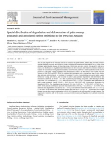
Spatial distribution of degradation and deforestation of palm swamp peatlands and associated carbon emissions in the Peruvian Amazon. Marcus Matthew S., Hergoualc'H Kristell Anaïk, Honorio Coronado Eurídice N., Gutiérrez-Vélez Víctor Hugo. 2024. Journal of Environmental Management, 351:119665, 13 p.
[img]
Prévisualisation

Spatial mechanistic modelling to simulate movements and contacts between wildlife and livestock in Southern Africa. Rumiano Florent, Miguel Eve, Dufleit Victor, Degenne Pascal, Gaucherel Cédric, Valls Fox Hugo, De Garine-Wichatitsky Michel, Gandiwa Edson, Caron Alexandre, Tran Annelise. 2024. Ecological Modelling, 498:110863, 15 p.
[img]
Prévisualisation

Spatiotemporal analysis of wildfires and their relationship with climate and land use in the Gran Chaco and Pantanal ecoregions. Vidal-Riveros Cristina, Currey Bryce, McWethy David B., Ngo Bieng Marie-Ange, Souza-Alonso Pablo. 2024. Science of the Total Environment, 955:176823, 13 p.
[img]
Prévisualisation

Tropical peatland water table estimations from space. Koupaei-Abyazani Nikaan, Burdun Iuliia, Desai Ankur R., Hergoualc'H Kristell Anaïk, Hirano Takashi, Melling Lulie, Swails Erin, Tang Angela Che Ing, Wong Guan Xhuan. 2024. Journal of Geophysical Research: Biogeosciences, 129 (6):e2024JG008116, 22 p.
[img]
Prévisualisation

Use of GEDI signal and environmental parameters to improve canopy height estimation over tropical forest ecosystems in Mayotte Island. Lahssini Kamel, Baghdadi Nicolas, Le Maire Guerric, Dupuy Stéphane, Fayad Ibrahim. 2024. Canadian Journal of Remote Sensing, 50 (1):2351004, 22 p.
[img]
Prévisualisation

An assessment of recent peat forest disturbances and their drivers in the Cuvette Centrale, Africa. Nesha Karimon, Herold Martin, Reiche Johannes, Masolele Robert N., Hergoualc'H Kristell Anaïk, Swails Erin, Murdiyarso Daniel, Ewango Corneille. 2024. Environmental Research Letters, 19 (10):104031, 25 p.
[img]
Prévisualisation

A calibration protocol for soil-crop models. Wallach Daniel, Buis Samuel, Seserman Diana‑Maria, Palosuo Taru, Thorburn Peter J., Mielenz Henrike, Justes Eric, Kersebaum Kurt Christian, Dumont Benjamin, Launay Marie, Seidel Sabine Julia. 2024. Environmental Modelling and Software, 180:106147, 11 p.
[img]

The effect of a political crisis on performance of community forests and protected areas in Madagascar. Neugarten Rachel A., Rasolofoson Ranaivo A., Barrett Christopher B., Vieilledent Ghislain, Rodewald Amanda D.. 2024. Nature Communications, 15:2963, 13 p.
[img]
Prévisualisation

A framework for national-scale predictions of forage dry mass in Senegal: UAVs an intermediate step between field measurements and Sentinel-2 images. Nungi-Pambu Maïalicah, Lo Adama, Fassinou Cofélas, Tageson Torbern, Fensholt Rasmus, Diouf Abdoul Aziz, Menassol Jean-Baptiste, Assouma Mohamed Habibou, Touré Ibra, Taugourdeau Simon. 2024. International Journal of Remote Sensing, 45 (13) : 4199-4218.
[img] [img]

The global distribution and drivers of wood density and their impact on forest carbon stocks. Mo Lidong, Crowther Thomas W., Maynard Daniel S., van den Hoogen Johan, Ma Haozhi, Bialic-Murphy Lalasia, Liang Jingjing, de-Miguel Sergio, Nabuurs Gert-Jan, Reich Peter B., Phillips Oliver L., Abegg Meinrad, Adou Yao Yves C., Alberti Giorgio, Almeyda Zambrano Angélica María, Alvarado Braulio Vilchez, Álvarez-Dávila Esteban, Alvarez-Loayza Patricia, Alves Luciana F., Amaral Îeda, Ammer Christian, Antón-Fernández Clara, Araujo-Murakami Alejandro, Arroyo Luzmila, Avitabile Valerio, Aymard Gerardo A., Baker Timothy R., Bałazy Radomir, Banki Olaf, Barroso Jorcely G., Bastian Meredith L., Bastin Jean-François, Birigazzi Luca, Birnbaum Philippe, Bitariho Robert, Boeckx Pascal, Bongers Frans, Boonman Coline C. F., Bouriaud Olivier, Brancalion Pedro H.S., Brandl Susanne, Brearley Francis Q., Brienen Roel, Broadbent Eben North, Bruelheide Helge, Bussotti Filippo, Cazzolla Gatti Roberto, César Ricardo G., Cesljar Goran, Chazdon Robin, Chen Han Y. H., Chisholm Chelsea, Cho Hyunkook, Cienciala Emil, Clark Connie, Clark David, Colletta Gabriel D., Coomes David A., Cornejo Valverde Fernando, Corral-Rivas José Javier, Crim Philip M., Cumming Jonathan R., Dayanandan Selvadurai, De Gasper André Luis, Decuyper Mathieu, Derroire Géraldine, DeVries Ben, Djordjevic Ilija, Dolezal Jiri, Dourdain Aurélie, Engone Obiang Nestor Laurier, Enquist Brian J., Eyre Teresa J., Fandohan Adandé Belarmain, Fayle Tom M., Feldpausch Ted R., Ferreira Leandro V., Finér Leena, Fischer Markus, Fletcher Christine, Frizzera Lorenzo, Gamarra Javier Garcia Perez, Gianelle Damiano, Glick Henry B., Harris David J., Hector Andrew, Hemp Andreas, Hengeveld Geerten, Herault Bruno, Herbohn John, Herold Martin, Hietz Peter, Hillers Annika, Honorio Coronado Eurídice N., Hui Cang, Ibanez Thomas, Imai Nobuo, Jagodzinski Andrzej M., Jaroszewicz Bogdan, Johannsen Vivian Kvist, Joly Carlos Alfredo, Jucker Tommaso, Jung Ilbin, Karminov Viktor, Kartawinata Kuswata, Kearsley Elizabeth, Kenfack David, Kennard Deborah K., Kepfer-Rojas Sebastian, Keppel Gunnar, Latif Khan Mohammed, Killeen Timothy J., Kim Hyun Seok, Kitayama Kanehiro, Köhl Michael, Korjus Henn, Kraxner Florian, Kucher Dmitry, Laarmann Diana, Lang Mait, Lewis Simon L., Li Yuanzhi, Lopez-Gonzalez Gabriela, Lu Huicui, Lukina Natalia, Maitner Brian S., Malhi Yadvinder, Marcon Eric, Marimon Beatriz Schwantes, Marimon-Junior Ben Hur, Marshall Andrew Robert, Martin Emanuel H., McCarthy James K., Meave Jorge A., Melo-Cruz Omar, Mendoza Casimiro, Mendoza-Polo Irina, Miscicki Stanislaw, Merow Cory, Monteagudo Mendoza Abel, Moreno Vanessa S., Mukul Sharif A., Mundhenk Philip, Nava-Miranda Maria Guadalupe, Neill David, Neldner Victor J., Nevenic Radovan V., Ngugi Michael R., Niklaus Pascal A., Ontikov Petr, Ortiz-Malavasi Edgar, Pan Yude, Paquette Alain, Parada-Gutierrez Alexander, Parfenova Elena I., Park Minjee, Parren Marc, Parthasarathy Narayanaswamy, Peri Pablo L., Pfautsch Sebastian, Picard Nicolas, Piedade Maria Teresa F., Piotto Daniel, Pitman Nigel C.A., Poorter Lourens, Poulsen Axel Dalberg, Poulsen John R., Pretzsch Hans, Ramirez Arevalo Freddy, Restrepo-Correa Zorayda, Richardson Sarah J., Rodeghiero Mirco, Rolim Samir, Roopsind Anand, Rovero Francesco, Rutishauser Ervan, Saikia Purabi, Salas-Eljatib Christian, Saner Philippe, Schall Peter, Schelhaas Mart-Jan, Schepaschenko Dmitry, Scherer-Lorenzen Michael, Schmid Bernhard, Schöngart Jochen, Searle Eric B., Seben Vladimir, Serra-Diaz Josep M., Sheil Douglas, Shvidenko Anatoly Z., Da Silva Ana Carolina, Silva-Espejo Javier, Silveira Marcos, Singh James, Sist Plinio, et al.. 2024. Nature Ecology and Evolution, 22 p.
[img]
Prévisualisation

2023

Advances in plant imaging across scales. Soltis Pamela S., Teixeira‐Costa Luiza, Bonnet Pierre, Nelson Gil. 2023. Applications in Plant Sciences, 11 (5), n.spéc. Advances in Plant Imaging across Scales:11550, 4 p.
[img]
Prévisualisation

BFASTm-L2, an unsupervised LULCC detection based on seasonal change detection - An application to large-scale land acquisitions in Senegal. Ngadi Scarpetta Yasmine, Lebourgeois Valentine, Laques Anne-Elisabeth, Dieye Mohamadou, Bourgoin Jeremy, Bégué Agnès. 2023. International Journal of Applied Earth Observation and Geoinformation, 121:103379, 14 p.
[img]
Prévisualisation

Characterization of rice yield based on biomass and SPAD-based leaf nitrogen for large genotype plots. Duque Andres F., Patino Diego, Colorado Julian D., Petro Eliel, Rebolledo Maria Camila, Mondragon Ivan F., Espinosa Natalia, Amezquita Nelson, Puentes Oscar D., Mendez Diego, Jaramillo-Botero Andres. 2023. Sensors, 23 (13), n.spéc. Sensors and Artificial Intelligence in Smart Agriculture:5917, 21 p.
[img]
Prévisualisation

Diameter, height and species of 42 million trees in three European landscapes generated from field data and airborne laser scanning data [version 2; peer review: 2 approved]. Aussenac Raphaël, Monnet Jean-Matthieu, Klopcic Matija, Hawryło Pawel, Socha Jarosław, Mahnken Mats, Gutsch Martin, Cordonnier Thomas, Vallet Patrick. 2023. Open Research Europe, 3:32, 37 p.
[img]
Prévisualisation

Effect of land use change on carbon stocks in an agricultural region of southern Benin. Houssoukpèvi Issiakou Alladé, Le Maire Guerric, Aholoukpè Hervé Nonwègnon Sayimi, Fassinou Démayi Jorès Mauryo, Amadji Guillaume Lucien, Chapuis-Lardy Lydie, Chevallier Tiphaine. 2023. Land Degradation and Development, 34 (5) : 1447-1463.
[img] [img]
Prévisualisation

Enhancing monitoring of mangrove spatiotemporal tree diversity and distribution patterns. Pimple Uday, Simonetti Dario, Peters Ronny, Berger Uta, Podest Erika, Gond Valéry. 2023. Land Degradation and Development, 34 (5) : 1265-1282.
[img] [img]

Envisaging a global infrastructure to exploit the potential of digitised collections. Groom Quentin, Dillen Mahtias, Addink Wouter, Ariño Arturo H., Bölling Christian, Bonnet Pierre, Cecchi Lorenzo, Ellwood Elizabeth R., Figueira Rui, Gagnier Pierre-Yves, Grace Olwen, Güntsch Anton, Hardy Helen, Huybrechts Pieter, Hyam Roger, Joly Alexis, Kommineni Vamsi Krishna, Larridon Isabel, Livermore Laurence, Lopes Ricardo Jorge, Meeus Sofie, Miller Jeremy, Milleville Kenzo, Panda Renato, Pignal Marc, Poelen Jorrit, Ristevski Blagoj, Robertson Tim, Rufino Ana C., Santos Joaquim, Schermer Maarten, Scott Ben, Seltmann Katja Chantre, Teixeira Heliana, Trekels Maarten, Gaikwad Jitendra. 2023. Biodiversity Data Journal, 11:e109439, 29 p.
[img]
Prévisualisation

Forest landscape restoration: Spectral behavior and diversity of tropical tree cover classes. Eiti Haneda Leo, Brancalion Pedro H.S., Molin Paulo G., Pinheiro Ferreira Matheus, Silva Carlos Alberto, Torres de Almeida Catherine, Faria Resende Angelica, Brossi Santoro Giulio, Rosa Marcos R., Guillemot Joannès, Le Maire Guerric, Feret Jean Baptiste, Alves de Almeida Danilo Roberti. 2023. Remote Sensing Applications. Society and Environment, 29:100882, 15 p.
[img]

Giants of the Amazon: How does environmental variation drive the diversity patterns of large trees? Borges de Lima Robson, Bastos Gorgens Eric, da Silva Diego Armando S., Pereira de Oliveira Cinthia, Batista Anderson Pedro B., Caraciolo Ferreira Rinaldo Luiz, Costa Flávia R.C, Ferreira de Lima Renato A., Da Silva Aparício Perseu, de Abreu Jadson Coelho, Da Silva José Antonio Alberto, Guimaraes Aretha Franklin, Fearnside Philip M., Sousa Thaiane R., Perdiz Ricardo, Higuchi Niro, Berenguer Erika, Resende Angélica F., Elias Fernando, Volkmer de Castilho Carolina, Brilhante de Medeiros Marcelo, de Matos Filho João Ramos, Alves Sardinha Maurício, Furtado Freitas Márcio André, da Silva José Jussian, Pereira da Cunha Aldemir, Mendes Santos Renan, Esquivel Muelbert Adriane, Carneiro Guedes Marcelino, Imbrózio Reinaldo, Campelo de Sousa Carla Samara, Campelo da Silva Aparício Wegliane, Marques da Silva e Silva Breno, Silva Celice Alexandre, Marimon Beatriz Schwantes, Marimon-Junior Ben Hur, Morandi Paulo, Storck-Tonon Danielle, Guimarães Vieira Ima Célia, Schietti Juliana, Coelho Fernanda, Alves de Almeida Danilo Roberti, Castro Wendeson, Carvalho Samuel P. C., da Silva Robson dos Santos A., Silveira Juliana M., Camargo Jose Luis C., Melgaço Karina, Mazzei de Freitas Lucas Jose, Vedovato Laura, Benchimol Maíra, de Oliveira de Almeida Gabriel, Prance Ghillean, da Silveira Alan Bernardes, Fragomeni Simon Marcelo, Garcia Marcos Leandro, Silveira Marcos, Vital Marcos, Andrade Maryane B. T., Silva Natalino, Oliveira de Araújo Raimunda, Cavalheiro Larissa, Carpanedo Rainiellen, Fernandes Letícia, Manzatto Angelo Gilberto, de Andrade Ricardo T. G., Magnusson William E, Laurance Bill, Nelson Bruce Walker, Peres Carlos, Daly Douglas C., Rodrigues Domingos, Zopeletto Ana Paula, Almeida de Oliveira Edmar, Dugachard Estelle, Rodrigues Barbosa Flávia, Santana Flavia, do Amaral Iêda Leão, Ferreira Leandro V., Charão Leandro S., Ferreira Joice Nunes, Barlow Jos, Blanc Lilian, Aragao Luiz E.O.C., Sist Plinio, et al.. 2023. Global Change Biology, 29 (11) : 4861-4879.
[img]

How well do EO-based food security warning systems for food security agree? Comparison of NDVI-based vegetation anomaly maps in West Africa. Bégué Agnès, Madec Simon, Lemettais Louise, Leroux Louise, Interdonato Roberto, Becker-Reshef Inbal, Barker Brian, Justice Christina, Kerdiles Hervé, Meroni Michele. 2023. IEEE Journal of Selected Topics in Applied Earth Observations and Remote Sensing, 16 : 1641-1653.
[img]
Prévisualisation

Integrated global assessment of the natural forest carbon potential. Mo Lidong, Zohner Constantin M., Reich Peter B., Liang Jingjing, De Miguel Sergio, Nabuurs Gert-Jan, Renner Susanne S., van den Hoogen Johan, Araza Arnan, Herold Martin, Mirzagholi Leila, Ma Haozhi, Averill Colin, Phillips Oliver L., Gamarra Javier Garcia Perez, Hordijk Iris, Routh Devin, Abegg Meinrad, Adou Yao C.Y., Alberti Giorgio, Almeyda Zambrano Angélica María, Alvarado Braulio Vilchez, Álvarez-Dávila Esteban, Alvarez-Loayza Patricia, Alves Luciana F., Amaral Iêda Leão, Ammer Christian, Antón-Fernández Clara, Araujo-Murakami Alejandro, Arroyo Luzmila, Avitabile Valerio, Aymard Gerardo A., Baker Timothy R., Bałazy Radomir, Banki Olaf, Barroso Jorcely, Bastian Meredith, Bastin Jean-François, Birigazzi Luca, Birnbaum Philippe, Bitariho Robert, Boeckx Pascal, Bongers Frans, Bouriaud Olivier, Brancalion Pedro H.S., Brandl Susanne, Brearley Francis Q., Brienen Roel, Broadbent Eben North, Bruelheide Helge, Bussotti Filippo, Cazzolla Gatti Roberto, César Ricardo G., Cesljar Goran, Chazdon Robin L., Chen Han Y. H., Chisholm Chelsea, Cho Hyunkook, Cienciala Emil, Clark Connie J., Clark David B., Colletta Gabriel D., Coomes David A., Cornejo Valverde Fernando, Corral-Rivas José Javier, Crim Philip, Cumming Jonathan, Dayanandan Selvadurai, De Gasper André Luis, Decuyper Mathieu, Derroire Géraldine, DeVries Ben, Djordjevic Ilija, Dolezal Jiri, Dourdain Aurélie, Engone Obiang Nestor Laurier, Enquist Brian, Eyre Teresa J., Belarmain Fandohan Adandé, Fayle Tom M., Feldpausch Ted R., Ferreira Leandro V., Finér Leena, Fischer Markus, Fletcher Christine, Frizzera Lorenzo, Gianelle Damiano, Glick Henry B., Harris David, Hector Andrew, Hemp Andreas, Hengeveld Geerten M., Herault Bruno, Herbohn John, Hillers Annika, Honorio Coronado Eurídice N., Hui Cang, Ibanez Thomas, Imai Nobuo, Jagodzinski Andrzej M., Jaroszewicz Bogdan, Johansen Kasper, Joly Carlos Alfredo, Jucker Tommaso, Jung Ilbin, Karminov Viktor, Kartawinata Kuswata, Kearsley Elizabeth, Kenfack David, Kennard Deborah K., Kepfer-Rojas Sebastian, Keppel Gunnar, Latif Khan Mohammed, Killeen Timothy J., Seok Kim Hyun, Kitayama Kanehiro, Köhl Michael, Korjus Henn, Kraxner Florian, Kucher Dmitry, Laarmann Diana, Lang Mait, Lu Huicui, Lukina Natalia, Maitner Brian S., Malhi Yadvinder, Marcon Eric, Marimon Beatriz Schwantes, Marimon-Junior Ben Hur, Marshall Andrew Robert, Martin Emanuel, Meave Jorge A., Melo-Cruz Omar, Mendoza Casimiro, Mendoza-Polo Irina, Miscicki Stanislaw, Merow Cory, Monteagudo Mendoza Abel, Moreno Vanessa S., Mukul Sharif A., Mundhenk Philip, Nava-Miranda Maria Guadalupe, Neill David, Neldner Victor J., Nevenic Radovan V., Ngugi Michael R., Niklaus Pascal A., Oleksyn Jacek, Ontikov Petr V., Ortiz-Malavasi Edgar, Pan Yude, Paquette Alain, Parada-Gutierrez Alexander, Parfenova Elena I., Park Minjee, Parren Marc, Parthasarathy Narayanaswamy, Peri Pablo Luis, Pfautsch Sebastian, Picard Nicolas, Piedade Maria Teresa F., Piotto Daniel, Pitman Nigel C.A., Dalberg Poulsen Axel, Poulsen John R., Pretzsch Hans, Ramirez Arevalo Freddy, Restrepo-Correa Zorayda, Rodeghiero Mirco, Rolim Samir, Roopsind Anand, Rovero Francesco, Rutishauser Ervan, Saikia Purabi, Salas-Eljatib Christian, Saner Philippe, Schall Peter, Schelhaas Mart-Jan, Schepaschenko Dmitry, Scherer-Lorenzen Michael, Schmid Bernhard, Schöngart Jochen, Searle Eric B., Seben Vladimir, Serra-Diaz Josep M., Sheil Douglas, Shvidenko Anatoly Z., Silva-Espejo Javier, Silveira Marcos, Singh James, Sist Plinio, et al.. 2023. Nature, 624 : 92-101.
[img]
Prévisualisation
[img]
Prévisualisation

Les observatoires fonciers en Afrique : un outil de gouvernance des territoires face aux réalités du terrain. Grislain Quentin, Bourgoin Jeremy, Magrin Géraud, Burnod Perrine, Anseeuw Ward. 2023. Bulletin de l'Association de Géographes Français, 100 (1) : 76-91.
[img]
Prévisualisation

More than one quarter of Africa's tree cover is found outside areas previously classified as forest. Reiner Florian, Brandt Martin, Tong Xiaoye, Skole David, Kariryaa Ankit, Ciais Philippe, Davies Andrew, Hiernaux Pierre, Chave Jérôme, Mugabowindekwe Maurice, Igel Christian, Oehmcke Stefan, Gieseke Fabian, Li Sizhuo, Liu Siyu, Saatchi Sassan, Boucher Peter, Singh Jenia, Taugourdeau Simon, Dendoncker Morgane, Song Xiao-Peng, Mertz Ole, Tucker Compton J., Fensholt Rasmus. 2023. Nature Communications, 14:2258, 10 p.
[img]
Prévisualisation

Multi-sensor airborne lidar requires intercalibration for consistent estimation of light attenuation and plant area density. Vincent Grégoire, Verley Philippe, Brede Benjamin, Delaitre Guillaume, Maurent Eliott, Ball James, Clocher Ilona, Barbier Nicolas. 2023. Remote Sensing of Environment, 286:113442, 14 p.
[img]

Multisensor temporal unsupervised domain adaptation for land cover mapping with spatial pseudo-labeling and adversarial learning. Capliez Emmanuel, Ienco Dino, Gaetano Raffaele, Baghdadi Nicolas, Hadj Salah Adrien, Le Goff Matthieu, Chouteau Florient. 2023. IEEE Transactions on Geoscience and Remote Sensing, 61:5405716 : 1-16.
[img]
Prévisualisation

Predicting global distributions of eukaryotic plankton communities from satellite data. Kaneko Hiroto, Endo Hisashi, Henry Nicolas, Berney Cédric, Mahe Frédéric, Poulain Julie, Labadie Karine, Beluche Odette, El Hourany Roy, Acinas Silvia G., Babin Marcel, Bork Peer, Bowler Chris, Cochrane Guy, de Vargas Colomban, Gorsky Gabriel, Guidi Lionel, Grimsley Nigel, Hingamp Pascal, Iudicone Daniele, Jaillon Olivier, Kandels Stefanie, Karsenti Eric, Not Fabrice, Poulton Nicole, Pesant Stéphane, Sardet Christian, Speich Sabrina, Stemmann Lars, Sullivan Matthew B., Sunagawa Shinichi, Chaffron Samuel, Wincker Patrick, Nakamura Ryosuke, Karp-Boss Lee, Boss Emmanuel, Bowler Chris, de Vargas Colomban, Tomii Kentaro, Ogata Hiroshi Y.. 2023. ISME Communications, 3 (1), 9 p.
[img]
Prévisualisation

Priority science can accelerate agroforestry as a natural climate solution. Terasaki Hart Drew, Yeo Samantha, Almaraz Maya, Beillouin Damien, Cardinael Rémi, Garcia Edenise, Kay Sonja, Taylor Lovell Sarah, Rosenstock Todd, Sprenkle-Hyppolite Starry, Stolle Fred, Suber Marta, Thapa Bhuwan, Wood Stephen, Cook‐Patton Susan C.. 2023. Nature Climate Change, 13 : 1179-1190.

Rethinking the nature of intraspecific variability and its consequences on species coexistence. Girard-Tercieux Camille, Marechaux Isabelle, Clark Adam T., Clark James S., Courbaud Benoît, Fortunel Claire, Guillemot Joannès, Kunstler Georges, Le Maire Guerric, Pélissier Raphaël, Rüger Nadja, Vieilledent Ghislain. 2023. Ecology and Evolution, 13 (3):e9860, 18 p.
[img]
Prévisualisation

Sense-making and shaping of temporary wetlands: A socio-hydrological analysis of dichotomous ontologies of merjas in Morocco. Choukrani Hajar, Lacombe Guillaume, Zwarteveen Margreet, Kuper Marcel, Taky Abdelilah, Hammani Ali. 2023. Journal of Hydrology, 627:130434, 14 p.
[img]

Solar-induced chlorophyll fluorescence detects photosynthesis variations and drought effects in tropical rubber plantation and natural deciduous forests. Wang Xueqiang, Blanken Peter D., Wood Jeffrey D., Nouvellon Yann, Thaler Philippe, Kasemsap Poonpipope, Chidthaisong Amnat, Petchprayoon Pakorn, Chayawat Chompunut, Xiao Jingfeng, Li Xing. 2023. Agricultural and Forest Meteorology, 339:109591, 14 p.
[img]

Temporal-domain adaptation for satellite image time-series land-cover mapping with adversarial learning and spatially aware self-training. Capliez Emmanuel, Ienco Dino, Gaetano Raffaele, Baghdadi Nicolas, Salah Adrien Hadj. 2023. IEEE Journal of Selected Topics in Applied Earth Observations and Remote Sensing, 16 : 3645-3675.
[img]
Prévisualisation

Toward a forest biomass reference measurement system for remote sensing applications. Labriere Nicolas, Davies Stuart J., Disney Mathias, Duncanson Laura, Herold Martin, Lewis Simon L., Phillips Oliver L., Quegan Shaun, Saatchi Sassan, Schepaschenko Dmitry, Scipal Klaus, Sist Plinio, Chave Jérôme. 2023. Global Change Biology, 29 (3) : 827-840.
[img]
Prévisualisation

Using publicly available remote sensing products to evaluate REDD projects in Brazil. Demarchi Gabriela, Subervie Julie, Catry Thibault, Tritsch Isabelle. 2023. Global Environmental Change, 80:102653, 13 p.
[img]

Validation of the DART model for airborne laser scanner simulations on complex forest environments. De Boissieu Florian, Heuschmidt Florence, Lauret Nicolas, Ebengo Dav M., Vincent Grégoire, Feret Jean Baptiste, Yin Tiangang, Gastellu-Etchegorry Jean-Philippe, Costeraste Josiane, Lefèvre-Fonollosa Marie-José, Durrieu Sylvie. 2023. IEEE Journal of Selected Topics in Applied Earth Observations and Remote Sensing, 16 : 8379-8394.
[img]
Prévisualisation

A multi-year land use trajectory strategy for non-active agricultural land mapping in sub-humid West Africa. Castro Alvarado Enzo, Bégué Agnès, Leroux Louise, Gaetano Raffaele. 2023. International Journal of Applied Earth Observation and Geoinformation, 122:103398, 15 p.
[img]
Prévisualisation

A review of wildfires effects across the Gran Chaco region. Vidal Riveros Cristina, Souza-Alonso Pablo, Bravo Sandra, Laino Rafaela, Ngo Bieng Marie-Ange. 2023. Forest Ecology and Management, 549:121432, 14 p.
[img]
Prévisualisation

A theoretical framework for upscaling species distribution models. Meynard Christine N., Piou Cyril, Kaplan David Michael. 2023. Methods in Ecology and Evolution, 14 (11) : 2888-2899.
[img]
Prévisualisation

2022

Automated landform classification and mapping using a combined textural-morphometric approach: The Congo basin and surroundings. Viennois Gaëlle, Bétard François, Freycon Vincent, Barbier Nicolas, Couteron Pierre. 2022. Journal of Geomorphology, 1 (1) : 79-102.
[img]
Prévisualisation
[img]
Prévisualisation

Can we detect the damage of a heatwave on vineyards using Sentinel-2 optical remote sensing data? Pantaleoni Reluy Núria, Baghdadi Nicolas, Simonneau Thierry, Bazzi Hassan, El Hajj Marcel, Pret Valentin, Amin Ghaith, Daret Emilie. 2022. OENO One, 56 (1) : 145-159.
[img]
Prévisualisation

Co-limitation towards lower latitudes shapes global forest diversity gradients. Liang Jingjing, Gamarra Javier Garcia Perez, Picard Nicolas, Zhou Mo, Pijanowski Bryan, Jacobs Douglass F., Reich Peter B., Crowther Thomas W., Nabuurs Gert-Jan, de-Miguel Sergio, Fang Jinyun, Woodall Christopher W., Svenning Jens-Christian, Jucker Tommaso, Bastin Jean-François, Wiser Susan, Slik J.W. Ferry, Herault Bruno, Alberti Giorgio, Keppel Gunnar, Hengeveld Geerten M., Ibisch Pierre L., Silva Carlos Alberto, Ter Steege Hans, Peri Pablo Luis, Coomes David A., Searle Eric B., von Gadow Klaus, Jaroszewicz Bogdan, Abbasi Akane O., Abegg Meinrad, Adou Yao Yves C., Aguirre-Gutiérrez Jesús, Almeyda Zambrano Angélica María, Altman Jan, Álvarez-Dávila Esteban, Álvarez-González Juan Gabriel, Alves Luciana F., Amani Bienvenu Hippolyte K, Amani Christian, Ammer Christian, Angoboy Ilondea Bhely, Antón-Fernández Clara, Avitabile Valerio, Aymard Gerardo A., Azihou Akomian Fortuné, Baard Johan A., Baker Timothy R., Balazy Radomir, Bastian Meredith, Batumike Rodrigue, Bauters Marijn, Beeckman Hans, Benu Nithanel Mikael Hendrik, Bitariho Robert, Boeckx Pascal, Bogaert Jan, Bongers Frans, Bouriaud Olivier, Brancalion Pedro H.S., Brandl Susanne, Brearley Francis Q., Briseno-Reyes Jaime, Broadbent Eben North, Bruelheide Helge, Bulte Erwin, Catlin Ann Christine, Cazzolla Gatti Roberto, César Ricardo G., Chen Han Y. H., Chisholm Chelsea, Cienciala Emil, Colletta Gabriel D., Corral-Rivas José Javier, Cuchietti Anibal, Cuni-Sanchez Aida, Dar Javid A., Dayanandan Selvadurai, De Haulleville Thales, Decuyper Mathieu, Delabye Sylvain, Derroire Géraldine, DeVries Ben, Diisi John, Van Do Tran, Dolezal Jiri, Dourdain Aurélie, Durrheim Graham P., Engone Obiang Nestor Laurier, Ewango Corneille, Eyre Teresa J., Fayle Tom M., Feunang Lethicia Flavine N., Finér Leena, Fischer Markus, Fridman Jonas K., Frizzera Lorenzo, De Gasper André Luis, Gianelle Damiano, Glick Henry B., Gonzalez-Elizondo Maria Socorro, Gorenstein Lev, Habonayo Richard, Hardy Olivier J., Harris David, Hector Andrew, Hemp Andreas, Herold Martin, Hillers Annika, Hubau Wannes, Ibanez Thomas, Imai Nobuo, Imani Gérard, Jagodzinski Andrzej M., Janecek Stepan, Johannsen Vivian Kvist, Joly Carlos Alfredo, Jumbam Blaise, Kabelong Banoho L. P. R., Kahsay Goytom Abraha, Karminov Viktor, Kartawinata Kuswata, Kassi Justin, Kearsley Elizabeth, Kennard Deborah K., Kepfer-Rojas Sebastian, Latif Khan Mohammed, Kigomo John N., Kim Hyun Seok, Klauberg Carine, Klomberg Yannick, Korjus Henn, Kothandaraman Subashree, Kraxner Florian, Kumar Amit, Kuswandi Relawan, Lang Mait, Lawes Michael J., Leite Rodrigo V., Lentner Geoffrey, Lewis Simon L., Libalah Moses, Lisingo Janvier, López-Serrano Pablito Marcelo, Lu Huicui, Lukina Natalia, Lykke Anne Mette, Maicher Vincent, Maitner Brian S., Marcon Eric, Marshall Andrew Robert, Martin Emanuel, Martynenko Olga V., Mbayu Faustin M., Mbuvi Musingo T. E., Meave Jorge A., Merow Cory, Miscicki Stanislaw, Moreno Vanessa S., Morera Albert, Mukul Sharif A., Müller Jörg C., Murdjoko Agustinus, Nava-Miranda Maria Guadalupe, Ndive Litonga Elias, Neldner Victor J., Nevenic Radovan V., Nforbelie Louis N., Ngoh Michael L., N’Guessan Anny E., Ngugi Michael R., Ngute Alain S.K., Njila Emile Narcisse N., Nyako Melanie C., Ochuodho Thomas O., Oleksyn Jacek, Paquette Alain, Parfenova Elena I., Park Minjee, Parren Marc, Parthasarathy Narayanaswamy, Pfautsch Sebastian, Phillips Oliver L., Piedade Maria Teresa F., Piotto Daniel, Pollastrini Martina, Poorter Lourens, Poulsen John R., Poulsen Axel Dalberg, Pretzsch Hans, Rodeghiero Mirco, Rolim Samir, Rovero Francesco, Rutishauser Ervan, Sagheb-Talebi Khosro, Saikia Purabi, Sainge Moses Nsanyi, Salas-Eljatib Christian, Salis Antonello, Schall Peter, Schepaschenko Dmitry, Scherer-Lorenzen Michael, Schmid Bernhard, Schöngart Jochen, Seben Vladimir, Sellan Giacomo, Selvi Federico, Serra-Diaz Josep M., Sheil Douglas, Shvidenko Anatoly Z., Sist Plinio, et al.. 2022. Nature Ecology and Evolution, 27 p.
[img]

Deep species distribution modeling from Sentinel-2 image time-series: A global scale analysis on the Orchid family. Estopinan Joaquim, Servajean Maximilien, Bonnet Pierre, Munoz François, Joly Alexis. 2022. Frontiers in Plant Science, 13, 21 p.
[img]
Prévisualisation

Dry season forage assessment across senegalese rangelands using earth observation data. Lo Adama, Diouf Abdoul Aziz, Diédhiou Ibrahima, Bassène Cyrille Djitamagne Edouard, Leroux Louise, Tagesson Torbern, Fensholt Rasmus, Hiernaux Pierre, Mottet Anne, Taugourdeau Simon, Ngom Daouda, Touré Ibra, Ndao Babacar, Sarr Mamadou Adama. 2022. Frontiers in Environmental Science, 10:931299, 15 p.
[img]
Prévisualisation

Influence of GEDI acquisition and processing parameters on canopy height estimates over tropical forests. Lahssini Kamel, Baghdadi Nicolas, Le Maire Guerric, Fayad Ibrahim. 2022. Remote Sensing, 14 (24):6264, 25 p.
[img]
Prévisualisation

Les tourbières de la cuvette centrale du bassin du Congo. Réalités et perspectives. Sonwa Denis Jean, Lewis Simon L., Ifo Suspens Averti, Ewango Corneille, Mitchard Edward T.A., Dargie Greta C., Lawson Ian T., Gourlet-Fleury Sylvie, Doumenge Charles, Gond Valéry, Betbeder Julie, Kamdem Toham Andre, Van Offelen Julie, Kopansky Dianna, D'Annunzio Rémi, Monsembula Raoul, Nuutinen Maria, Villegas Laura, Milliken Kai, Philippon Nathalie, Bigot Sylvain, Freeman Olivia E., Bambuta Jean-Jacques, Jungers Quentin, Roman-Cuesta Rosa. 2022. In : Les forêts du Bassin du Congo : état des Forêts 2021. Eba'a Atyi Richard (ed.), Hiol Hiol François (ed.), Lescuyer Guillaume (ed.), Mayaux Philippe (ed.), Defourny Pierre (ed.), Bayol Nicolas (ed.), Saracco Filippo (ed.), Pokem Dany (ed.), Sufo Kankeu Richard (ed.), Nasi Robert (ed.). Bogor : CIFOR, 255-282.
[img]
Prévisualisation

Linking drone and ground-based liana measurements in a congolese forest. Kacamak Asli Begum, Barbier Nicolas, Aubry-Kientz Mélaine, Forni Eric, Gourlet-Fleury Sylvie, Guibal Daniel, Loumeto Jean-Joël, Pollet Sasha, Rossi Vivien, Rowe Nick P., Van Hoef Yorick, Rejou-Mechain Maxime. 2022. Frontiers in Forests and Global Change, 5:803194, 16 p.
[img]
Prévisualisation

Mapping 33 years of sugarcane evolution in São Paulo state, Brazil, using landsat imagery and generalized space-time classifiers. Luciano Ana Cláudia dos Santos, Campagnuci Bruna Cristina Gama, Le Maire Guerric. 2022. Remote Sensing Applications: Society and Environment, 26:100749, 12 p.
[img]

Mapping the abundance of multipurpose agroforestry Faidherbia albida trees in Senegal. Lu Tingting, Brandt Martin, Tong Xiaoye, Hiernaux Pierre, Leroux Louise, Ndao Babacar, Fensholt Rasmus. 2022. Remote Sensing, 14 (3), n.spéc. Mapping Tree Species Diversity:662, 16 p.
[img]
Prévisualisation

Seeing the locust in the swarm: Accounting for spatiotemporal hierarchy improves ecological models of insect populations. Lawton Douglas, Scarth Peter, Deveson Edward, Piou Cyril, Spessa Allan, Waters Cathy, Cease Arianne J.. 2022. Ecography, 2022 (2):e05763, 14 p.
[img]
Prévisualisation
[img]
Prévisualisation

Sentinel-2 satellite image time-series land cover classification with Bernstein copula approach. Tamborrino Cristiano, Interdonato Roberto, Teisseire Maguelonne. 2022. Remote Sensing, 14 (13):3080, 21 p.
[img]
Prévisualisation

Télédétection et modélisation spatiale. Applications à la surveillance et au contrôle des maladies liées aux moustiques. Tran Annelise, Daudé Eric, Catry Thibault. 2022. Versailles : Ed. Quae, 151 p. (Update sciences et technologies) ISBN 978-2-7592-3628-2
[img]
Prévisualisation

allodb: An R package for biomass estimation at globally distributed extratropical forest plots. Gonzalez‐Akre Erika B., Piponiot Camille, Lepore Mauro, Herrmann Valentine, Lutz James A., Baltzer Jennifer L., Dick Christopher W., Gilbert Gregory S., He Fangliang, Heym Michael, Huerta Alejandra I., Jansen Patrick A., Johnson Daniel J., Knapp Nikolai, Král Kamil, Lin Dunmei, Malhi Yadvinder, McMahon Sean M., Myers Jonnathan A., Orwig David, Rodríguez-Hernández Diego I., Russo Sabrina E., Shue Jessica, Wang Xugao, Wolf Amy, Yang Tonghui, Davies Stuart J., Anderson‐Teixeira Kristina. 2022. Methods in Ecology and Evolution, 13 (2) : 330-338.
[img]
Prévisualisation

A comprehensive framework for assessing the accuracy and uncertainty of global above-ground biomass maps. Araza Arnan, de Bruin Sytze, Herold Martin, Quegan Shaun, Labriere Nicolas, Rodriguez-Veiga Pedro, Avitabile Valerio, Santoro Maurizio, Mitchard Edward T.A., Ryan Casey M., Phillips Oliver L., Willcock Simon, Verbeeck Hans, Carreiras João M.B., Hein Lars, Schelhaas Mart-Jan, Pacheco-Pascagaza Ana Maria, da Conceição Bispo Polyanna, Laurin Gaia Vaglio, Vieilledent Ghislain, Slik J.W. Ferry, Wijaya Arief, Lewis Simon L., Morel Alexandra, Liang Jingjing, Sukhdeo Hansrajie, Schepaschenko Dmitry, Cavlovic Jura, Gilani Hammad, Lucas Richard. 2022. Remote Sensing of Environment, 272:112917, 16 p.
[img]
Prévisualisation

A spatialized assessment of ecosystem service relationships in a multifunctional agroforestry landscape of Senegal. Leroux Louise, Clermont-Dauphin Cathy, Ndienor Moussa, Jourdan Christophe, Roupsard Olivier, Seghieri Josiane. 2022. Science of the Total Environment, 853:158707, 19 p.
[img]

2021

Assessment of GEDI's LiDAR data for the estimation of canopy heights and wood volume of eucalyptus plantations in Brazil. Fayad Ibrahim, Baghdadi Nicolas, Alcarde Alvares Clayton, Stape Jose Luiz, Bailly Jean Stéphane, Ferraço Scolforo Henrique, Zribi Mehrez, Le Maire Guerric. 2021. IEEE Journal of Selected Topics in Applied Earth Observations and Remote Sensing, 14 : 7095-7110.
[img]
Prévisualisation

Attentive spatial temporal graph CNN for land cover mapping from multi temporal remote sensing data. Censi Alessandro Michele, Ienco Dino, Gbodjo Yawogan Jean Eudes, Pensa Ruggero Gaetano, Interdonato Roberto, Gaetano Raffaele. 2021. IEEE Access, 9:20324283 : 23070-23082.
[img]
Prévisualisation

Automatic detection of inland water bodies along altimetry tracks for estimating surface water storage variations in the Congo Basin. Frappart Frédéric, Zeiger Pierre, Betbeder Julie, Gond Valéry, Bellot Régis, Baghdadi Nicolas, Blarel Fabien, Darrozes José, Bourrel Luc, Seyler Frédérique. 2021. Remote Sensing, 13:3804, 22 p.
[img]
Prévisualisation

[img]
Prévisualisation

Dynamiques des paysages forestiers au Mozambique : étude de l'écologie du Miombo pour contribuer aux stratégies de restauration des terres dégradées. Montfort Frédérique. 2021. Montpellier : AgroParisTech, 188 p. Thèse de doctorat : Science de l'environnement : AgroParisTech
[img]
Prévisualisation

Empirical model for forecasting sugarcane yield on a local scale in Brazil using Landsat imagery and random forest algorithm. dos Santos Luciano Ana Cláudia, Araújo Picoli Michelle Cristina, Garbellini Duft Daniel, Vieira Rocha Jansle, Lima Verde Leal Manoel Regis, Le Maire Guerric. 2021. Computers and Electronics in Agriculture, 184:106063, 10 p.
[img]

Estimating crop parameters using Sentinel-1 and 2 datasets and geospatial field data. Mercier Audrey, Betbeder Julie, Denize Julien, Roger Jean-Luc, Spicher Fabien, Lacoux Jérôme, Roger David, Baudry Jacques, Hubert-Moy Laurence. 2021. Data in Brief, 38:107408, 5 p.
[img]
Prévisualisation

[img]
Prévisualisation

From local spectral species to global spectral communities: A benchmark for ecosystem diversity estimate by remote sensing. Rocchini Duccio, Salvatori Nicole, Beierkuhnlein Carl, Chiarucci Alessandro, De Boissieu Florian, Förster Michael, Garzon-Lopez Carol X., Gillespie Thomas, Hauffe Heidi C., He Kate S., Kleinschmit Birgit, Lenoir Jonathan, Malavasi Marco, Moudrý Vítĕzslav, Nagendra Harini, Payne Davnah, Símová Petra, Torresani Michele, Wegmann Martin, Feret Jean Baptiste. 2021. Ecological Informatics, 61:101195, 10 p.
[img]

Harmonized in situ datasets for agricultural land use mapping and monitoring in tropical countries. Jolivot Audrey, Lebourgeois Valentine, Leroux Louise, Ameline Maël, Andriamanga Valérie, Bellon Béatriz, Castets Mathieu, Crespin-Boucaud Arthur, Defourny Pierre, Diaz Santiana, Dieye Mohamadou, Dupuy Stéphane, Ferraz Rodrigo P.D., Gaetano Raffaele, Gély Marie, Jahel Camille, Kabore Bertin, Lelong Camille, Le Maire Guerric, Lo Seen Danny, Muthoni Martha, Ndao Babacar, Newby Terrence, de Oliveira Santos Cecília Lira Melo, Rasoamalala Eloise, Simoes Margareth, Thiaw Ibrahima, Timmermans Alice, Tran Annelise, Bégué Agnès. 2021. Earth System Science Data, 13 (12) : 5951-5967.
[img]
Prévisualisation

Implications of landscape configuration on understory forage productivity: A remote sensing assessment of native forests openings. Trinco Fabio Daniel, Rusch Verónica Elena, Howison Ruth Alison, Garibaldi Lucas Alejandro, Tittonell Pablo. 2021. Agroforestry Systems, 95 (8) : 1675-1688.
[img]

Landscape heterogeneity analysis using geospatial techniques and a priori knowledge in Sahelian agroforestry systems of Senegal. Ndao Babacar, Leroux Louise, Gaetano Raffaele, Diouf Abdoul Aziz, Soti Valérie, Bégué Agnès, Mbow Cheikh, Sambou Bienvenu. 2021. Ecological Indicators, 125:107481, 16 p.
[img]
Prévisualisation

Looking beyond forest cover: an analysis of landscape-scale predictors of forest degradation in the Brazilian Amazon. Bourgoin Clément, Betbeder Julie, Le Roux Renan, Gond Valéry, Oszwald Johan, Arvor Damien, Baudry Jacques, Boussard Hugues, Le Clech Solen, Mazzei Lucas, Dessard Hélène, Läderach Peter, Reymondin Louis, Blanc Lilian. 2021. Environmental Research Letters, 16 (11):114045, 15 p.
[img]
Prévisualisation

Monitoring restored tropical forest diversity and structure through UAV-borne hyperspectral and lidar fusion. Alves de Almeida Danilo Roberti, Broadbent Eben North, Pinheiro Ferreira Matheus, Meli Paula, Almeyda Zambrano Angélica María, Bastos Gorgens Eric, Faria Resende Angelica, Torres de Almeida Catherine, Hummel do Amaral Cibele, Dalla Corte Ana Paula, Silva Carlos Alberto, Romanelli João P., Atticciati Prata Gabriel, de Almeida Papa Daniel, Stark Scott C., Valbuena Ruben, Nelson Bruce Walker, Guillemot Joannès, Feret Jean Baptiste, Chazdon Robin, Brancalion Pedro H.S.. 2021. Remote Sensing of Environment, 264:112582, 13 p.
[img]

Multi-sensor land cover classification with sparsely annotated data based on Convolutional Neural Networks and Self-Distillation. Gbodjo Jean Eudes, Montet Didier, Ienco Dino, Gaetano Raffaele, Dupuy Stéphane. 2021. IEEE Journal of Selected Topics in Applied Earth Observations and Remote Sensing, 15 p.
[img]
Prévisualisation

PROSPECT-PRO for estimating content of nitrogen-containing leaf proteins and other carbon-based constituents. Feret Jean Baptiste, Berger Katja, De Boissieu Florian, Malenovský Zbyněk. 2021. Remote Sensing of Environment, 252:112173, 15 p.
[img]

Pantropical variability in tree crown allometry. Loubota Panzou Grace Jopaul, Fayolle Adeline, Jucker Tommaso, Phillips Oliver L., Bohlman Stephanie, Banin Lindsay F., Lewis Simon L., Affum-Baffoe Kofi, Alves Luciana F., Antin Cécile, Arets Eric, Arroyo Luzmila, Baker Timothy R., Barbier Nicolas, Beeckman Hans, Berger Uta, Bocko Yannick, Bongers Frans, Bowers Samuel, Brade Thomas, Brondizio Eduardo S., Chantrain Arthur, Chave Jérôme, Compaore Halidou, Coomes David A., Diallo Adama, Dias Arildo S., Dimobe Kangbéni, Djaney Djagbletey Gloria, Domingues Tomas, Doucet Jean-Louis, Drouet Thomas, Forni Eric, Godlee John L., Goodman Rosa C., Gourlet-Fleury Sylvie, et al.. 2021. Global Ecology and Biogeography, 30 (2) : 459-475.
[img]
Prévisualisation

Sun-induced fluorescence and near-infrared reflectance of vegetation track the seasonal dynamics of gross primary production over Africa. Mengistu Anteneh Getachew, Mengistu Tsidu Gizaw, Koren Gerbrand, Kooreman Maurits L., Boersma K. Folkert, Tagesson Torbern, Ardö Junas, Nouvellon Yann, Peters Wouter. 2021. Biogeosciences, 18 (9) : 2843-2857.
[img]
Prévisualisation

Terrain slope effect on forest height and wood volume estimation from GEDI data. Fayad Ibrahim, Baghdadi Nicolas, Alcarde Alvares Clayton, Stape Jose Luiz, Bailly Jean Stéphane, Ferraço Scolforo Henrique, Ramos Cegatta Italo, Zribi Mehrez, Le Maire Guerric. 2021. Remote Sensing, 13 (11):2136, 22 p.
[img]
Prévisualisation

Towards user-adaptive remote sensing: knowledge-driven automatic classification of Sentinel-2 time series. Arvor Damien, Betbeder Julie, Daher Felipe R.G., Blossier Tim, Le Roux Renan, Corgne Samuel, Corpetti Thomas, De Freitas Silgueiro Vinicius, Da Silva Jr Carlos Antonio. 2021. Remote Sensing of Environment, 264:112615, 27 p.
[img]
Prévisualisation

Télédétection et intégration de connaissances via la modélisation spatiale pour une cartographie plus cohérente des systèmes agricoles complexes : aplication aux Hautes Terres, à Madagascar. Crespin-Boucaud Arthur. 2021. Montpellier : Université de Montpellier, 325 p. Thèse de doctorat : Géomatique : Université de Montpellier
[img]
Prévisualisation

Using geographic information systems and spatial modelling in area-wide integrated pest management programmes that integrate the sterile insect technique. Bouyer Jérémy, Cox J. St. H., Guerrini Laure, Lancelot Renaud, Dicko Ahmadou Hamady, Vreysen Marc J.B.. 2021. In : Sterile insect technique: principles and practice in area-wide integrated pest management. Dyck Victor A. (ed.), Hendrichs Jorge (ed.), Robinson A.S. (ed.). Boca Raton : CRC Press, 703-730. ISBN 978-0-367-47434-8
[img]
Prévisualisation

[img]
Prévisualisation

The combined use of remote sensing and spatial modelling for animal movement - Application to the study of wildlife/livestock contacts and the risk of pathogen transmission in Southern Africa. Rumiano Florent. 2021. Montpellier : Université de Montpellier, 277 p. Thèse de doctorat : Ecologie : Université de Montpellier
[img]
Prévisualisation

2020

Assessing Worldview-3 multispectral imaging abilities to map the tree diversity in semi-arid parklands. Lelong Camille, Kalenga Tshingomba Urcel, Soti Valérie. 2020. International Journal of Applied Earth Observation and Geoinformation, 93:102211, 10 p.
[img]
Prévisualisation

C-band synthetic aperture radar (SAR) imagery for the classification of diverse cropping systems. Dingle Robertson Laura, Davidson Andrew M., McNairn Heather, Hosseini Mehdi, Mitchell Scott W., de Abelleyra Diego, Verón Santiago R., Le Maire Guerric, Plannells Milena, Valero Silvia, Ahmadian Nima, Coffin Alisa, Bosch David, Cosh Michael H., Basso Bruno, Saliendra Nicanor. 2020. International Journal of Remote Sensing, 41 (24) : 9628-9649.
[img]

Convergence between satellite information and farmers' perception of drought in rangelands of North-West Patagonia, Argentina. Solano-Hernández A., Bruzzone Octavio A., Groot Jeroen C. J., Laborda Luciana, Martinez A., Tittonell Pablo, Easdale Marcos Horacio. 2020. Land Use Policy, 97:104726, 10 p.
[img]

Evaluation of Sentinel-1&2 time series for predicting wheat and rapeseed phenological stages. Mercier Audrey, Betbeder Julie, Baudry Jacques, Le Roux Vincent, Spicher Fabien, Lacoux Jérôme, Roger David, Hubert-Moy Laurence. 2020. ISPRS Journal of Photogrammetry and Remote Sensing, 163 : 231-256.
[img]

Evaluation of sentinel-1 and -2 time series for estimating LAI and biomass of wheat and rapeseed crop types. Mercier Audrey, Betbeder Julie, Rapinel Sébastien, Jégou Nicolas, Baudry Jacques, Hubert-Moy Laurence. 2020. Journal of Applied Remote Sensing, 14 (2):024512, 22 p.
[img]

Extracting multilayer networks from Sentinel-2 satellite image time series. Interdonato Roberto, Gaetano Raffaele, Lo Seen Danny, Roche Mathieu, Scarpa Giuseppe. 2020. Network Science, 8 (51) : 526-542.
[img] [img]

Image-based time series representations for pixelwise eucalyptus region classification: A comparative study. Dias Danielle, Dias Ulisses, Menini Nathalia, Lamparelli Rubens Augusto Camargo, Le Maire Guerric, da S. Torres Ricardo. 2020. IEEE Geoscience and Remote Sensing Letters, 17 (8) : 1450-1454.
[img]

Land cover maps of Antananarivo (capital of Madagascar) produced by processing multisource satellite imagery and geospatial reference data. Dupuy Stéphane, Defrise Laurence, Gaetano Raffaele, Andriamanga Valérie, Rasoamalala Eloise. 2020. Data in Brief, 31:105952, 13 p.
[img]
Prévisualisation

Landscape fragmentation in coffee agroecological subzones in central Kenya: A multiscale remote sensing approach. Mosomtai Gladys, Odindi John, Abdel-Rahman Elfatih M., Babin Régis, Pinard Fabrice, Mutanga Onisimo, Tonnang Henri E.Z., David Guillaume, Landmann Tobias. 2020. Journal of Applied Remote Sensing, 14 (4):044513, 20 p.
[img]

Leveraging signatures of plant functional strategies in wood density profiles of African trees to correct mass estimations from terrestrial laser data. Momo Takoudjou Stéphane, Ploton Pierre, Martin-Ducup Olivier, Lehnebach Romain, Fortunel Claire, Takougoum Sagang Le Bienfaiteur, Boyemba Faustin, Couteron Pierre, Fayolle Adeline, Libalah Moses, Loumeto Jean-Joël, Medjibé Vincent, Ngomanda Alfred, Obiang Diosdado, Pélissier Raphaël, Rossi Vivien, Yongo Olga Diane, Sonké Bonaventure, Barbier Nicolas. 2020. Scientific Reports, 10:2001, 11 p.
[img]
Prévisualisation

Object-based multi-temporal and multi-source land cover mapping leveraging hierarchical class relationships. Gbodjo Yawogan Jean Eudes, Ienco Dino, Leroux Louise, Interdonato Roberto, Gaetano Raffaele, Ndao Babacar. 2020. Remote Sensing, 12 (17), n.spéc. Multi-Sensor Data Fusion and Analysis of Multi-Temporal Remote Sensed Imagery:2814, 28 p.
[img]
Prévisualisation

Quantitative airborne inventories in dense tropical forest using imaging spectroscopy. Laybros Anthony, Aubry-Kientz Mélaine, Feret Jean Baptiste, Bedeau Caroline, Brunaux Olivier, Derroire Géraldine, Vincent Grégoire. 2020. Remote Sensing, 12:1577, 27 p.
[img]
Prévisualisation

Remote sensing and multi-criteria evaluation for malaria risk mapping to support indoor residual spraying prioritization in the Central highlands of Madagascar. Rakotoarison Hobiniaina Anthonio, Rasamimalala Mampionona, Rakotondramanga Jean Marius, Ramiranirina Brune, Franchard Thierry, Kapesa Laurent, Razafindrakoto Jocelyn, Guis Hélène, Tantely Luciano Michaël, Girod Romain, Rakotoniaina Solofoarisoa, Baril Laurence, Piola Patrice, Rakotomanana Fanjasoa. 2020. Remote Sensing, 12, n.spéc. Remote Sensing for Health: from Fine-Scale Investigations towards Early-Warning Systems:1585, 22 p.
[img]
Prévisualisation

Remote sensing of environmental drivers influencing the movement ecology of sympatric wild and domestic ungulates in semi-arid savannas, a review. Rumiano Florent, Wielgus Elodie, Miguel Eve, Chamaille-Jammes Simon, Valls-Fox Hugo, Cornélis Daniel, De Garine-Wichatitsky Michel, Fritz Hervé, Caron Alexandre, Tran Annelise. 2020. Remote Sensing, 12:3218, 37 p.
[img]
Prévisualisation

Remote sensing products and services in support of agricultural public policies in Africa: Overview and challenges. Bégué Agnès, Leroux Louise, Soumaré Mamy, Faure Jean-François, Diouf Abdoul Aziz, Augusseau Xavier, Touré Labaly, Tonneau Jean-Philippe. 2020. Frontiers in Sustainable Food Systems, 4:58, 11 p.
[img]
Prévisualisation

Temporal patterns in illumination conditions and its effect on vegetation indices using Landsat on google earth engine. Martín-Ortega Pablo, García-Montero Luis Gonzaga, Sibelet Nicole. 2020. Remote Sensing, 12 (2):211, 17 p.
[img]
Prévisualisation

Toward spatio-spectral analysis of sentinel-2 time series data for land cover mapping. Gbodjo Jean Eudes, Ienco Dino, Leroux Louise. 2020. IEEE Geoscience and Remote Sensing Letters, 17 (2) : 307-311.
[img]
Prévisualisation

UAV-based canopy textures assess changes in forest structure from long-term degradation. Bourgoin Clément, Betbeder Julie, Couteron Pierre, Blanc Lilian, Dessard Hélène, Oszwald Johan, Le Roux Renan, Cornu Guillaume, Reymondin Louis, Mazzei Lucas, Sist Plinio, Läderach Peter, Gond Valéry. 2020. Ecological Indicators, 115:106386, 11 p.
[img]

Using remote sensing to assess the effect of trees on millet yield in complex parklands of Central Senegal. Leroux Louise, Falconnier Gatien N., Diouf Abdoul Aziz, Ndao Babacar, Gbodjo Jean Eudes, Tall Laure, Balde Alpha Bocar, Clermont-Dauphin Cathy, Bégué Agnès, Affholder François, Roupsard Olivier. 2020. Agricultural Systems, 184:102918, 13 p.
[img] [img]
Prévisualisation

biodivMapR: An r package for α‐ and β‐diversity mapping using remotely sensed images. Feret Jean Baptiste, De Boissieu Florian. 2020. Methods in Ecology and Evolution, 11 (1) : 64-70.
[img]
Prévisualisation

A history of the rehabilitation of mangroves and an assessment of their diversity and structure using Landsat annual composites (1987–2019) and transect plot inventories. Pimple Uday, Simonetti Dario, Hinks Isabella, Oszwald Johan, Berger Uta, Pungkul Sukan, Leadprathom Kumron, Pravinvongvuthi Tamanai, Maprasoap Pasin, Gond Valéry. 2020. Forest Ecology and Management, 462:118007, 17 p.
[img]

lidR: An R package for analysis of Airborne Laser Scanning (ALS) data. Roussel Jean-Romain, Auty David, Coops Nicholas C., Tompalski Piotr, Goodbody Tristan R.H., Sánchez Meador Andrew, Bourdon Jean-François, De Boissieu Florian, Achim Alexis. 2020. Remote Sensing of Environment, 251:112061, 15 p.
[img]
Prévisualisation

A mapping review on urban landscape factors of dengue retrieved from earth observation data, GIS techniques, and survey questionnaires. Marti Renaud, Li Zhichao, Catry Thibault, Roux Emmanuel, Mangeas Morgan, Handschumacher Pascal, Gaudart Jean, Tran Annelise, Demagistri Laurent, Faure Jean-François, Carvajal José Joaquín, Drumond Bruna, Xu Lei, Herbreteau Vincent, Gurgel Hélène, Dessay Nadine, Gong Peng. 2020. Remote Sensing, 12 (6), n.spéc. Remote Sensing for Health: from Fine-Scale Investigations towards Early-Warning Systems:932, 82 p.
[img]
Prévisualisation

A multirepresentational fusion of time series for pixelwise classification. Dias Danielle, Pinto Allan, Dias Ulisses, Lamparelli Rubens Augusto Camargo, Le Maire Guerric, da S. Torres Ricardo. 2020. IEEE Journal of Selected Topics in Applied Earth Observations and Remote Sensing, 13 : 4399-4409.
[img]
Prévisualisation

2019

Classification of crops, pastures, and tree plantations along the season with multi-sensor image time series in a subtropical agricultural region. de Oliveira Santos Cecília Lira Melo, Lamparelli Rubens Augusto Camargo, Dantas Araújo Figueiredo Gleyce Kelly, Dupuy Stéphane, Boury Julie, dos Santos Luciano Ana Cláudia, da Silva Torres Ricardo, Le Maire Guerric. 2019. Remote Sensing, 11 (3):334, 27 p.
[img]
Prévisualisation

Cumulative disturbances to assess forest degradation using spectral unmixing in the north-eastern Amazon. Hasan Ali Fadhil, Laurent François, Messner François, Bourgoin Clément, Blanc Lilian. 2019. Applied Vegetation Science, 22 (3) : 394-408.
[img] [img]

Deforestation processes in the livestock territory of La Vía Láctea, Matagalpa, Nicaragua. Tobar-López Diego, Bonin Muriel, Andrade Hernan J., Pulido Astrid, Ibrahim Muhammad. 2019. Journal of Land Use Science, 14 (3) : 225-241.
[img]

Disentangling the sources of chlorophyll-content variability in banana fields. Lamour Julien, Leroux C., Le Moguédec Gilles, Naud O., Lechaudel Mathieu, Tisseyre Bruno. 2019. In : Precision agriculture 19. Stafford John V. (ed.). Wageningen : Wageningen Academic Publishers, 299-305. ISBN 978-90-8686-337-2
[img] [img]

DuPLO: A DUal view Point deep Learning architecture for time series classificatiOn. Interdonato Roberto, Ienco Dino, Gaetano Raffaele, Osé Kenji. 2019. ISPRS Journal of Photogrammetry and Remote Sensing, 149 : 91-104.
[img]

Développement d'un logiciel (3C-BIOVIS) pour la détermination de la disponibilité des ressources fourragères par une approche de modélisation et télédétection. Razafinarivo Tsirinirina Donnah, Rahetlah Volatsara Baholy, Salgado Paulo, Rakotozandriny Jean de Neupomuscène, Andriarimalala Herilalao José, Ralainindriana Iavo, Artus Florence, Le Mézo Lionel. 2019. Madagascar Conservation and Development, 14 (1) : 19-26.
[img]
Prévisualisation
[img]
Prévisualisation

Evaluation of sentinel-1 and 2 time series for land cover classification of forest–agriculture mosaics in temperate and tropical landscapes. Mercier Audrey, Betbeder Julie, Rumiano Florent, Baudry Jacques, Gond Valéry, Blanc Lilian, Bourgoin Clément, Cornu Guillaume, Ciudad Carlos, Marchamalo Miguel, Poccard-Chapuis René, Hubert-Moy Laurence. 2019. Remote Sensing, 11:979, 20 p.
[img]
Prévisualisation

Failure of inland valleys development: A hydrological diagnosis of the Bankandi valley in Burkina Faso. Yira Yacouba, Bossa Aymar Yaovi, Keïta Amadou, Fusillier Jean-Louis, Serpantié Georges, Yameogo Thomas B., Idrissou Mouhamed, Lidon Bruno. 2019. Modeling Earth Systems and Environment, 5 (4) : 1733-1741.
[img]

Fine-scale mapping and dynamics of cyclic agroforestry agriculture using UAV remote sensing in Borneo. Laumonier Yves, Astrono U., Lambrecht F., Narulita S.. 2019. In : 4th World Congress on Agroforestry. Book of abstracts. Dupraz Christian (ed.), Gosme Marie (ed.), Lawson Gerry (ed.). CIRAD, INRA, World Agroforestry, Agropolis International, MUSE. Montpellier : CIRAD-INRA, Résumé, p. 565. World Congress on Agroforestry. 4, Montpellier, France, 20 Mai 2019/22 Mai 2019.
[img]
Prévisualisation

Finite element analysis of trees in the wind based on terrestrial laser scanning data. Jackson T., Shenkin Alexander, Wellpott A., Calders Kim, Origo N., Disney Mathias, Burt A., Raumonen Pasi, Gardiner Barry, Herold Martin, Fourcaud Thierry, Malhi Yadvinder. 2019. Agricultural and Forest Meteorology, 265 : 137-144.
[img]
Prévisualisation

First mission - towards a global harmonised in-situ data repository for forest biomass datasets validation. Schepaschenko Dmitry, Chave Jérôme, Phillips Oliver L., Davies Stuart J., Lewis Simon L., Sist Plinio, Rejou-Mechain Maxime, Perger Christoph. 2019. Pesquisa Florestal Brasileira, 39, n.spéc., Résumé : 211. IUFRO World Congress 2019 "Forest Research and Cooperation for Sustainable Development". 25, Curitiba, Brésil, 29 Septembre 2019/5 Octobre 2019.
[img]
Prévisualisation

The Forest Observation System, building a global reference dataset for remote sensing of forest biomass. Schepaschenko Dmitry, Chave Jérôme, Phillips Oliver L., Lewis Simon L., Rejou-Mechain Maxime, Sist Plinio, Scipal Klaus, Perger Christoph, Herault Bruno, Labriere Nicolas, Hofhansl Florian, Affum-Baffoe Kofi, Aleinikov Alexei, Alonso Alfonso, Amani Christian, Araujo-Murakami Alejandro, Armston John, Arroyo Luzmila, Ascarrunz Nataly, Azevedo Celso, Baker Timothy R., Balazy Radomir, Bedeau Caroline, Berry Nicholas, Bilous Andrii M., Bissiengou Pulcherie, Blanc Lilian, Bobkova Kapitolina S., Braslavskaya Tatyana, Brienen Roel, Burslem David F. R. P, Condit Richard, Cuni Sanchez Aida, Danilina Dilshad, del Castillo Torres Dennis, Derroire Géraldine, Descroix Laurent, Doff Sotta Eleneide, d’Oliveira Marcus Vinicio Neves, Dresel Christopher, Erwin Terry, Evdokimenko Mikhail D., Falck Jan, Feldpausch Ted R., Foli Ernest G., Foster Robin, Fritz Steffen, Garcia-Abril Antonio Damian, Gornov Aleksey, Gornov Aleksey, Gothard Bassede Marie Céline, Gourlet Sylvie, et al.. 2019. Scientific Data, 6:198, 11 p.
[img]
Prévisualisation

Ground data are essential for biomass remote sensing missions. Chave Jérôme, Davies Stuart J., Phillips Oliver L., Lewis Simon L., Sist Plinio, Schepaschenko Dmitry, Armston John, Baker Timothy R., Coomes David A., Disney Mathias, Duncanson Laura, Herault Bruno, Labriere Nicolas, Meyer Victoria, Rejou-Mechain Maxime, Scipal Klaus, Saatchi Sassan. 2019. Surveys in Geophysics, 40 (4), n.spéc. Forest properties and carbon cycle studies from Earth Observations : 863-880.
[img] [img]

L'information géospatiale au service de l'agriculture africaine. Tonneau Jean-Philippe. 2019. Afrique Agriculture (433) : 14-15.
[img]

Maize yield estimation in West Africa from crop process-induced combinations of multi-domain remote sensing indices. Leroux Louise, Castets Mathieu, Baron Christian, Escorihuela Maria-José, Bégué Agnès, Lo Seen Chong Danny. 2019. European Journal of Agronomy, 108 : 11-26.
[img] [img]
Prévisualisation

Mapping land cover on Reunion Island in 2017 using satellite imagery and geospatial ground data. Dupuy Stéphane, Gaetano Raffaele, Le Mézo Lionel. 2019. Data in Brief, 28:104934, 12 p.
[img]
Prévisualisation

Near real-time agriculture monitoring at national scale at parcel resolution: Performance assessment of the Sen2-Agri automated system in various cropping systems around the world. Defourny Pierre, Bontemps Sophie, Bellemans Nicolas, Cara Cosmin, Dedieu Gérard, Guzzonato Eric, Hagolle Olivier, Inglada Jordi, Nicola Laurentiu, Rabaute Thierry, Savinaud Mickael, Udroiu Cosmin, Valero Silvia, Bégué Agnès, Dejoux Jean-François, El Harti Abderrazak, Ezzahar Jamal, Kussul Nataliia, Labbassi Kamal, Lebourgeois Valentine, Miao Zhang, Newby Terrence, Nyamugama Adolph, Salh Norakhan, Shelestov Andrii, Simonneaux Vincent, Traoré Pierre Sibiry, Traore Souleymane Sidi, Koetz Benjamin. 2019. Remote Sensing of Environment, 221 : 551-568.
[img]
Prévisualisation

Problématique des plantes envahissantes au sud du Togo (Afrique de l'Ouest) : apport de l'analyse systémique paysagère et de la télédétection. Akodewou Amah, Oszwald Johan, Akpavi Sêmihinva, Gazull Laurent, Akpagana Koffi, Gond Valéry. 2019. Biotechnologie, Agronomie, Société et Environnement, 23 (2) : 88-103.
[img]
Prévisualisation
[img]
Prévisualisation

Soil moisture from remote sensing to forecast desert locust presence. Piou Cyril, Gay Pierre-Emmanuel, Benahi Ahmed Salem, Babah Ebbe Mohamed Abdallahi Ould, Chihrane Jamal, Ghaout Saïd, Cissé Sory, Diakite Fakaba, Lazar Mohamed, Cressman Keith, Merlin Olivier, Escorihuela Maria-José. 2019. Journal of Applied Ecology, 56 (4) : 966-975.
[img]

Spatial modeling of mosquito vectors for rift valley fever virus in northern Senegal: Integrating satellite-derived meteorological estimates in population dynamics models. Tran Annelise, Fall Assane Gueye, Biteye Biram, Ciss Mamadou, Gimonneau Geoffrey, Castets Mathieu, Talla Seck Monar, Chevalier Véronique. 2019. Remote Sensing, 11 (9), 1024, 24 p.
[img]
Prévisualisation

Trend-cycles of vegetation dynamics as a tool for land degradation assessment and monitoring. Easdale Marcos Horacio, Fariña C., Hara Sofía María, Pérez León N., Umaña F., Tittonell Pablo, Bruzzone Octavio A.. 2019. Ecological Indicators, 107:105545, 10 p.
[img]

Tucumã: A toolbox for spatiotemporal remote sensing image analysis [Software and Data Sets]. Menini Nathalia, Almeida Alexandre E., Lamparelli Rubens Augusto Camargo, Le Maire Guerric, Oliveira Rafael S., Verbesselt Jan, Hirota Marina, da S. Torres Ricardo. 2019. IEEE Geoscience and Remote Sensing Magazine, 7 (3) : 110-122.
[img]

Understanding the drivers of deforestation and agricultural transformations in the Northwestern uplands of Cambodia. Kong Rada, Diepart Jean-Christophe, Castella Jean-Christophe, Lestrelin Guillaume, Tivet Florent, Belmain Elisa, Bégué Agnès. 2019. Applied Geography, 102 : 84-98.
[img]

A remote sensing based approach for optimizing sampling strategies in tree monitoring and agroforestry systems mapping. Ndao Babacar, Leroux Louise, Diouf Abdoul Aziz, Soti Valérie, Sambou Bienvenu. 2019. In : 4th World Congress on Agroforestry. Book of abstracts. Dupraz Christian (ed.), Gosme Marie (ed.), Lawson Gerry (ed.). CIRAD, INRA, World Agroforestry, Agropolis International, MUSE. Montpellier : CIRAD-INRA, Résumé, p. 563. World Congress on Agroforestry. 4, Montpellier, France, 20 Mai 2019/22 Mai 2019.
[img]
Prévisualisation

A semantic-based approach for landscape identification. Toulet Anne, Roux Emmanuel, Laques Anne-Elisabeth, Delaitre Eric, Demagistri Laurent, Mougenot Isabelle. 2019. In : Advances In knowledge discovery and management. Volume 8. Pinaud Bruno (ed.), Guillet Fabrice (ed.), Gandon Fabien (ed.), Largeron Christine (ed.). Cham : Springer, 119-136. (Studies in Computational Intelligence, 834, 834) ISBN 978-3-030-18128-4
[img]

A soft computing framework for image classification based on recurrence plots. Menini Nathalia, Almeida Alexandre E., Lamparelli Rubens Augusto Camargo, Le Maire Guerric, dos Santos Jefersson A., Pedrini Helio, Hirota Marina, Torres Ricardo da S.. 2019. IEEE Geoscience and Remote Sensing Letters, 16 (2) : 320-324.
[img]

Évaluation de la dégradation des forêts primaires par télédétection dans un espace de front pionnier consolidé d'Amazonie orientale (Paragominas). Hasan Ali Fadhil. 2019. Le Mans : Le Mans Université, 243 p. Thèse de doctorat : Géographie physique : Le Mans Université
[img]
Prévisualisation

2018

The 2013-2014 vegetation structure map of Hwange National Park, Zimbabwe, produced using free satellite images and software. Arraut Eduardo M., Loveridge Andrew J., Chamaille-Jammes Simon, Valls-Fox Hugo, Macdonald David W.. 2018. Koedoe, 60 (1):a1497, 10 p.
[img]
Prévisualisation

3D plant model assessed by terrestrial LiDAR and hemispherical photographs: A useful tool for comparing light interception among oil palm progenies. Perez Raphaël, Costes Evelyne, Théveny Frédéric, Griffon Sébastien, Caliman Jean-Pierre, Dauzat Jean. 2018. Agricultural and Forest Meteorology, 249 : 250-263.
[img]

Analysing plausible futures from past patterns of land change in West Burkina Faso. Jahel Camille, Vall Eric, Rodriguez Zermeño, Bégué Agnès, Baron Christian, Augusseau Xavier, Lo Seen Danny. 2018. Land Use Policy, 71 : 60-74.
[img]

Deep recurrent neural networks for winter vegetation quality mapping via multitemporal SAR sentinel-1. Ho Tong Minh Dinh, Ienco Dino, Gaetano Raffaele, Lalande Nathalie, Ndikumana Emile, Osman Faycal, Maurel Pierre. 2018. IEEE Geoscience and Remote Sensing Letters, 15 (3) : 464-468.
[img]

Disturbance regimes drive the diversity of regional floristic pools across Guianan rainforest landscapes. Guitet Stéphane, Sabatier Damien, Brunaux Olivier, Couteron Pierre, Denis Thomas, Freycon Vincent, Gonzalez Sophie, Herault Bruno, Jaouen Gaëlle, Molino Jean-François, Pélissier Raphaël, Richard-Hansen Cécile, Vincent Grégoire. 2018. Scientific Reports, 8:3872, 12 p.
[img]
Prévisualisation

Estimation of corn yield by assimilating SAR and optical time series into a simplified agro-meteorological model: From diagnostic to forecast. Ameline Maël, Fieuzal Remy, Betbeder Julie, Berthoumieu Jean-François, Baup Frederic. 2018. IEEE Journal of Selected Topics in Applied Earth Observations and Remote Sensing, 11 (12) : 4747-4760.
[img]

Generalized space-time classifiers for monitoring sugarcane areas in Brazil. dos Santos Luciano Ana Cláudia, Araújo Picoli Michelle Cristina, Vieira Rocha Jansle, Franco Henrique Coutinho Junqueira, Martineli Sanches Guilherme, Lima Verde Leal Manoel Regis, Le Maire Guerric. 2018. Remote Sensing of Environment, 215 : 438-454.
[img]

Google earth engine based three decadal landsat imagery analysis for mapping of mangrove forests and its surroundings in the trat province of Thailand. Pimple Uday, Simonetti Dario, Sitthi Asamaporn, Pungkul Sukan, Leadprathom Kumron, Skupek Henry, Som-ard Jaturong, Gond Valéry, Towprayoon Sirintornthep. 2018. Journal of Computer and Communications, 6 (1):e81443, 18 p.
[img]
Prévisualisation

In situ reference datasets from the TropiSAR and AfriSAR campaigns in support of upcoming spaceborne biomass missions. Labriere Nicolas, Tao Shengli, Chave Jérôme, Scipal Klaus, Le Toan Thuy, Abernethy Katharine A., Alonso Alfonso, Barbier Nicolas, Bissiengou Pulcherie, Casal Tania, Davies Stuart J., Ferraz Antonio, Herault Bruno, Jaouen Gaëlle, Jeffery Kathryn J., Kenfack David, Korte Lisa, Lewis Simon L., Malhi Yadvinder, Memiaghe Herve R., Poulsen John R., Rejou-Mechain Maxime, Villard Ludovic, Vincent Grégoire, White Lee J.T., Saatchi Sassan. 2018. IEEE Journal of Selected Topics in Applied Earth Observations and Remote Sensing, 11 (10) : 3617-3627.
[img]

Land cover mapping using sentinel-2 images and the semi-automatic classification plugin: A northern Burkina Faso case study. Leroux Louise, Congedo Luca, Bellon Béatriz, Gaetano Raffaele, Bégué Agnès. 2018. In : QGIS and applications in agriculture and forest. Baghdadi Nicolas (ed.), Mallet Clément (ed.), Zribi Mehrez (ed.). Chichester : Wiley-ISTE, 119-151. (Earth System - Environmental Sciences, Series QGIS in Remote Sensing SET, 2) ISBN 978-1-786-30188-8
[img]

Mapping Lorey's height over Hyrcanian forests of Iran using synergy of ICESat/GLAS and optical images. Pourrahmati Manizheh Rajab, Baghdadi Nicolas, Darvishsefat Ali Asghar, Namiranian Manouchehr, Gond Valéry, Bailly Jean Stéphane, Zargham Nosratollah. 2018. European Journal of Remote Sensing, 51 (1) : 100-115.
[img]
Prévisualisation

Mapping ecosystem services at the regional scale: the validity of an upscaling approach. Le Clec'h Solen, Sloan Sean, Gond Valéry, Cornu Guillaume, Decaëns Thibaud, Dufour Simon, Grimaldi Michel, Oszwald Johan. 2018. International Journal of Geographical Information Science, 32 (8) : 1593-1610.
[img] [img]

Millet yield estimates in the Sahel using satellite derived soil moisture time series. Gibon François, Pellarin Thierry, Román-Cascón Carlos, Alhassane Agali, Traoré Seydou, Kerr Yann, Lo Seen Chong Danny, Baron Christian. 2018. Agricultural and Forest Meteorology, 262 : 100-109.
[img]

Monitoring mangrove forests after aquaculture abandonment using time series of very high spatial resolution satellite images: A case study from the Perancak estuary, Bali, Indonesia. Proisy Christophe, Viennois Gaëlle, Sidik Frida, Andayani Ariani, Enright James Anthony, Guitet Stéphane, Gusmawati Niken Financia, Lemonnier Hugues, Muthusankar Gowrappan, Olagoke Adewole, Prospéri Maria-Juliana, Rahmania Rinny, Ricout Anaïs, Soulard Benoit, Suhardjono. 2018. Marine Pollution Bulletin, 131 (Part B), n.spéc. Indonesia seas management : 61-71.
[img] [img]

Potential of satellite imagery to study the effect of natural vegetation on the spatial distribution of greyback canegrub, Dermolepida albohirtum, in Australia. Soti Valérie, Tran Annelise, Goebel François-Régis. 2018. International Sugar Journal, 120 (1430) : 144-148. Congress of the International Society of Sugar CaneTechnologist. 29, Chiang Mai, Thaïlande, 5 Décembre 2016/8 Décembre 2016.
[img]

Production des cartes de probabilité de présence des Criquets pèlerins sur le territoire marocain à partir des données de télédétection. Layelmam Mohammed, Bouziani Mourad, Faouzi Smiej Mohammed, El Hassane Semali, Ghaout Saïd, Piou Cyril. 2018. Revue Française de Photogrammétrie et de Télédétection (216) : 49-59.
[img]

Remote sensing and cropping practices: A review. Bégué Agnès, Arvor Damien, Bellon De La Cruz Beatriz, Betbeder Julie, de Abelleyra Diego, Ferraz Rodrigo P.D., Lebourgeois Valentine, Lelong Camille, Simoes Margareth, Verón Santiago R.. 2018. Remote Sensing, 10 (1):99, 32 p.
[img]
Prévisualisation

Télédétection et modélisation du fonctionnement carboné et hydrique des écosystèmes forestiers gérés. Le Maire Guerric. 2018. Montpellier : Université Montpellier 2, 101 p. Habilitation à diriger des recherches : Université Montpellier 2
[img]

Une approche multiscalaire par télédétection pour la cartographie et la caractérisation des systèmes agricoles à l'échelle régionale. Bellon De La Cruz Beatriz. 2018. Montpellier : Université de Montpellier, 244 p. Thèse de doctorat : Géomatique : Université de Montpellier
[img]
Prévisualisation

Using volume-weighted average wood specific gravity of trees reduces bias in aboveground biomass predictions from forest volume data. Sagang Le Bienfaiteur Takougoum, Momo Stéphane Takoudjou, Libalah Moses Bakonck, Rossi Vivien, Fonton Noël Houédougbé, Mofack Gislain II, Kamdem Narcisse Guy, Nguetsop Victor Francois, Sonké Bonaventure, Pierre Ploton, Barbier Nicolas. 2018. Forest Ecology and Management, 424 : 519-528.
[img]

Variabilité des crues et évolution des agricultures dans la vallée inférieure du fleuve Logone au sud-ouest du Tchad. Denenodji Antoinette. 2018. Maroua : Université de Maroua, 446 p. Thèse de doctorat : Géographie rurale : Université de Maroua
[img]

Vers une écologie territoriale des résidus organiques. Wassenaar Tom. 2018. Montpellier : Université de Montpellier, 176 p. Habilitation à diriger des recherches : Université de Montpellier
[img]
Prévisualisation

What controls local-scale aboveground biomass variation in central Africa? Testing structural, composition and architectural attributes. Loubota Panzou Grace Jopaul, Fayolle Adeline, Feldpausch Ted R., Ligot Gauthier, Doucet Jean-Louis, Forni Eric, Zombo Isaac, Mazengue Mathurin, Loumeto Jean-Joël, Gourlet-Fleury Sylvie. 2018. Forest Ecology and Management, 429 : 570-578.
[img]

The potential of multisource remote sensing for mapping the biomass of a degraded amazonian forest. Bourgoin Clément, Blanc Lilian, Bailly Jean Stéphane, Cornu Guillaume, Berenguer Erika, Oszwald Johan, Tritsch Isabelle, Laurent François, Hasan Ali Fadhil, Sist Plinio, Gond Valéry. 2018. Forests, 9 (6):303, 21 p.
[img]
Prévisualisation

A two-branch CNN architecture for land cover classification of PAN and MS imagery. Gaetano Raffaele, Ienco Dino, Osé Kenji, Cresson Rémi. 2018. Remote Sensing, 10 (11):1746, 20 p.
[img]
Prévisualisation

2017

Acquisition d'images thermiques par drone : corrections radiométriques à partir de données terrain. Jolivot Audrey, Gomez-Candon David, Labbé Sylvain, Virlet Nicolas, Regnard Jean-Luc. 2017. Revue Française de Photogrammétrie et de Télédétection (213-214), n.spéc. Drones : 117-123.
[img] [img]
Prévisualisation

Assessing the performance of remotely-sensed flooding indicators and their potential contribution to early warning for leptospirosis in Cambodia. Ledien Julien, Sorn Sopheak, Hem Sopheak, Huy Rekol, Buchy Philippe, Tarantola Arnaud, Cappelle Julien. 2017. PloS One, 12 (7):0181044, 15 p.
[img]
Prévisualisation

Assimilating satellite-based canopy height within an ecosystem model to estimate aboveground forest biomass. Joetzjer E., Pillet Michiel, Ciais Philippe, Barbier Nicolas, Chave Jérôme, Schlund M., Maignan Fabienne, Barichivich J., Luyssaert Sebastiaan, Herault Bruno, von Poncet F., Poulter Benjamin. 2017. Geophysical Research Letters, 44 (13) : 6823-6832.
[img]

Development of a spatial sampling protocol using GIS to measure health disparities in Bobo-Dioulasso, Burkina Faso, a medium-sized African city. Kassie Daouda, Roudot Anna, Dessay Nadine, Piermay Jean-Luc, Salem Gérard, Fournet Florence. 2017. International Journal of Health Geographics, 16:14, 16 p.
[img]
Prévisualisation

Driving forces of recent vegetation changes in the Sahel: Lessons learned from regional and local level analyses. Leroux Louise, Bégué Agnès, Lo Seen Chong Danny, Jolivot Audrey, Kayitakire François. 2017. Remote Sensing of Environment, 191 : 38-54.
[img]

Dynamique centrifuge du maraîchage périurbain de Lomé (Togo) en réponse à la pression foncière. Kanda Madjouma, Badjana Hèou Maléki, Folega Fousseni, Akpavi Sêmihinva, Wala Kperkouma, Imbernon Jacques, Akpagana Koffi. 2017. Cahiers Agricultures, 26 (1):15001, 10 p.
[img]
Prévisualisation

Environmental evaluation of MODIS-derived land units. Bisquert Mar, Bégué Agnès, Deshayes Michel, Ducrot Danielle. 2017. GIScience and Remote Sensing, 54 (1) : 64-77.
[img]

Estimating wheat green area index from ground-based LiDAR measurement using a 3D canopy structure model. Liu Shouyang, Baret Frédéric, Abichou Mariem, Boudon Frédéric, Thomas Samuel, Zhao Kaiguang, Fournier Christian, Andrieu Bruno, Irfan Kamran, Hemmerlé Matthieu, De Solan Benoit. 2017. Agricultural and Forest Meteorology, 247 : 12-20.
[img]

Estimation de la biomasse fourragère des prairies. Apports du couplage entre modèles dynamiques de croissance et imagerie satellitaire : exemple de la Réunion et du Kalahari. Alexandre Cyprien. 2017. Saint-Denis : Université de la Réunion, 158 p. Thèse de doctorat : Géographie : Université de la Réunion
[img]
Prévisualisation

Etude des paysages agricoles par télédétection radar. Corgne Samuel, Hubert-Moy Laurence, Betbeder Julie. 2017. In : Observation des surfaces continentales par télédétection. Baghdadi Nicolas (ed.) ; Zribi Mehrez (ed.). Londres : ISTE, 223-246. (Collection Système Terre - Environnement, Série Télédétection pour l'observation des surfaces continentales, 3) ISBN 978-1-78405-158-7
[img]

Gold-rush in a forested El Dorado: deforestation leakages and the need for regional cooperation. Dezécache Camille, Faure Emmanuel, Gond Valéry, Salles Jean Michel, Vieilledent Ghislain, Hérault Bruno. 2017. Environmental Research Letters, 12 (3):034013, 11 p.
[img]
Prévisualisation

Interest of integrating spaceborne LiDAR data to improve the estimation of biomass in high biomass forested areas. Hajj Mohammad, Baghdadi Nicolas, Fayad Ibrahim, Vieilledent Ghislain, Bailly Jean Stéphane, Tong Minh Dinh Ho. 2017. Remote Sensing, 9 (3):e213, 19 p.
[img]
Prévisualisation

La télédétection au service de la lutte antiacridienne. Latchininsky Alexandre, Piou Cyril, Franc Alex, Soti Valérie. 2017. In : Observation des surfaces continentales par télédétection IV : environnement et risques. Baghdadi Nicolas (ed.), Zribi Mehrez (ed.). Londres : ISTE, 267-294. (Télédétection pour l'observation des surfaces continentales, 6) ISBN 978-1-78405-161-7
[img]

Landsat-8 cloud-free observations in wet tropical areas: A case study in South East Asia. Laborde Henri, Douzal Vincent, Ruiz Piña Hugo Antonio, Morand Serge, Cornu Jean Francois. 2017. Remote Sensing Letters, 8 (6) : 537-546.
[img]

Mapping plant area index of tropical evergreen forest by airborne laser scanning. A cross-validation study using LAI2200 optical sensor. Vincent Grégoire, Antin Cécile, Laurans Marilyne, Heurtebize Julien, Durrieu Sylvie, Lavalley Claudia, Dauzat Jean. 2017. Remote Sensing of Environment, 198 : 254-266.
[img]

Moving forward socio-economically focused models of deforestation. Dezécache Camille, Salles Jean Michel, Vieilledent Ghislain, Hérault Bruno. 2017. Global Change Biology, 23 (9) : 3484-3500.
[img] [img]

Quantifying micro-environmental variation in tropical rainforest understory at landscape scale by combining airborne LiDAR scanning and a sensor network. Tymen Blaise, Vincent Grégoire, Courtois Elodie A., Heurtebize Julien, Dauzat Jean, Marechaux Isabelle, Chave Jérôme. 2017. Annals of Forest Science, 74 (2):32, 13 p.
[img]

Remote sensing of industrial palm groves in Cameroon. Komba Mayossa Prune Christobelle, Gadal Sébastien, Roda Jean-Marc. 2017. ASM Science Journal (1), n.spéc. ICT-Bio : 16-45.
[img]
Prévisualisation

Simulating the canopy reflectance of different eucalypt genotypes with the DART 3-D model. De Castro Oliveira Julianne, Feret Jean Baptiste, Ponzoni Flávio Jorge, Nouvellon Yann, Gastellu Etchegorry Jean-Philippe, Camargo Campoe Otávio, Stape Jose Luiz, Estraviz Rodriguez Luiz Carlos, Le Maire Guerric. 2017. IEEE Journal of Selected Topics in Applied Earth Observations and Remote Sensing, 10 (11) : 4844-4852.
[img]

Supervised image segmentation using Q-Shift Dual-Tree Complex Wavelet Transform coefficients with a texton approach. Kennel Pol, Fiorio Christophe, Borne Frédéric. 2017. Pattern Analysis and Application, 20 (1) : 227-237.
[img] [img]

Synthetic Aperture Radar (SAR) images improve habitat suitability models. Betbeder Julie, Laslier Marianne, Hubert-Moy Laurence, Burel Françoise, Baudry Jacques. 2017. Landscape Ecology, 32 : 1867-1879.
[img]

Texture-based classification for characterizing regions on remote sensing images. Borne Frédéric, Viennois Gaëlle. 2017. Journal of Applied Remote Sensing, 11 (3):e036028, 31 p.
[img]

Toward a general tropical forest biomass prediction model from very high resolution optical satellite images. Ploton Pierre, Barbier Nicolas, Couteron Pierre, Antin Cécile, Ayyappan Narayanan, Balachandran Natesan, Barathan Narayanan, Bastin Jean-François, Chuyong George B., Dauby Gilles, Droissart Vincent, Gastellu Etchegorry Jean-Philippe, Kamdem Narcisse Guy, Kenfack David, Libalah Moses, Mofack Gislain II, Momo S.T., Pargal S., Petronelli Pascal, Proisy Christophe, Rejou-Mechain Maxime, Sonké Bonaventure, Texier Nicolas, Thomas Duncan, Verley Philippe, Zebaze Dongmo D., Berger Uta, Pélissier Raphaël. 2017. Remote Sensing of Environment, 200 : 140-153.
[img]

Tree cover in Central Africa: Determinants and sensitivity under contrasted scenarios of global change. Aleman Julie, Blarquez Olivier, Gourlet-Fleury Sylvie, Bremond Laurent, Favier Charly. 2017. Scientific Reports, 7:41393, 12 p.
[img]

Télédétection appliquée à l'épidémiologie des maladies infectieuses : quelques exemples. Tran Annelise, Kassie Daouda, Herbreteau Vincent. 2017. In : Observation des surfaces continentales par télédétection IV : environnement et risques. Baghdadi Nicolas (ed.), Zribi Mehrez (ed.). Londres : ISTE, 295-313. (Télédétection pour l'observation des surfaces continentales, 6) ISBN 978-1-78405-161-7
[img]

Télédétection et mesure de la déforestation. Blanc Lilian, Gond Valéry, Tong Minh Dinh Ho. 2017. In : Observation des surfaces continentales par télédétection IV : environnement et risques. Baghdadi Nicolas (ed.), Zribi Mehrez (ed.). Londres : ISTE, 45-70. (Télédétection pour l'observation des surfaces continentales, 6) ISBN 978-1-78405-161-7
[img]

Uncertainty assessment and comparison of vegetation indices, surface emissivity models and split-window algorithms used to estimate surface temperature from satellite images. Kotchi Serge-Olivier, Viau Alain A., Barrette Nathalie, Gond Valéry, Jang Jae-Dong, Mostafavi Mir Abolfazl. 2017. In : Horizons in earth science research. Veress Benjamin (ed.), Szigethy Jozsi (ed.). New-York : Nova Science Publisher, 185-257. (Horizons in Earth Science Research, 15) ISBN 978-1-63485-696-6
[img]

Upscaling instantaneous to daily evapotranspiration using modelled daily shortwave radiation for remote sensing applications: an artificial neural network approach. Wandera Loise, Mallick Kaniska, Kiely Gérard, Roupsard Olivier, Peichl Matthias, Magliulo Vincenzo. 2017. Hydrology and Earth System Sciences, 21 (1) : 197-215.
[img]
Prévisualisation

Vers un observatoire agro-environnemental des territoires. Un système décisionnel multi-échelle pour le bassin de la Charente. Vernier Françoise, Miralles André, Tonneau Jean-Philippe. 2017. Revue Internationale de Géomatique, 27 (3) : 399-422.
[img]

[img]
Prévisualisation

A pilot study to delimit tsetse target populations in Zimbabwe. Chikowore Gerald, Dicko Ahmadou Hamady, Chinwada Peter, Zimba Moses, Shereni William, Roger François, Bouyer Jérémy, Guerrini Laure. 2017. PLoS Neglected Tropical Diseases, 11 (5):e0005566, 17 p.
[img]
Prévisualisation

A remote sensing approach for regional-scale mapping of agricultural land-use systems based on NDVI time series. Bellon De La Cruz Beatriz, Bégué Agnès, Lo Seen Danny, Aparecido de Almeida Claudio, Simoes Margareth. 2017. Remote Sensing, 9 (6):600, 17 p.
[img]
Prévisualisation

2016

[img]
Prévisualisation

Analysis of the diurnal cycles for a better understanding of the mean annual cycle of forests greenness in Central Africa. Philippon Nathalie, De Lapparent B., Gond Valéry, Sèze Geneviève, Martiny Nadège, Camberlin Pierre, Cornu Guillaume, Morel B., Bigot S., Brou T., Dubreuil Vincent. 2016. Agricultural and Forest Meteorology, 223 : 81-94.
[img]

Applications of remote sensing to locust management. Latchininsky Alexandre, Piou Cyril, Franc Alex, Soti Valérie. 2016. In : Land Surface Remote Sensing: Environment and Risks. Baghdadi Nicolas (ed.), Zribi Mehrez (ed.). Londres : Elsevier-ISTE Press, 263-293. (Remote Sensing Observations of Continental Surfaces Set) ISBN 978-1-78548-105-5
[img]

Applications of remote sensing to the epidemiology of infectious diseases: Some examples. Tran Annelise, Kassie Daouda, Herbreteau Vincent. 2016. In : Land surface remote sensing: Environment and risks. Baghdadi Nicolas (ed.), Zribi Mehrez (ed.). Londres : Elsevier-ISTE Press, 295-315. (Remote Sensing Observations of Continental Surfaces Set) ISBN 978-1-78548-105-5
[img]

Apport de la télédétection pour le suivi des cultures en zones tropicales. Todoroff Pierre, Kemp Jacobus. 2016. In : Observation des surfaces continentales par Télédétection I, agriculture et forêt. Baghdadi Nicolas (ed.), Zribi Mehrez (ed.). Londres : ISTE, 185-218. (Télédétection pour l'observation des surfaces continentales, vol 3) ISBN 978-1-78405-158-7
[img]

Assimilation of LAI and dry biomass data from optical and SAR images into an agro-meteorological model to estimate soybean yield. Betbeder Julie, Fieuzal Remy, Baup Frederic. 2016. IEEE Journal of Selected Topics in Applied Earth Observations and Remote Sensing, 9 (6) : 2540-2553.
[img]

Climate change projections of West Nile virus infections in Europe: Implications for blood safety practices. Semenza Jan C., Tran Annelise, Espinosa Laura, Sudre Bertrand, Domanovic Dragoslav, Paz Shlomit. 2016. Environmental Health, 15 (28), suppl. 1. Healthy-Polis: Challenges and Opportunities for Urban Environmental Health and Sustainability, 12 p.
[img]
Prévisualisation

Completing the picture: Importance of considering participatory mapping for REDD+ measurement, Reporting and verification (MRV). Beaudoin Guillaume, Rafanoharana Serge, Boissière Manuel, Wijaya Arief, Wardhana Wahyu. 2016. PloS One, 11 (12):e0166592, 24 p.
[img]
Prévisualisation

Contribution of multitemporal polarimetric synthetic aperture radar data for monitoring winter wheat and rapeseed crops. Betbeder Julie, Fieuzal Remy, Philippets Yannick, Ferro-Famil Laurent, Baup Frederic. 2016. Journal of Applied Remote Sensing, 10 (2):026020, 20 p.
[img]

Contribution of remote sensing to crop monitoring in tropical zones. Todoroff Pierre, Kemp Jacobus. 2016. In : Land surface remote sensing in agriculture and forest. Baghdadi Nicolas (ed.), Zribi Mehrez (ed.). Londres : ISTE, 179-220. (Remote Sensing Observations of Continental Surfaces Set) ISBN 978-1-78548-103-1
[img]

Estimation and uncertainty assessment of surface microclimate indicators at local scale using airborne infrared thermography and multispectral imagery. Kotchi Serge-Olivier, Barrette Nathalie, Viau Alain A., Jang Jae-Dong, Gond Valéry, Mostafavi Mir Abolfazl. 2016. In : Geospatial Technology - Environmental and Social Applications. Imperatore Pascuale (ed.), Pepe Antonio (ed.). Rijeka : Intech Publisher, 99-141. ISBN 978-953-51-4768-8
[img]

Field phenotyping of water stress at tree scale by UAV-sensed imagery: New insights for thermal acquisition and calibration. Gomez-Candon David, Virlet Nicolas, Labbé Sylvain, Jolivot Audrey, Regnard Jean-Luc. 2016. Precision Agriculture, 17 (6) : 786-800.
[img] [img]

Forest cover and carbon stock change dynamics in the Democratic Republic of Congo: Case of the wood-fuel supply basin of Kinshasa. Gond Valéry, Dubiez Emilien, Boulogne Marine, Gigaud Morgan, Peroches Adrien, Pennec Alexandre, Fauvet Nicolas, Peltier Régis. 2016. Bois et Forêts des Tropiques (327) : 19-28.
[img]
Prévisualisation

Gestion de pâturages par utilisation combinée d'un modèle de prédiction du rendement fourrager et de la télédétection : cas de la station de recherche de Kianjasoa, Madagascar. Razafinarivo Tsirinirina Donnah, Rahetlah Volatsara Baholy, Rakotozandriny Jean de Neupomuscène, Salgado Paulo, Rakotomanana Olga Rachel, Artus Helène, Le Mezo Lionel. 2016. Bulletin de l'académie Malgache, 96 (1) : 107-114.
[img]

Monitoring of agricultural landscapes using remote sensing data. Corgne Samuel, Hubert-Moy Laurence, Betbeder Julie. 2016. In : Land surface remote sensing in agriculture and forest. Baghdadi Nicolas (ed.), Zribi Mehrez (ed.). Londres : ISTE, 221-247. (Remote Sensing Observations of Continental Surfaces Set) ISBN 978-1-78548-103-1
[img] [img]

Multiple patterns of forest disturbance and logging shape forest landscapes in Paragominas, Brazil. Tritsch Isabelle, Sist Plinio, da Silva Narvaes Igor, Mazzei Lucas, Blanc Lilian, Bourgoin Clément, Cornu Guillaume, Gond Valéry. 2016. Forests, 7 (315), 15 p.
[img]
Prévisualisation

Observation spatiale pour l'agriculture en Afrique: potentiels et défis. Charrier Bertrand (ed.), Torre Claude (ed.), Bégué Agnès, Leroux Louise, Lo Seen Danny, Tonneau Jean-Philippe, Morant Philippe. 2016. Paris : AFD-CIRAD, 182 p. (Notes techniques : AFD, 12)
[img]
Prévisualisation

Predators, prey and habitat structure: can key conservation areas and early signs of population collapse be detected in neotropical forests? De Thoisy Benoit, Fayad Ibrahim, Clément Luc, Barrioz Sébastien, Poirier Eddy, Gond Valéry. 2016. PloS One, 11 (11):e0165362, 19 p.
[img]
Prévisualisation

Regional scale rain-forest height mapping using regression-kriging of spaceborne and airborne LiDAR data: Application on French Guiana. Fayad Ibrahim, Baghdadi Nicolas, Bailly Jean Stéphane, Barbier Nicolas, Gond Valéry, Hérault Bruno, El Hajj Mahmoud, Fabre Frédéric, Perrin Jose. 2016. Remote Sensing, 8 (3):e240, 18 p.
[img]
Prévisualisation

Remote sensing and measuring deforestation. Blanc Lilian, Gond Valéry, Tong Minh Dinh Ho. 2016. In : Land Surface Remote Sensing: Environment and Risks. Baghdadi Nicolas (ed.), Zribi Mehrez (ed.). Londres : Elsevier-ISTE Press, 27-53. (Remote Sensing Observations of Continental Surfaces Set) ISBN 978-1-78548-105-5
[img]

Rift Valley fever vector diversity and impact of meteorological and environmental factors on Culex pipiens dynamics in the Okavango Delta, Botswana. Hammami Pachka, Tran Annelise, Kemp Alan, Tshikae Power, Kgori Patrick M., Chevalier Véronique, Paweska Janusz, Jori Ferran. 2016. Parasites and Vectors, 9 (434), 17 p.
[img]
Prévisualisation

Suivi et modélisation des changements d'usage des terres et stocks de carbone dans les sols et les arbres dans le cadre de la REDD+ à Madagascar : Vers des mesures pertinentes localement et cohérentes à large échelle. Grinand Clovis. 2016. Montpellier : Montpellier SupAgro, 245 p. Thèse de doctorat : Ecologie fonctionnelle et sciences agronomiques : Montpellier SupAgro
[img]
Prévisualisation

The development of aquaculture on the northern coast of Manila Bay (Philippines): an analysis of long-term land-use changes and their causes. Mialhe François, Gunnell Yanni, Mering Catherine, Gaillard Jean-Christophe, Gonzales Coloma June, Dabbadie Lionel. 2016. Journal of Land Use Science, 11 (2) : 236-256.
[img] [img]

A multiscale simulation approach for linking mangrove dynamics to coastal processes using remote sensing observations. Proisy Christophe, Degenne Pascal, Anthony Edward J., Berger Uta, Blanchard Elodie, Fromard François, Gardel Antoine, Olagoke Adewole, Santos Valdenira, Walcker Romain, Lo Seen Chong Danny. 2016. Journal of Coastal Research, n.spéc. 75 : 810-814. International Coastal Symposium. 14, Sydney, Australie, 6 Mars 2016/11 Mars 2016.
[img]

The potential of sentinel satellites for burnt area mapping and monitoring in the Congo Basin forests. Verhegghen Astrid, Eva Hugh D., Ceccherini Guido, Achard Frédéric, Gond Valéry, Gourlet-Fleury Sylvie, Cerutti Paolo Omar. 2016. Remote Sensing, 8 (986), 22 p.
[img]
Prévisualisation

2015

Agricultural systems studies using remote sensing. Bégué Agnès, Arvor Damien, Lelong Camille, Vintrou Elodie, Simoes Margareth. 2015. In : Land resources monitoring, modeling, and mapping with remote sensing. Prasad S. (ed.), Thenkabail Ph.D. (ed.). Boca Raton : CRC Press, 113-130. (Remote Sensing Handbook, 2) ISBN 978-1-4822-1795-7
[img]

Assessing ecological habitat structure from local to landscape scales using synthetic aperture radar. Betbeder Julie, Hubert-Moy Laurence, Burel Françoise, Corgne Samuel, Baudry Jacques. 2015. Ecological Indicators, 52 : 545-557.
[img]

Building a data set over 12 globally distributed sites to support the development of agriculture monitoring applications with sentinel-2. Bontemps Sophie, Arias Marcela, Cara Cosmin, Dedieu Gérard, Guzzonato Eric, Hagolle Olivier, Inglada Jordi, Matton Nicolas, Morin David, Popescu Ramona, Rabaute Thierry, Savinaud Mickael, Sepulcre Guadalupe, Valero Silvia, Ahmad Ljaz, Bégué Agnès, Bingfang Wu, de Abelleyra Diego, Diarra Alhousseine, Dupuy Stéphane, French Andrew, ul Hassan Akhtar Ibrar, Kussul Nataliia, Lebourgeois Valentine, Le Page Michel, Newby Terrence, Savin Igor, Verón Santiago R., Koetz Benjamin, Defourny Pierre. 2015. Remote Sensing, 7 (12) : 16062-16090.
[img]
Prévisualisation

Capability of GLAS/ICESat data to estimate forest canopy height and volume in mountainous forests of Iran. Pourrahmati Manizheh Rajab, Baghdadi Nicolas, Darvishsefat Ali Asghar, Namiranian Manouchehr, Fayad Ibrahim, Bailly Jean Stéphane, Gond Valéry. 2015. IEEE Journal of Selected Topics in Applied Earth Observations and Remote Sensing, 8 (11) : 5246-5261.
[img]

Characterizing tropical forests with multispectral imagery. Helmer E.H., Goodwin Nicholas R., Gond Valéry, Souza Carlos M. Jr, Asner Gregory P.. 2015. In : Land Resources Monitoring, Modeling and Mapping with Remote Sensing. Thenkabail Prasad S. (ed.). Boca Raton : CRC Press, 363-391. (Remote Sensing Handbook, 2) ISBN 978-1-4822-1795-7
[img]

Decrease of L-band SAR backscatter with biomass of dense forests. Mermoz Stéphane, Rejou-Mechain Maxime, Villard Ludovic, Le Toan Thuy, Rossi Vivien, Gourlet-Fleury Sylvie. 2015. Remote Sensing of Environment, 159 : 307-317.
[img]

Evaluation des données de télédétection pour l'identification et la caractérisation des continuités écologiques. Betbeder Julie. 2015. Rennes : Université de Rennes 2, 373 p. Thèse de doctorat : Géographie : Université de Rennes 2
[img]
Prévisualisation

Evaluation of ALOS/PALSAR L-Band data for the estimation of Eucalyptus plantations aboveground biomass in Brazil. Baghdadi Nicolas, Le Maire Guerric, Bailly Jean Stéphane, Osé Kenji, Nouvellon Yann, Zribi Mehrez, Lemos Cristiane, Hakamada Rodrigo. 2015. IEEE Journal of Selected Topics in Applied Earth Observations and Remote Sensing, 8 (8) : 3802-3811.
[img]

Framework tool for a rapid cumulative effects assessment: Case of a prominent wetland in Myanmar. Pradhan N., Habib H., Venkatappa M., Ebbers Theo, Duboz Raphaël, Shipin O.. 2015. Environmental Monitoring and Assessment, 187 (6):341, 18 p.
[img]

Identification des moteurs de déforestation dans la région d'Isangi, République démocratique du Congo. Katembera Ciza Salomon, Mikwa Jean-Fiston, Cirhuza Malekezi Augustin, Gond Valéry, Boyemba Bosela Faustin. 2015. Bois et Forêts des Tropiques (324) : 29-38.
[img]
Prévisualisation

Importance des forêts d'Afrique centrale. Marquant Baptiste, Mosnier Aline, Bodin Blaise, Dessard Hélène, Feintrenie Laurène, Molto Quentin, Gond Valéry, Bayol Nicolas, Batti Abmed (collab.), Eba'a Atyi Richard (collab.), Chevalier Jean-François (collab.). 2015. In : Les forêts du Bassin du Congo - Forêts et changements climatiques. De Wasseige Carlos (ed.), Tadoum Martin (ed.), Eba'a Atyi Richard (ed.), Doumenge Charles (ed.). Neufchâteau : Weyrich, 17-35. ISBN 978-2-87489-356-8
[img]
Prévisualisation

Improving the performance of remote sensing models for capturing intra- and inter-annual variations in daily GPP: An analysis using global FLUXNET tower data. Verma M., Friedl Mark A., Law Beverly, Bonal Damien, Kiely Gérard, Black Thomas Andrew, Wohlfahrt Georg, Moors Eddy J., Montagnani Leonardo, Marcolla Barbara, Toscano Piero, Varlagin Andrej, Roupsard Olivier, Cescatti Alessandro, Arain M. Altaf, D'Odorico Petra. 2015. Agricultural and Forest Meteorology, 214-215 : 416-429.
[img]

La fièvre de West Nile dans le Bassin méditerranéen. Tran Annelise, Paz Shlomit, Semenza Jan C., Sudre Bertrand, Chevalier Véronique. 2015. Bulletin Epidémiologique (66), spec. : 66-68.
[img]
Prévisualisation

Legacy of logging roads in the Congo Basin: How persistent are the scars in forest cover? Kleinschroth Fritz, Gourlet-Fleury Sylvie, Sist Plinio, Mortier Frédéric, Healey John R.. 2015. Ecosphere, 6 (4):64, 17 p.
[img]
Prévisualisation

Mapping cropping practices of a sugarcane-based cropping system in Kenya using remote sensing. Mulianga Betty, Bégué Agnès, Clouvel Pascal, Todoroff Pierre. 2015. Remote Sensing, 7 (11) : 14428-14444.
[img]
Prévisualisation

Mapping landscape friction to locate isolated tsetse populations candidate for elimination. Bouyer Jérémy, Dicko Ahmadou Hamady, Cecchi Giuliano, Ravel Sophie, Guerrini Laure, Solano Philippe, Vreysen Marc J.B., De Meeus Thierry, Lancelot Renaud. 2015. Proceedings of the National Academy of Sciences of the United States of America, 112 (47) : 14575-14580.
[img]
Prévisualisation
[img]
Prévisualisation

Object-based delineation of homogeneous landscape units at regional scale based on MODIS time series. Bisquert Mar, Bégué Agnès, Deshayes Michel. 2015. International Journal of Applied Earth Observation and Geoinformation, 37 : 72-82.
[img]

Plant canopy modeling from Terrestrial LiDAR System (TLS) distance and intensity data. Balduzzi Mathide. 2015. Montpellier : Université de Montpellier 2, 231 p. Thèse de doctorat : Informatique : Université Montpellier 2
[img]
Prévisualisation

Prédire la structure des forêts tropicales humides calédoniennes : analyse texturale de la canopée sur des images Pléiades. Blanchard Elodie, Birnbaum Philippe, Proisy Christophe, Ibanez Thomas, Vandrot Hervé, Chambrey Céline, Hequet Vanessa, Couteron Pierre. 2015. Revue Française de Photogrammétrie et de Télédétection (209) : 141-147.
[img]

Spatio-temporal data classification through multidimensional sequential patterns: Application to crop mapping in complex landscape. Pitarch Yoann, Ienco Dino, Vintrou Elodie, Bégué Agnès, Laurent Anne, Poncelet Pascal, Sala Michel, Teisseire Maguelonne. 2015. Engineering Applications of Artificial Intelligence, 37 : 91-102.
[img]

[img]
Prévisualisation

TerraSAR-X dual-pol time-series for mapping of wetland vegetation. Betbeder Julie, Rapinel Sébastien, Corgne Samuel, Pottier Eric, Hubert-Moy Laurence. 2015. ISPRS Journal of Photogrammetry and Remote Sensing, 107 : 90-98.
[img] [img]

Télédétection et traitement des photos aériennes. Gond Valéry, Betbeder Julie. 2015. In : Mémento du forestier tropical. Mille Gilles (ed.), Louppe Dominique (ed.). Versailles : Ed. Quae, 515-531. ISBN 978-2-7592-2340-4
[img]

Using repeated small-footprint LiDAR acquisitions to infer spatial and temporal variations of a high-biomass Neotropical forest. Rejou-Mechain Maxime, Tymen Blaise, Blanc Lilian, Fauset Sophie, Feldpausch Ted R., Monteagudo Abel, Phillips Oliver L., Richard Hélène, Chave Jérôme. 2015. Remote Sensing of Environment, 169 : 93-101.
[img]

The importance of Central Africa's forests. Marquant Baptiste, Mosnier Aline, Bodin Blaise, Dessard Hélène, Feintrenie Laurène, Molto Quentin, Gond Valéry, Bayol Nicolas, Batti Abmed (collab.), Eba'a Atyi Richard (collab.), Chevalier Jean-François (collab.), Doumenge Charles (collab.). 2015. In : The forests of the Congo Basin - Forests and climate change. De Wasseige Carlos (ed.), Tadoum Martin (ed.), Eba'a Atyi Richard (ed.), Doumenge Charles (ed.). Neufchâteau : Weyrich, 17-35. ISBN 978-2-87489-355-1
[img]
Prévisualisation

A satellite-based hybrid algorithm to determine the Priestley–Taylor parameter for global terrestrial latent heat flux estimation across multiple biomes. Yao Yunjun, Liang Shunlin, Li Xianglan, Chen Jiquan, Wang Kaicum, Jia Kun, Cheng Jie, Jiang Bo, Fisher Joshua B., Mu Qiaozhen, Grünwald Thomas, Bernhofer Christian, Roupsard Olivier. 2015. Remote Sensing of Environment, 165 : 216-233.
[img]

A simple fusion method for image time series based on the estimation of image temporal validity. Bisquert Mar, Bordogna Gloria, Bégué Agnès, Candiani Gabriele, Teisseire Maguelonne, Poncelet Pascal. 2015. Remote Sensing, 7 (1) : 704-724.
[img]
Prévisualisation

A vertically discretised canopy description for ORCHIDEE (SVN r2290) and the modifications to the energy, water and carbon fluxes. Naudts K., Ryder James, McGrath Matthew J., Otto Juliane, Chen Yiying, Valade Aude, Bellassen Valentin, Berhongaray G., Bönisch Gerhard, Campioli M., Ghattas Josefine, De Groote T., Haverd V., Kattge Jens, MacBean N., Maignan Fabienne, Merilä P., Peñuelas Josep, Peylin P., Pinty Bernard, Pretzsch Hans, Schulze Ernst-Detlef, Solyga D., Vuichard Nicolas, Yan Y., Luyssaert Sebastiaan. 2015. GeoScientific Model Development, 8 (7) : 2035-2065.
[img]
Prévisualisation

2014

ANIMITEX : analyse d'images fondée sur des informations textuelles. Roche Mathieu, Teisseire Maguelonne, Crémilleux Bruno, Gancarski Pierre, Sallaberry Christian. 2014. Ingénierie des Systèmes d'Information, 19 (3), spec. : 163-167.
[img]

Assessing spatial heterogeneity and temporal dynamics of sugarcane landscape in Western Kenya by remote sensing: Implications for environmental services. Mulianga Betty. 2014. Montpellier : Montpellier SupAgro, 196 p. Thèse de doctorat : Ecosystèmes et sciences agronomiques : Montpellier SupAgro Centre international d'études supérieures en sciences agronomiques
[img]
Prévisualisation

Coupling a sugarcane crop model with the remotely sensed time series of fIPAR to optimise the yield estimation. Morel Julien, Bégué Agnès, Todoroff Pierre, Martiné Jean-François, Lebourgeois Valentine, Petit Michel. 2014. European Journal of Agronomy, 61 : 60-68.
[img]

Coupling potential of ICESat/GLAS and SRTM for the discrimination of forest landscape types in French Guiana. Fayad Ibrahim, Baghdadi Nicolas, Gond Valéry, Bailly Jean Stéphane, Barbier Nicolas, El Hajj Mahmoud, Fabre Francis. 2014. International Journal of Applied Earth Observation and Geoinformation, 33 : 21-31.
[img]

Detection and characterization of hedgerows using TerraSAR-X imagery. Betbeder Julie, Nabucet Jean, Pottier Eric, Baudry Jacques, Corgne Samuel, Hubert-Moy Laurence. 2014. Remote Sensing, 6 (5) : 3752-3769.
[img]
Prévisualisation

Differences between cropland and rangeland MODIS phenology (start-of-season) in Mali. Bégué Agnès, Vintrou Elodie, Saad Alexandre. 2014. International Journal of Applied Earth Observation and Geoinformation, 31 : 167-170.
[img]

Discrimination of tropical agroforestry systems in very high resolution satellite imagery using object-based hierarchical classification: A case-study in Cameroon. Lelong Camille, Alexandre Cyprien, Dupuy Stéphane. 2014. South-Eastern European Journal of Earth Observation and Geomatics, 3 (2S) : 255-258. Conference on Geographic Object-Based Image Analysis. 5, Thessaloniki, Grèce, 21 Mai 2014/24 Mai 2014.
[img]
Prévisualisation

Ecologie de la transmission des virus aviaires dans les communautés d'oiseaux sauvages. Gaidet Nicolas. 2014. Montpellier : Université Montpellier 2, 88 p. Habilitation à diriger des recherches : Université Montpellier 2
[img]
Prévisualisation

Ecosystem services of regulation and support in Amazonian pioneer fronts: searching for landscape drivers. Grimaldi Michel, Oszwald Johan, Dolédec Sylvain, Del Pilar Hurtado Maria, Miranda Izildinha de Souza, De Sartre Xavier Arnaud, Santos de Assis William, Castañeda Edna, Desjardins Thierry, Dubs Florence, Guevara Edward, Gond Valéry, Lima Tâmara Thaiz Santana, Marichal Raphaël, Michelotti Fernando, Mitja Danielle, Noronha Norberto Cornejo, Delgado Oliveira Mariana Nascimento, Ramirez Bertha, Rodriguez Gamadiel, Sarrazin Max, Da Silva Jr Mário Lopes, Costa Luiz Gonzaga Silva, De Souza Simao, Veiga Iran, Velasquez Elena, Lavelle Patrick. 2014. Landscape Ecology, 29 (2) : 311-328.
[img]

Environmental predictors of West Nile fever risk in Europe. Tran Annelise, Sudre Bertrand, Paz Shlomit, Rossi Massimiliano, Desbrosse Annie, Chevalier Véronique, Semenza Jan C.. 2014. International Journal of Health Geographics, 13 (26), 11 p.
[img]
Prévisualisation

Estimation de la biomasse de canne par modélisation et télédetection. Morel Julien. 2014. s.l. : s.n., 150 p. Thèse de doctorat : Agronomie : Université de la Réunion
[img]
Prévisualisation

Global comparison of light use efficiency models for simulating terrestrial vegetation gross primary production based on the LaThuile database. Yuan Wenping, Cai Wenwen, Xia Jiangzhou, Chen Jiquan, Liu Shuguang, Dong Wenjie, Merbold Lutz, Law Beverly, Arain M.H., Beringer Jason, Bernhofer Christian, Black Andy, Blanken Peter D., Cescatti Alessandro, Chen Yang, François Louis, Gianelle Damiano, Janssens Ivan A., Jung Martin, Kato Tomomichi, Kiely Gérard, Liu Dan, Marcolla Barbara, Montagnani Leonardo, Raschi Antonio, Roupsard Olivier, Varlagin Andrej, Wohlfahrt Georg. 2014. Agricultural and Forest Meteorology, 192-193 : 108-120.
[img]

How reliable is the MODIS land cover product for crop mapping Sub-Saharan agricultural landscapes? Leroux Louise, Jolivot Audrey, Bégué Agnès, Lo Seen Danny, Zoungrana Bernardin. 2014. Remote Sensing, 6 (9) : 8541-8564.
[img]
Prévisualisation

Importance of wetlands management for West Nile virus circulation risk, Camargue, Southern France. Pradier Sophie, Sandoz Alain, Paul Mathilde, Lefebvre Gaëtan, Tran Annelise, Maingault Josiane, Lecollinet Sylvie, Leblond Agnès. 2014. International Journal of Environmental Research and Public Health, 11 (8) : 7740-7754.
[img]
Prévisualisation

Landscape attributes driving avian influenza virus circulation in the Lake Alaotra region of Madagascar. Guerrini Laure, Paul Mathilde, Leger Lucas, Harentsoaniaina Rasamoelina Andriamanivo, Maminiaina Olivier Fridolin, Jourdan Marion, Molia Sophie, Rakotondravao René, Chevalier Véronique. 2014. Geospatial Health, 8 (2) : 445-453.
[img]
Prévisualisation

Leaf area index as an indicator of ecosystem services and management practices: An application for coffee agroforestry. Taugourdeau Simon, Le Maire Guerric, Avelino Jacques, Jones Jeffrey R., Ramirez Luis G., Jara Quesada Manuel, Charbonnier Fabien, Gómez-Delgado Federico, Harmand Jean-Michel, Rapidel Bruno, Vaast Philippe, Roupsard Olivier. 2014. Agriculture, Ecosystems and Environment, 192 : 19-37.
[img]

Local spatial structure of forest biomass and its consequences for remote sensing of carbon stocks. Rejou-Mechain Maxime, Muller-Landau Hélène C., Detto M., Thomas Sean C., Le Toan Thuy, Saatchi Sassan, Barreto-Silva J.S., Bourg N.A., Bunyavejchewin Sarayudh, Butt Nathalie, Brockelman W.Y., Cao M., Cardenas D., Chiang J.M., Chuyong George B., Clay K., Condit Richard, Dattaraja Handanakere Shivaramai, Davies Stuart J., Duque Alvaro, Esufali S., Ewango Corneille, Fernando R.H.S., Fletcher Christine D., Gunatilleke I.A.U.N., Hao Z., Harms K.E., Hart T.B., Hérault Bruno, Howe Robert, Hubbell Stephen P., Johnson D.J., Kenfack David, Larson A.J., Lin L., Lin Y., Lutz James A., Makana Jean-Rémy, Malhi Yadvinder, Marthews T. R., McEwan R. W., McMahon S.M., McShea William, Muscarella R., Nathalang A., Noor N.S.M., Nytch C.J., Oliveira A.A., Phillips R.P., Pongpattananurak N., Punchi-Manage R., Salim R., Schurman J., Sukumar Raman, Suresh Hebbalalu S., Suwanvecho U., Thomas D.W., Thompson J., Uriarte Maria, Valencia Renato, Vicentini Alberto, Wolf A.T., Yap S., Yuan Zuoqiang, Zartman Charles Eugene, Zimmerman Jess K., Chave Jérôme. 2014. Biogeosciences, 11 : 6827-6840.
[img]
Prévisualisation
[img]
Prévisualisation

Major atmospheric emissions from peat fires in Southeast Asia during non-drought years: Evidence from the 2013 Sumatran fires. Gaveau David L.A., Salim Mohammad A., Hergoualc'h Kristell, Locatelli Bruno, Sloan Sean, Wooster Martin, Marlier Miriam E., Molidena Elis, Yaen Husna, Defries Ruth, Verchot Louis, Murdiyarso Daniel, Nasi Robert, Holmgren Peter, Sheil Douglas. 2014. Scientific Reports, 4 (6112), 7 p.
[img]
Prévisualisation

Mapping of Central Africa forested wetlands using remote sensing. Betbeder Julie, Gond Valéry, Frappart Frédéric, Baghdadi Nicolas, Briant Gaël, Bartholomé Etienne. 2014. IEEE Journal of Selected Topics in Applied Earth Observations and Remote Sensing, 7 (2) : 531-542.
[img]

Mapping short-rotation plantations at regional scale using MODIS time series: case of eucalypt plantations in Brazil. Le Maire Guerric, Dupuy Stéphane, Nouvellon Yann, Loos Rodolfo Araujo, Hakamada Rodrigo. 2014. Remote Sensing of Environment, 152 : 136-149.
[img]

Multitemporal classification of TerraSAR-X data for wetland vegetation mapping. Betbeder Julie, Rapinel Sébastien, Corpetti Thomas, Pottier Eric, Corgne Samuel, Hubert-Moy Laurence. 2014. Journal of Applied Remote Sensing, 8 (1):083648, 17 p.
[img]

Participating in REDD+ Measurement, Reporting, and Verification (PMRV): Opportunities for local people? Boissière Manuel, Beaudoin Guillaume, Hofstee Carola, Rafanoharana Serge. 2014. Forests, 5 (8) : 1855-1878.
[img]
Prévisualisation

Predictive modeling of west nile virus transmission risk in the mediterranean basin: How far from landing? Chevalier Véronique, Tran Annelise, Durand Benoit. 2014. International Journal of Environmental Research and Public Health, 11 (1) : 67-90.
[img]
Prévisualisation

Remote sensing of annual terrestrial gross primary productivity from MODIS: an assessment using the FLUXNET La Thuile data set. Verma M., Friedl Mark A., Richardson Andrew D., Kiely Gérard, Cescatti Alessandro, Law Bev, Wohlfahrt Georg, Gielen Bert, Roupsard Olivier, Moors Eddy J., Toscano Piero, Vaccari Francesco Primo, Gianelle Damiano, Bohrer Gil, Varlagin Andrej, Buchmann Nina, Van Gorsel Eva, Montagnani Leonardo, Propastin P.. 2014. Biogeosciences, 11 (8) : 2185-2200.
[img]
Prévisualisation
[img]
Prévisualisation

Risks of avian influenza transmission in areas of intensive free-ranging duck production with wild waterfowl. Cappelle Julien, Zhao Delong, Gilbert Marius, Nelson Martha I., Newman Scott, Takekawa John Y., Gaidet Nicolas, Prosser Diann J., Liu Ying, Li Peng, Shu Yuelong, Xiao Xiangming. 2014. Ecohealth, 11 (1) : 109-119.
[img]

Simulation of multitemporal and hyperspectral vegetation canopy bidirectional reflectance using detailed virtual 3-D canopy models. Kuester Theres, Spengler Daniel, Barczi Jean-François, Segl Karl, Hostert Patrick, Kaufmann Hermann. 2014. IEEE Transactions on Geoscience and Remote Sensing, 52 (4) : 2096-2108.
[img]

Smallholders' agricultural practices trajectories in Amazonia. Billard Cécile, Gond Valéry, Oszwald Johan, Arnauld de Sartre Xavier, Pokorny Benno. 2014. Bois et Forêts des Tropiques (319) : 53-64.
[img]
Prévisualisation

Spatiotemporal dynamics of coastal savannas nested in French Guiana space center from pléiades imagery and aerial photographs. Viennois Gaëlle, Nicolini Eric-André, Borne Frédéric. 2014. Revue Française de Photogrammétrie et de Télédétection, 208 : 89-95.
[img]

Stress indicators based on airborne thermal imagery for field phenotyping a heterogeneous tree population for response to water constraints. Virlet Nicolas, Lebourgeois Valentine, Martinez Sébastien, Costes Evelyne, Labbé Sylvain, Regnard Jean-Luc. 2014. Journal of Experimental Botany, 65 (18) : 5429-5442.
[img]

Testing different methods of forest height and aboveground biomass estimations from ICESat/GLAS data in eucalyptus plantations in Brazil. Baghdadi Nicolas, Le Maire Guerric, Fayad Ibrahim, Bailly Jean Stéphane, Nouvellon Yann, Lemos Cristiane, Hakamada Rodrigo. 2014. IEEE Journal of Selected Topics in Applied Earth Observations and Remote Sensing, 7 (1) : 290-299.
[img]

Timing and patterns of the ENSO signal in Africa over the last 30 years: Insights from normalized difference vegetation index data. Philippon Nathalie, Martiny Nadège, Camberlin Pierre, Hoffman M.T., Gond Valéry. 2014. Journal of Climate, 27 (7) : 2509-2532.
[img]

Toward a satellite-based system of sugarcane yield estimation and forecasting in smallholder farming conditions: A case study on Reunion Island. Morel Julien, Todoroff Pierre, Bégué Agnès, Bury Aurore, Martiné Jean-François, Petit Michel. 2014. Remote Sensing, 6 (7) : 6620-6635.
[img]
Prévisualisation

A comparative study on satellite- and model-based crop phenology in West Africa. Vintrou Elodie, Bégué Agnès, Baron Christian, Saad Alexandre, Lo Seen Danny, Traoré Seydou B.. 2014. Remote Sensing, 6 (2) : 1367-1389.
[img]
Prévisualisation

A remote sensing and GIS approach to the relationship between canegrub infestations and natural vegetation in the sugarcane landscape of Queensland, Australia. Zellner Peter, Lelong Camille, Soti Valérie, Tran Annelise, Sallam Nader, Robson Andrew, Goebel François-Régis. 2014. IOBC/WPRS Bulletin, 100 : 153-158. Meeting on Landscape Management for Functional Biodiversity. 6, Poznan, Pologne, 21 Mai 2014/23 Mai 2014.
[img]

2013

Asynchronism in leaf and wood production in tropical forests: A study combining satellite and ground-based measurements. Wagner Fabien, Rossi Vivien, Stahl Clément, Bonnal Damien, Hérault Bruno. 2013. Biogeosciences Discussions, 10 (5) : 8247-8281.
[img]
Prévisualisation

Characterization of the horizontal structure of the tropical forestcanopy using object-based LiDAR and multispectral image analysis. Dupuy Stéphane, Lainé Gérard, Tassin Jacques, Sarrailh Jean-Michel. 2013. International Journal of Applied Earth Observation and Geoinformation, 25 : 76-86.
[img]

The Congo basin: low rates of deforestation but multiple threats. Gond Valéry. 2013. In : A new emerging rural world : An overview of rural change in Africa. Losch Bruno (ed.), Magrin Géraud (ed.), Imbernon Jacques (ed.). NEPAD. Montpellier : CIRAD, 40-41. ISBN 978-2-87614-693-8
[img]

Coupling historical prospection data and a remotely-sensed vegetation index for the preventative control of Desert locusts. Piou Cyril, Lebourgeois Valentine, Benahi Ahmed Salem, Bonnal Vincent, El Hacen Jaavar Mohamed, Lecoq Michel, Vassal Jean-Michel. 2013. Basic and Applied Ecology, 14 (7) : 593-604.
[img]

Data mining, a promising tool for large-area cropland mapping. Vintrou Elodie, Ienco Dino, Bégué Agnès, Teisseire Maguelonne. 2013. IEEE Journal of Selected Topics in Applied Earth Observations and Remote Sensing, 6 (5) : 2132-2138.
[img]

Dynamiques territoriales et revendications identitaires des Amérindiens wayãpi et teko de la commune de Camopi (Guyane française). Tritsch Isabelle. 2013. Pointe-à-Pitre : UAG, 438 p. Thèse de doctorat : Géographie : Université des Antilles et de la Guyane
[img]
Prévisualisation

Effects of landscape segregation on livelihood vulnerability: Moving from extensive shifting cultivation to rotational agriculture and natural forests in Northern Laos. Castella Jean-Christophe, Lestrelin Guillaume, Hett Cornelia, Bourgoin Jeremy, Fitriana Yulia Rahma, Heinimann Andreas, Pfund Jean-Laurent. 2013. Human Ecology, 41 (1) : 63-76.
[img]

Estimating deforestation in tropical humid and dry forests in Madagascar from 2000 to 2010 using multi-date Landsat satellite images and the random forests classifier. Grinand Clovis, Rakotomalala Fety, Gond Valéry, Vaudry Romuald, Bernoux Martial, Vieilledent Ghislain. 2013. Remote Sensing of Environment, 139 : 68-80.
[img]

Evaluation of MODIS gross primary productivity for Africa using eddy covariance data. Sjöström M., Zhao M., Archibald S., Arneth Almur, Cappelaere Bernard, Falk U., De Grandcourt Agnès, Hanan N., Kergoat Laurent, Kutsch Werner L., Merbold L., Mougin E., Nickless A., Nouvellon Yann, Scholes Robert J., Veenendaal Elmar M., Ardö Junas. 2013. Remote Sensing of Environment, 131 : 275-286.
[img]

Evaluation of the potential of MODIS satellite data to predict vegetation phenology in different biomes: An investigation using ground-based NDVI measurements. Hmimina Gabriel, Dufrêne Eric, Pontailler J.Y., Delpierre Nicolas, Aubinet Marc, Caquet B., De Grandcourt Agnès, Burban Benoit, Flechard Christophe, Granier André, Gross P., Heinesch Bernard, Longdoz Bernard, Moureaux Christine, Ourcival Jean-Marc, Rambal Serge, Saint André Laurent, Soudani Kamel. 2013. Remote Sensing of Environment, 132 : 145-158.
[img]

Facteurs de risques environnmentaux pour la circulation du virus. Durand Benoit, Tran Annelise, Leblond Agnès, Sandoz Alain, Bicout Dominique. 2013. In : Le virus du Nil occidental. Versailles : Ed. Quae, 157-175. (Synthèses) ISBN 978-2-7592-1968-1
[img]

Forecasting regional sugarcane yield based on time integral and spatial aggregation of MODIS NDVI. Mulianga Betty, Bégué Agnès, Simoes Margareth, Todoroff Pierre. 2013. Remote Sensing, 5 (5) : 2184-2199.
[img]
Prévisualisation

Forêts tropicales et télédétection. Gond Valéry. 2013. Rennes : UEB, 191 p. Habilitation à diriger des recherches : Géographie : Université eyropéenne de Bretagne
[img]
Prévisualisation
[img]
Prévisualisation

How satellite rainfall estimate errors may impact rainfed cereal yield simulation in West Africa. Ramarohetra Johanna, Sultan Benjamin, Baron Christian, Gaiser Thomas, Gosset Marielle. 2013. Agricultural and Forest Meteorology, 180 : 118-131.
[img]

Identifying landscape features associated with Rift Valley fever virus transmission, Ferlo region, Senegal, using very high spatial resolution satellite imager. Soti Valérie, Chevalier Véronique, Maura Jonathan, Bégué Agnès, Lelong Camille, Lancelot Renaud, Thiongane Yaya, Tran Annelise. 2013. International Journal of Health Geographics, 12 (10), 11 p.
[img]
Prévisualisation

Improving operational land surface model canopyevapotranspiration in Africa using a direct remote sensing approach. Marshall K., Tu Kevin P., Funk C., Michaelsen J., Williams P., Williams Christopher, Ardö Junas, Boucher M., Cappelaere Bernard, De Grandcourt Agnès, Nickless A., Nouvellon Yann, Scholes Robert J., Kutsch Werner L.. 2013. Hydrology and Earth System Sciences, 17 : 1079-1091.
[img]
Prévisualisation

Landform and landscape mapping, French Guiana (South America). Guitet Stéphane, Cornu Cyrille, Brunaux Olivier, Betbeder Julie, Carozza Marlène, Richard-Hansen Cécile. 2013. Journal of Maps, 9 (3) : 325-335.
[img]
Prévisualisation

Large-scale estimation of forest canopy opening using remote sensing in Central Africa. Bourbier Lucas, Cornu Guillaume, Pennec Alexandre, Brognoli Christine, Gond Valéry. 2013. Bois et Forêts des Tropiques (315) : 3-9. IUFRO International Conference on Research Priorities in Tropical Silviculture, Montpellier, France, 15 Novembre 2011/18 Novembre 2011.
[img]
Prévisualisation

Le bassin du Congo : Une faible déforestation face à de multiples menaces. Gond Valéry. 2013. In : Une nouvelle ruralité émergente : Regards croisés sur les transformations rurales africaines. Losch Bruno (ed.), Magrin Géraud (ed.), Imbernon Jacques (ed.). NEPAD. Montpellier : CIRAD, 38-39. ISBN 978-2-87614-692-1
[img]

Mapping local density of young Eucalyptus plantations by individual tree detection in high spatial resolution satellite images. Zhou Jia, Proisy Christophe, Descombes Xavier, Le Maire Guerric, Nouvellon Yann, Stape Jose Luiz, Viennois Gaëlle, Zerubia Josiane, Couteron Pierre. 2013. Forest Ecology and Management, 301 : 129-141.
[img]

Modelling the spatial distribution of Culicoides biting midges at the local scale. Kluiters Georgette, Sugden David, Guis Hélène, McIntyre K. Marie, Labuschagne Karien, Vilar Maria J., Baylis Matthew. 2013. Journal of Applied Ecology, 50 (1) : 232-242.
[img]

Monitoring restored riparian vegetation: How can recent developments in remote sensing sciences help? Dufour S., Bernez I., Betbeder Julie, Corgne Samuel, Hubert-Moy Laurence, Nabucet Jean, Rapinel Sébastien, Sawtschuk J., Trollé C.. 2013. Knowledge and Management of Aquatic Ecosystems (410):10, 15 p.
[img]
Prévisualisation

Occupation du territoire et gestion des ressources naturelles en contexte amérindien : le cas des Wayampi et Teko de Camopi en Guyane française. Tritsch Isabelle, Gond Valéry, Oszwald Johan, Davy Damien, Grenand Pierre. 2013. In : Forêts et foresterie : mutations et décloisonnements. Farcy Christine, Peyron Jean-Luc, Poss Yves. ASRDLF. Paris : L'Harmattan, 155-173. ISBN 978-2-336-29066-9 Colloque ASRDLF 2011. 48, Schoelcher, Martinique, 6 Juillet 2011/8 Juillet 2011.
[img]

[img]
Prévisualisation

[img]
Prévisualisation

Structure de la végétation en Afrique centrale : rôles des forçages anthropiques et naturels. Aleman Julie. 2013. Montpellier : UM2, 219 p. Thèse de doctorat : Systèmes intégrés en biologie, agronomie, géosciences, hydrosciences et environnement (SIBAGHE). Ecologie, évolution, ressources génétiques, paléontologie : Université Montpellier 2
[img]
Prévisualisation

Tracking land-cover changes with sedimentary charcoal in the Afrotropics. Aleman Julie, Blarquez Olivier, Bentaleb Ilham, Bonté Philippe, Brossier Benoit, Carcaillet Christopher, Gond Valéry, Gourlet-Fleury Sylvie, Kpolita Arnot, Lefèvre Irène, Oslisly Richard, Power Mitchell J., Yongo Olga Diane, Bremond Laurent, Favier Charly. 2013. Holocene, 23 (12) : 1853-1862.
[img]

Télédétection, analyse et modélisation spatiales appliquées à l'épidémiologie des maladies vectorielles. Tran Annelise. 2013. Montpellier : UM2, 207 p. Habilitation à diriger des recherches : Université Montpellier 2
[img]
Prévisualisation

Urbanisation en périphérie de Meknès (Maroc) et devenir des terres agricoles : l'exemple de la coopérative agraire Naïji. Valette Elodie, Chéry Jean-Pierre, Debolini Marta, Azodjilande Judicaël, François Marie, El Amrani Mohamed. 2013. Cahiers Agricultures, 22 (6) : 535-543.
[img]
Prévisualisation

Vegetation structure and greenness in Central Africa from Modis multi-temporal data. Gond Valéry, Fayolle Adeline, Pennec Alexandre, Cornu Guillaume, Mayaux Philippe, Camberlin Pierre, Doumenge Charles, Fauvet Nicolas, Gourlet-Fleury Sylvie. 2013. Philosophical Transactions - Royal Society. Biological Sciences, 368 (1625), 8 p.
[img] [img]

Vulnerability of baobab species to climate change and effectiveness of the protected area network in Madagascar: Towards new conservation priorities. Vieilledent Ghislain, Cornu Cyrille, Cuni Sanchez Aida, Leong Pock Tsy Jean-Michel, Danthu Pascal. 2013. Biological Conservation, 166 : 11-22.
[img]

A geographical information system-based multicriteria evaluation to map areas at risk for rift valley fever vector-borne transmission in Italy. Tran Annelise, Ippoliti C., Balenghien Thomas, Conte Ann Amaria, Gély Marie, Calistri Paolo, Goffredo Maria, Baldet Thierry, Chevalier Véronique. 2013. Transboundary and Emerging Diseases, 60, suppl.S2 : 14-23.
[img]

A statistical method for detecting logging-related canopy gaps using high-resolution optical remote sensing. Pithon Sophie, Jubelin Guillaume, Guitet Stéphane, Gond Valéry. 2013. International Journal of Remote Sensing, 34 (2) : 700-711.
[img]

2012

Abrupt shifts in African savanna tree cover along a climatic gradient. Favier Charly, Aleman Julie, Bremond Laurent, Dubois Marc A., Freycon Vincent, Yangakola Jean-Michel. 2012. Global Ecology and Biogeography, 21 (8) : 787-797.
[img]

Accuracy of small footprint airborne LiDAR in its predictions of tropical moist forest stand structure. Vincent Grégoire, Sabatier Daniel, Blanc Lilian, Chave Jérôme, Weissenbacher Emilien, Pélissier Raphaël, Fonty E., Molino Jean-François, Couteron Pierre. 2012. Remote Sensing of Environment, 125 : 23-33.
[img]

Analyzing the agricultural transition in Mato Grosso, Brazil, using satellite-derived indices. Arvor Damien, Margareth Meirelles, Dubreuil Vincent, Bégué Agnès, Shimabukuro Yosio E.. 2012. Applied Geography, 32 (2) : 702-713.
[img]

Cartographie et caractérisation des systèmes agricoles au Mali par télédétection à moyenne résolution spatiale. Vintrou Elodie. 2012. Paris : AgroParisTech, 205 p. Thèse de doctorat : AgroParisTech
[img]

Contribution of airborne remote sensing to high-throughput phenotyping of a hybrid apple population in response to soil water constraints. Virlet Nicolas, Martinez S., Lebourgeois Valentine, Labbé Sylvain, Regnard Jean-Luc. 2012. In : The use of remote sensing and geographic information systems for irrigation management in Southwest Europe. M. Erena, A. López-Francos, S. Montesinos, J-F. Berthoumieu. Zaragoza : CIHEAM, 185-191. (Options Méditerranéennes, Series B: Studies and Research, 67) ISBN 2-85352-482-5
[img]

Contribution of remote sensing in analysis of crop water stress. Case study on durum wheat. Jolivot Audrey, Labbé Sylvain, Lebourgeois Valentine. 2012. In : The use of remote sensing and geographic information systems for irrigation management in Southwest Europe. M. Erena, A. López-Francos, S. Montesinos, J-F. Berthoumieu. Zaragoza : CIHEAM, 209-216. (Options Méditerranéennes, Series B: Studies and Research, 67) ISBN 2-85352-482-5
[img]

Crop area mapping in West Africa using landscape stratification of MODIS time series and comparison with existing global land products. Vintrou Elodie, Desbrosse Annie, Bégué Agnès, Traoré Sibiry, Baron Christian, Lo Seen Chong Danny. 2012. International Journal of Applied Earth Observation and Geoinformation, 14 (1) : 83-93.
[img]

Fusion of textural and spectral information for tree crop and other agricultural cover mapping with very-high resolution satellite images. Ursani Ahsan Ahmad, Kpalma Kidiyo, Lelong Camille, Ronsin Joseph. 2012. IEEE Journal of Selected Topics in Applied Earth Observations and Remote Sensing, 5 (1) : 225-235.
[img]

Human and environmental controls over aboveground carbon storage in Madagascar. Asner Gregory P., Clark John, Mascaro Joseph, Vaudry Romuald, Chadwick K.Diana, Vieilledent Ghislain, Rasamoelina Maminiaina, Balaji Aravindh, Kennedy-Bowdoin Ty, Maatoug Léna, Colgan Matthew S., Knapp David E.. 2012. Carbon Balance and Management, 7 (2), 13 p.
[img]

Impacts of logging on the canopy and the consequences for forest management in French Guiana. Guitet Stéphane, Pithon Sophie, Brumaux Olivier, Jubelin Guillaume, Gond Valéry. 2012. Forest Ecology and Management, 277 (1) : 124-131.
[img]

LiDAR shows that higher forests have more slender trees. Vincent Grégoire, Caron F., Sabatier Damien, Blanc Lilian. 2012. Bois et Forêts des Tropiques (314) : 51-56. IUFRO International Conference on Research Priorities in Tropical Silviculture, Montpellier, France, 15 Novembre 2011/18 Novembre 2011.
[img]
Prévisualisation

Mapping fragmented agricultural systems in the Sudano-Sahelian environments of Africa using random forest and ensemble metrics of coarse resolution MODIS imagery. Vintrou Elodie, Soumaré Mamy, Bernard Simon, Bégué Agnès, Baron Christian, Lo Seen Danny. 2012. Photogrammetric Engineering and Remote Sensing, 78 (8) : 839-848.
[img]

Monitoring a pioneer front using SPOT-VEGETATION time series. Oszwald Johan, Gond Valéry. 2012. Bois et Forêts des Tropiques (312) : 77-83.
[img]

Object-based image analysis for operational fine-scale regional mapping of land cover within river corridors from multispectral imagery and thematic data. Tormos Thierry, Kosuth Pascal, Durrieu Sylvie, Dupuy Stéphane, Villeneuve B., Wasson Jean-Gabriel. 2012. International Journal of Remote Sensing, 33 (14) : 4603-4633.
[img]

Quantitative comparison and selection of home range metrics for telemetry data. Cumming Graeme S., Cornélis Daniel. 2012. Diversity and Distributions, 18 (11) : 1057-1065.
[img]

Situation du verger villageois de palmiers à huile de la région de Sassandra : Rapport de mission en Côte d'Ivoire du 5 au 16 février 2012. Jannot Claude. 2012. Montpellier : CIRAD-PERSYST, 33 p. N° de rapport : CIRAD-PERSYST N°2456

Thermal infra-red remote sensing for water stress estimation in agriculture. Labbé Sylvain, Lebourgeois Valentine, Jolivot Audrey, Marti R.. 2012. In : The use of remote sensing and geographic information systems for irrigation management in Southwest Europe. M. Erena, A. López-Francos, S. Montesinos, J-F. Berthoumieu. Zaragoza : CIHEAM, 175-184. (Options Méditerranéennes, Series B: Studies and Research, 67) ISBN 2-85352-482-5
[img]

Un modèle de prévision de rendement de la canne à sucre basé sur des images satellitaires spot : l'exemple de la Réunion. Boyer Nathalie, Todoroff Pierre, Paulin Louis, Bégué Agnès. 2012. Revue Française de Photogrammétrie et de Télédétection (197) : 76-85.
[img]

Une autre vision de la forêt tropicale. Sabatier Daniel, Gond Valéry. 2012. Sciences au Sud (66), 1 p.
[img]

Utilisation de la télédétection et de données socio-économiques et écologiques pour comprendre l'impact des dynamiques de l'occupation des sols à Pacajà (Brésil). Oszwald Johan, Arnauld de Sartre Xavier, Decaëns Thibaud, Gond Valéry, Grimaldi Michel, Lefebvre Antoine, De Araujo Fretas Rafael Luis, Lindoso de Souza Simao, Marichal Raphaël, Veiga Iran, Velasquez Elena, Lavelle Patrick. 2012. Revue Française de Photogrammétrie et de Télédétection (198-199) : 8-24.
[img]

A light-weight multi-spectral aerial imaging system for nitrogen crop monitoring. Lebourgeois Valentine, Bégué Agnès, Labbé Sylvain, Houles Marion, Martiné Jean-François. 2012. Precision Agriculture, 13 (5) : 525-541.
[img]

The tropiSAR airborne campaign in French Guiana: Objectives, description, and oserved temporal behavior of the backscatter signal. Dubois-Fernandez Pascale, Le Toan Thuy, Daniel Sandrine, Oriot Hélène, Chave Jérôme, Blanc Lilian, Villard Ludovic, Davidson Malcom, Petit Michel. 2012. IEEE Transactions on Geoscience and Remote Sensing, 50 (8) : 3228-3241.
[img]
Prévisualisation

A universal airborne LiDAR approach for tropical forest carbon mapping. Asner Gregory P., Mascaro Joseph, Muller-Landau Hélène C., Vieilledent Ghislain, Vaudry Romuald, Rasamoelina Maminiaina, Hall Jefferson, Van Breugel Michiel. 2012. Oecologia, 168 (4) : 1147-1160.
[img]

A universal approach to estimate biomass and carbon stock in tropical forests using generic allometric models. Vieilledent Ghislain, Vaudry Romuald, Andriamanohisoa S.F.D., Rakotonarivo O.S., Randrianasolo Hasimboahirana, Razafindrabe H.N., Bidaud Rakotoarivony C., Ebeling J., Rasamoelina Maminiaina. 2012. Ecological Applications, 22 (2) : 572-583.
[img]

2011

Analyse des dynamiques spatiales et épidémiologie moléculaire de la maladie du swollen shoot du cacaoyer au Togo. Oro Zokou Franck. 2011. s.l. : UM2, 258 p. Thèse de doctorat : Systèmes intégrés en biologie, agronomie, géosciences hydrosciences et environnement . Epidémiologie végétale des maladies transmises par vecteur : Université Montpellier 2
[img]
Prévisualisation

Analyse orientée objet d'images de télédétection. Prise en main d'eCognition Developer. Dupuy Stéphane, Tormos Thierry. 2011. Paris : AgroParisTech, 86 p.
[img]
Prévisualisation

Apports de la télédétection pour la caractérisation des systèmes forestiers. Yaoundé, 16 mai 2011. Lelong Camille. 2011. In : Conférence donnée à l'Université de Yaoundé, 16 mai 2011, Yaoundé, Cameroun. s.l. : s.n., Diaporama, (108 vues) Conférence donnée à l'Université de Yaoundé, Yaoundé, Cameroun, 16 Mai 2011.
[img]

Broad-scale spatial pattern of forest landscape types in the Guiana Shield. Gond Valéry, Freycon Vincent, Molino Jean-François, Brunaux Olivier, Ingrassia Florent, Joubert Pierre, Pekel Jean-François, Prévost Marie-Françoise, Thierron Viviane, Trombe Pierre-Julien, Sabatier Daniel. 2011. International Journal of Applied Earth Observation and Geoinformation, 13 (3) : 357-367.
[img]

Can a 25-year trend in Soudano-Sahelian vegetation dynamics be interpreted in terms of land use change? A remote sensing approach. Bégué Agnès, Vintrou Elodie, Ruelland D., Claden M., Dessay Nadine. 2011. Global Environmental Change, 21 (2) : 413-420.
[img]

Caractérisation des zones et périodes à risque de la fièvre de la vallée du Rift au Sénégal par télédétection et modélisation éco-épidémiologique. Soti Valérie. 2011. Paris : AgroParisTech, 181 p. Thèse de doctorat : Systèmes intégrés en biologie, agronomie, géosciences, hydrosciences, environnement (SIBAGHE). Spécialité Eaux continentales et société (ECS) : AgroParisTech
[img]
Prévisualisation

Cartographie de la mangrove de la baie de Fort-de-France : CARIBSAT. Rapport technique. Action 5. Claden M., Bégué Agnès, Imbert Daniel, Guiral Daniel, De Gaulejac B.. 2011. s.l. : s.n., 39 p.
[img]
Prévisualisation

Characterizing the interface between wild ducks and poultry to evaluate the potential of transmission of avian pathogens. Cappelle Julien, Gaidet Nicolas, Iverson Samuel, Takekawa John Y., Newman Scott, Fofana Bouba, Gilbert Marius. 2011. International Journal of Health Geographics, 10 (60), 9 p.
[img]

Direct estimation of the dynamic of contact between poultry and wild ducks in African villages using distribution modeling based on satellite telemetry and remote sensing data. Cappelle Julien, Gaidet Nicolas, Iverson Samuel, Takekawa John Y., Newman Scott, Fofana Bouba. 2011. Ecohealth, 7, suppl., Résumé, S58-S59 International One Health Congress. 1, Victoria, Australie, 14 Février 2011/16 Février 2011.
[img]

Evaluation agronomique et conception de systèmes de culture agroforestiers. Lamanda Nathalie. 2011. In : Conférence donnée à l'Université de Yaoundé, mai 2011, Yaoundé, Cameroun. s.l. : s.n., Diaporama, (83 vues) Conférence donnée à l'Université de Yaoundé, Yaoundé, Cameroun, Mai 2011.
[img]

Exploring the potential of MODIS EVI for modeling gross primary production across African ecosystems. Sjöström M., Ardö Junas, Arneth Almur, Boulain N., Cappelaere Bernard, Eklundh Lars, De Grandcourt Agnès, Kutsch Werner L., Merbold L., Nouvellon Yann, Scholes Robert J., Schubert P., Seaquist J., Veenendaal Elmar M.. 2011. Remote Sensing of Environment, 115 (4) : 1081-1089.
[img]

An IKONOS-based comparison of methods to estimate cattle home ranges in a semi-arid landscape of southern Africa. Zengeya Fadzai, Murwira Amon, De Garine-Wichatitsky Michel. 2011. International Journal of Remote Sensing, 32 (22) : 7805-7826.
[img]

Identification d'indicateurs de changement d'occupation du sol pour le suivi des mosaïques paysagères. Oszwald Johan, Gond Valéry, Dolédec Sylvain, Lavelle Patrick. 2011. Bois et Forêts des Tropiques (307) : 7-21.
[img]

Identification of key areas for wildlife surveillance by combining spatial distribution of wild birds and an epidemiological indicator of avian influenza virus circulation. Cappelle Julien, Girard Olivier, Fofana Bouba, Gaidet Nicolas, Gilbert Marius. 2011. Ecohealth, 7, suppl., Résumé, S20-S21 International One Health Congress. 1, Victoria, Australie, 14 Février 2011/16 Février 2011.
[img]

Leaf area index estimation with MODIS reflectance time series and model inversion during full rotations of Eucalyptus plantations. Le Maire Guerric, Marsden Claire, Verhoef Wouter, Ponzoni Flávio Jorge, Lo Seen Danny, Bégué Agnès, Stape Jose Luiz, Nouvellon Yann. 2011. Remote Sensing of Environment, 115 (2) : 586-599.
[img]

MODIS NDVI time-series allow the monitoring of Eucalyptus plantation biomass. Le Maire Guerric, Marsden Claire, Nouvellon Yann, Grinand Clovis, Hakamada Rodrigo, Stape Jose Luiz, Laclau Jean-Paul. 2011. Remote Sensing of Environment, 115 (10) : 2613-2625.
[img]

Mapping malaria transmission risk in northern Morocco using entomological and environmental data. Adlaoui E., Faraj C., El Bouhmi M., El Aboudi A., Ouahabi S., Tran Annelise, Fontenille Didier, El Aouad R.. 2011. Malaria Research and Treatment (391463), 9 p.
[img]

Mining sequential patterns from MODIS time Series for cultivated area mapping. Pitarch Yoann, Vintrou Elodie, Badra Fadi, Bégué Agnès, Teisseire Maguelonne. 2011. In : Advancing geoinformation science for a changing world. Geertman Stan C.M. (ed.), Reinhardt Wolfgang P. (ed.), Toppen Fred J. (ed.). Heidelberg : Springer [Allemagne], 45-62. (Lecture notes in geoinformation and cartography) ISBN 978-3-642-19788-8
[img]

Multi-temporal observations of sugarcane by Terrasar-X images. Baghdadi Nicolas, Todoroff Pierre, Rabaute Thierry, Tinel Claire. 2011. In : 4th TerraSAR-X Science Team Meeting, Oberpfaffenhofen, Germany, 14-16 February 2011. s.l. : s.n., 7 p. TerraSAR-X Science Team Meeting. 4, Oberpfaffehofen, Allemagne, 14 Février 2011/16 Février 2011.
[img]
Prévisualisation

Potential knowledge gain in large-scale simulations of forest carbon fluxes from remotely sensed biomass and height. Bellassen Valentin, Delbart N., Le Maire Guerric, Luyssaert Sebastiaan, Ciais Philippe, Viovy Nicolas. 2011. Forest Ecology and Management, 261 (3) : 515-530.
[img]

Potential spread of highly pathogenic avian influenza H5N1 by wildfowl : dispersal ranges and rates determined from large-scale satellite telemetry. Gaidet Nicolas, Cappelle Julien, Takekawa John Y., Iverson Samuel, Perry William M., Douglas David C., Prosser Diann J., Mundkur Taej, Newman Scott. 2011. Ecohealth, 7, suppl., Résumé, S35 International One Health Congress. 1, Victoria, Australie, 14 Février 2011/16 Février 2011.
[img]

Recherche de motifs et cartographie des surfaces agricoles. Des relevés terrain aux données satellitaires : application au Mali. Vintrou Elodie, Pitarch Yoann, Bégué Agnès, Teisseire Maguelonne. 2011. Revue Internationale de Géomatique, 21 : 469-488.
[img]

Reconnaissance du patrimoine agronomique des sols : une démarche novatrice en Languedoc-Roussillon. Balestrat Maud, Barbe Eric, Chéry Jean-Pierre, Lagacherie Philippe, Tonneau Jean-Philippe. 2011. Norois (221) : 83-96.
[img]
Prévisualisation

Remote sensing for spatial ecology. Bégué Agnès. 2011. In : Atelier CIRAD Quels outils pour un changement d'échelle dans la gestion des insectes d'intérêt économique ? = Workshop Towards a Multi-Scale Approach for Improving Pest Management Workshop, Montpellier, France, 4-5 octobre 2011. CIRAD. s.l. : s.n., Diaporama, (36 vues) Workshop "Towards a Multi-Scale approach for Improving Pest Management", Montpellier, France, 4 Octobre 2011/5 Octobre 2011.
[img]

TropiSAR, a SAR data acquisition campaign in French Guiana. Dubois-Fernandez Pascale, Oriot Hélène, Coulombeix Colette, Cantalloube Hubert, Ruault du Plessis Olivier, Le Toan Thuy, Daniel Sandrine, Chave Jérôme, Blanc Lilian, Davidson Malcom. 2011. In : 8th European Conference on Synthetic Aperture Radar (EUSAR), 7-10 June 2010, Aachen, Germany. s.l. : s.n., 4 p. ISBN 978-3-8007-3272-2 European Conference on Synthetic Aperture Radar, Aachen, Allemagne, 7 Juin 2010/10 Juin 2010.
[img]

Use of remote sensing to determine target populations of glossines in Senegal. Bouyer Jérémy, Seck Momar Talla, Sall Baba, Ndiaye Elhadji Youssou, Guerrini Laure, Vreysen Marc J.B.. 2011. In : Workshop "Towards a Multi-Scale approach for Improving Pest Management", Montpellier, October 4-5, 2011 : résumés = Atelier "Quels outils pour un changement d'échelle dans la gestion des insectes d'intérêt économique?" Montpellier, 4-5 octobre 2011 : résumés. CIRAD. Montpellier : CIRAD, Résumé, 13. Workshop "Towards a Multi-Scale approach for Improving Pest Management", Montpellier, France, 4 Octobre 2011/5 Octobre 2011.
[img]
Prévisualisation
[img]
Prévisualisation

Workshop "Towards a Multi-Scale approach for Improving Pest Management", Montpellier, October 4-5, 2011 : résumés. CIRAD - FRA. 2011. Montpellier : CIRAD, 18 p. Workshop "Towards a Multi-Scale approach for Improving Pest Management", Montpellier, France, 4 Octobre 2011/5 Octobre 2011.
[img]

A new characterization of the land surface heterogeneity over Africa for use in land surface models. Kaptue Tchuente Armel Thibaut, Roujean Jean-Louis, Bégué Agnès, Los Sieste O., Boone Aaron.A, Mahfouf Jean-François, Carrer Dominique, Daouda Badiane. 2011. Journal of Hydrometeorology, 12 (6) : 1321-1336.
[img]

2010

Analyse des directions de changement des états de surface végétaux pour renseigner la dynamique du front pionnier de Maçaranduba (Para, Brésil) entre 1997 et 2006. Oszwald Johan, Lefebvre Antoine, Arnauld de Sartre Xavier, Thales Marcelo Cordeiro, Gond Valéry. 2010. Télédétection, 9 (2) : 97-111.
[img]

Baobabs : entre ciel et terre. Quand les satellites observent Adansonia grandidieri. Cornu Cyrille (ed.), Danthu Pascal (ed.), Corduant Stéphane (réal.). 2010. Montpellier : CIRAD, 1 DVD

Comparing national and global data collection systems for reporting, outbreaks of H5N1 HPAI. Farnsworth Matthew L., Hamilton-West Christopher, Fitchett Stéphanie, Newman Scott, De La Rocque Stéphane, De Simone Lorenzo, Lubroth Juan, Pinto Julio. 2010. Preventive Veterinary Medicine, 95 (3-4) : 175-185.
[img]

Dynamics of cocoa swollen shoot disease in Togo from satellite images and field observations at regional and local levels. Oro Zokou Franck, Delaitre Eric, Wegbe Komlan, Mississo Essivi, Muller Emmanuelle, Dufour Bernard Pierre, Cilas Christian. 2010. In : Proceedings of Agro 2010 : the XIth ESA Congress, August 29th - September 3rd, 2010, Montpellier, France. Wery Jacques (ed.), Shili-Touzi I. (ed.), Perrin A. (ed.). Montpellier : Agropolis international, 151-152. ISBN 978-2-909613-01-7 ESA Congress. 11, Montpellier, France, 29 Août 2010/3 Septembre 2010.
[img] [img]

Détection des variations de structure de peuplements en forêt dense tropicale humide par Lidar aeroporte. Vincent Grégoire, Weissenbacher Emilien, Sabatier Damien, Blanc Lilian, Proisy Christophe, Couteron Pierre. 2010. Revue Française de Photogrammétrie et de Télédétection (191) : 42-51.
[img]

Fifty years of research and fight against tsetse flies and animal trypanosomosis in Burkina Faso. An overview. Sow A., Sidibé I., Bengaly Zakaria, Bouyer Jérémy, Bauer Burkhard, Van Den Bossche Peter. 2010. Bulletin of Animal Health and Production in Africa, 58 (2) : 95-118.
[img]

Habitat fragmentation and the desiccation of forest canopies: A case study from eastern Amazonia. Briant Gaël, Gond Valéry, Laurance Susan G.W.. 2010. Biological Conservation, 143 (11) : 2763-2769.
[img]

Integrating livestock, agriculture and forestry at the landscape scale. Experiences in West Africa and Brazilian Amazon Regions. Poccard Chapuis René, Ba Alassane, Navegantes-Alves Livia de Freitas, Thales Marcelo Cordeiro, Livio Claudino, Ferreira Laura Angelica, Coulibaly Doubangolo. 2010. Advances in Animal Biosciences, 1 (2) : 521. International Symposium on Sustainable Animal Production in the Tropics: Farming in a Changing World, Gosier, Guadeloupe, 15 Novembre 2010/18 Novembre 2010.
[img] [img]

Mise au point d'une méthode d'inventaire des terres agricoles en friches par télédétection à la Réunion. Genet Benoit. 2010. Toulouse : ENSAT, 47 p. Mémoire de master 2 professionnel : Géomatique. Sciences de l'information géoréférencée pour la maîtrise de l'environnement et l'aménagement des territoires : Ecole nationale supérieure agronomique de Toulouse
[img]

Multitemporal Observations of Sugarcane by TerraSAR-X Images. Baghdadi Nicolas, Cresson Rémi, Todoroff Pierre, Moinet Soizic. 2010. Sensors, 10 (10) : 8899-8919.
[img]
Prévisualisation

P-band SAR study of tropical forest in French Guiana. Daniel Sandrine, Dubois-Fernandez Pascale, Le Toan Thuy, Chave Jérôme, Blanc Lilian, Davidson Malcom. 2010. In : Remote sensing for agriculture, ecosystems, and hydrology XII. Neale Christopher M.U. (ed.), Maltese Antonino (ed.). SPIE. Bellingham : SPIE, 1-6. (Proceedings of SPIE, 7824) ISBN 978-0-8194-8341-6 Conference on Remote Sensing for Agriculture, Ecosystems, and Hydrology. 12, Toulouse, France, 20 Septembre 2010/22 Septembre 2010.
[img]

Pathogenic landscapes: Interactions between land, people, disease vectors, and their animal hosts. Lambin Eric F., Tran Annelise, Vanwambeke Sophie O, Linard Catherine, Soti Valérie. 2010. International Journal of Health Geographics, 9 (54), 13 p.
[img]

Potential spread of highly pathogenic avian influenza H5N1 by wildfowl: Dispersal ranges and rates determined from large-scale satellite telemetry. Gaidet Nicolas, Cappelle Julien, Takekawa John Y., Prosser Diann J., Iverson Samuel, Douglas David C., Perry William M., Mundkur Taej, Newman Scott. 2010. Journal of Applied Ecology, 47 (5) : 1147-1157.
[img]

Recent decline in the global land evapotranspiration trend due to limited moisture supply. Jung Martin, Reichstein Markus, Ciais Philippe, Seneviratne Sonia I., Sheffield Justin, Goulden Michaël L., Cescatti Alessandro, Bonan Gordon, Chen Jiquan, De Jeu Richard, Dolman A. Johannes, Eugster Werner, Gerten Dieter, Gianelle Damiano, Gobron Nadine, Heinke Jens, Kimball John, Law Beverly, Montagnani Leonardo, Mu Qiaozhen, Mueller Brigitte, Oleson Keith, Papale Dario, Richardson Andrew D., Roupsard Olivier, Running Steve, Tomelleri Enrico, Viovy Nicolas, Weber Ulrich, Williams Christopher, Wood Eric, Zaehle Sönke, Zhang Ke. 2010. Nature, 461 (7318) : 951-954.
[img]

Relating MODIS vegetation index time-series with structure, light absorption and stem production of fast-growing Eucalyptus plantations. Marsden Claire, Le Maire Guerric, Stape Jose Luiz, Lo Seen Danny, Roupsard Olivier, Cabral Osvaldo Machado Rodrigues, Epron Daniel, Nascimento Lima Augusto Miguel, Nouvellon Yann. 2010. Forest Ecology and Management, 259 (9) : 1741-1753.
[img]

Remote sensing and avian influenza: a review of image processing methods for extracting key variables affecting avian influenza virus survival in water from Earth Observation satellites. Tran Annelise, Goutard Flavie, Chamaillé Lise, Baghdadi Nicolas, Lo Seen Danny. 2010. International Journal of Applied Earth Observation and Geoinformation, 12 (1) : 1-8.
[img]

Spatial and temporal variability of the carbon budget of tropical eucalyptus plantations assessed of tropical eucalyptus plantations assessed using ecosystem modelling and remote-sensing. Le Maire Guerric, Marsden Claire, Laclau Jean-Paul, Stape Jose Luiz, Corbeels Marc, Nouvellon Yann. 2010. In : LandMod 2010: International Conference on Integrative Landscape Modelling = LandMod 2010 : Conférence internationale sur la modélisation intégrée des paysages. Jaeger Marc (ed.), Louchart X. (ed.), Müller Jean Pierre (ed.). INRA, CIRAD. Versailles : Ed. Quae, 1-8. ISBN 978-2-7592-0859-3 International Conference on Integrative Landscape Modelling, Montpellier, France, 3 Février 2010/5 Février 2010.
[img] [img]

Spatio-temporal variability of sugarcane fields and recommendations for yield forecast using NDVI. Bégué Agnès, Lebourgeois Valentine, Bappel Eric, Todoroff Pierre, Pellegrino Anne, Baillarin Florence, Siegmund Bertrand. 2010. International Journal of Remote Sensing, 31 (20) : 5391-5407.
[img]

TropiSAR, a SAR data acquisition campaign in French Guiana. Dubois-Fernandez Pascale, Oriot Hélène, Coulombeix Colette, Cantalloube Hubert, Ruault du Plessis Olivier, Le Toan Thuy, Daniel Sandrine, Chave Jérôme, Blanc Lilian, Davidson Malcom. 2010. In : 2010 IEEE International Geoscience and Remote Sensing Symposium, July 25-30, 2010, Honolulu, USA. IEEE ; GRSS. Piscataway : IEEE, 4 p. ISBN 978-1-4244-9566-5 2010 IEEE International Geoscience and Remote Sensing Symposium, Honolulu, États-Unis, 25 Juillet 2010/30 Juillet 2010.

Utilisation des systèmes d'information géographique en épidémiologie : [Annexe (n°2 en doc attaché)]. Guis Hélène, Gély Marie, Moiroux Nicolas, Tran Annelise. 2010. In : Epidémiologie appliquée à la lutte collective contre les maladies animales transmissibles majeures. B. Toma, B. Dufour, J.J. Bénét, M. Sanaa, A. Shaw, F. Moutou. Maisons-Alfort : AEEMA, 2-9.
[img]

The potential for remote sensing and hydrologic modelling to assess the spatio-temporal dynamics of ponds in the Ferlo Region (Senegal). Soti Valérie, Puech Christian, Lo Seen Danny, Bertran Aline, Vignolles C., Mondet Bernard, Dessay Nadine, Tran Annelise. 2010. Hydrology and Earth System Sciences, 14 (8) : 1449-1464.
[img]

2009

Accuracy assessment of a 300 m global land cover map : the GlobCover experience. Defourny Pierre, Schouten L., Bartalev Sergey, Bontemps Sophie, Caccetta P., De Wit A.J.W., Di Bella Carlos Marcelo, Gérard Bruno, Giri P., Gond Valéry, et al.. 2009. In : 33rd International Symposium on Remote Sensing of Environment (ISRSE), May 4-8-, 2009, Stresa, Italy. s.l. : s.n., 5 p. International Symposium on Remote sensing of Environment, Stresa, Italie, 4 Mai 2009/8 Mai 2009.
[img]
Prévisualisation

Analyse multiscalaire de la caractérisation des écosystèmes forestiers guyanais et des impacts anthropiques à partir de la télédédection spatiale. Gond Valéry, Bernard Jérôme Zacharie, Brognoli Christine, Brunaux Olivier, Coppel Alain, Demenois Julien, Engel Julien, Galarraga Damien, Gaucher Philippe, Guitet Stéphane, Ingrassia Florent, Lelièvre Mathias, Linarès Sébastien, Lokonadinpoulle Flora, Nasi Robert, Pekel Jean-François, Sabatier Damien, Thierron Viviane, De Thoisy Benoit, Trébuchon Jean-François, Verger Gaëlle. 2009. In : Ecosystèmes forestiers des Caraïbes. Joseph Philippe (ed.). UAG. Paris : Karthala, 461-481. ISBN 978-2-8111-0090-2 Colloque International et Pluridisciplinaire sur Les Ecosystèmes Forestiers des Caraïbes : entre Ecologie et Developpement (de la Connaissance fondamentale à la Gestion Durable), Trois-Ilets, Martinique, 5 Décembre 2005/10 Décembre 2005.

Application de la télédétection à moyenne résolution spatiale et des systèmes d'information géographique à la définition d'indicateurs environnementaux relatifs au risque de grippe aviaire au Vietnam. Tollis Sébastien. 2009. Toulouse : Université de Toulouse-Le Mirail, 188 p. Mémoire de master 2 professionnel : Géomatique. Science de l'information géoréférencée pour la maitrise de l'environnement et l'aménagement des territoires (SIGMA) : Université de Toulouse-Le Mirail
[img]
Prévisualisation

Assessing optical earth observation systems for mapping and monitoring temporary ponds in arid areas. Soti Valérie, Tran Annelise, Bailly Jean Stéphane, Puech Christian, Lo Seen Danny, Bégué Agnès. 2009. International Journal of Applied Earth Observation and Geoinformation, 11 (5) : 344-351.
[img]

Combining ecosystem modelling and remote-sensing to establish the spatial and temporal dynamics of the carbon budget of fast-growing tropical Eucalyptus plantations. Marsden Claire, Le Maire Guerric, Epron Daniel, Corbeels Marc, Stape Jose Luiz, Laclau Jean-Paul, Nouvellon Yann. 2009. In : ICDC8 : 8th International Carbon Dioxide Conference, Jena, Germany, September 13-19. s.l. : s.n., 2 p. International Carbon Dioxide Conference. 8, Iéna, Allemagne, 13 Septembre 2009/19 Septembre 2009.
[img] [img]

[img]
Prévisualisation

Epidémiologie spatiale : les maladies vues du ciel. Tran Annelise, Guis Hélène, Guernier Vanina, Gerbier Guillaume. 2009. In : Introduction à l'épidémiologie intégrative des maladies infectieuses et parasitaires. Guégan Jean-François, Choisy Marc. Paris : De Boeck Université, 41-80. (LMD) ISBN 978-2-8041-5948-1

Integrating SPOT-5 time series, crop growth modeling and expert knowledge for monitoring agricultural practices. The case of sugarcane harvest on Reunion Island. El Hajj Mahmoud, Bégué Agnès, Guillaume Serge, Martiné Jean-François. 2009. Remote Sensing of Environment, 113 (10) : 2052-2061.
[img]

La géomatique, outil de surveillance de l'orpaillage clandestin en Guyane française. Gond Valéry, Bluteau Jocelyn, Kotchi Serge-Olivier, Koné Bakary Bafetégué, Linarès Sébastien. 2009. Canadian Journal of Latin American and Caribbean Studies, 34 (68) : 177-193.
[img]

La télédétection et la dynamique des paysages en milieu aride en Algérie : le cas de la région de Naâma. Haddouche Idriss, Saidi Slim, Toutain Bernard. 2009. In : Colloque Energies, changements climatiques et développement durable, Hammamet (Tunisie), 15 au 17 juin 2009. s.l. : s.n., 10 p. Colloque Energies, changements climatiques et développement durable, Hammamet, Tunisie, 15 Juin 2009/17 Juin 2009.
[img]
Prévisualisation

La télédétection et la dynamique des paysages en milieu aride et semi-aride en Algérie : cas de la région de Naâma. Haddouche Idriss. 2009. Tlemcen : Université de Tlemcen, 238 p. Thèse de doctorat : Biologie. Ecologie végétale : Université de Tlemcen

The PBRM (perception-based regional mapping): A spatial method to support regional development initiatives. Saqalli Mehdi, Caron Patrick, Defourny Pierre, Issaka Ali. 2009. Applied Geography, 29 (3) : 358-370.
[img]

Phytogéographie du Parc national de Zakouma (Sud-Est du Tchad). Poilecot Pierre, Saidi Slim, Bemadjim N'Gakoutou Etienne. 2009. Sécheresse, 20 (3) : 286-295.
[img]

Potential of SAR sensors TerraSAR-X, ASAR/ENVISAT and PALSAR/ALOS for monitoring sugarcane crops on Reunion Island. Baghdadi Nicolas, Boyer Nathalie, Todoroff Pierre, El Hajj Mahmoud, Bégué Agnès. 2009. Remote Sensing of Environment, 113 (8) : 1724-1738.
[img]

Potential of very high resolution remote sensing gor the estimation of oil palm leaf areal index (LAI). Lelong Camille, Roussel Fanny M., Sitorus Nurul Amin, Raharja Doni Artanto, Prabowo Novita Anang, Caliman Jean-Pierre. 2009. In : MPOB International Palm Oil Congress (PIPOC 2009), Kuala Lumpur, 9-12 november 2009. MPOB. s.l. : s.n., 10 p. MPOB International Palm Oil Congress, Kuala Lumpur, Malaisie, 9 Novembre 2009/12 Novembre 2009.
[img]
Prévisualisation

Production laitière dans la zone sylvopastorale du Sénégal : étude des facteurs de variation et modes de gestion par les populations locales. Diop Amadou Tamsir, Ickowicz Alexandre, Diène M., Nzimulinda J.C., Schelling E.. 2009. Revue d'Elevage et de Médecine Vétérinaire des Pays Tropicaux, 62 (1) : 39-47.
[img]

Rangelands of the Ravnina region in the Karakum desert (Turkmenistan) : current condition and utilisation. Gintzburger Gustave, Saïdi Slim, Soti Valérie. 2009. Tachkent : CGIAR-PFU, 98 p. (Sustainable agriculture in Central Asia and the Caucasus series : CGIAR-PFU, 2)
[img]

Suivi temporel des points d'eau du parc régional du W (Burkina Faso, Bénin, Niger). Laventure Sylvio. 2009. Montpellier : UM2, 78 p. Mémoire de master 2 professionnel : Physique-informatique : Université Montpellier 2
[img]

The application of remote sensing and early warning systems for Rift Valley Fever surveillance and control. Anyamba Assaf, Linthicum Kenneth J., Small Jennifer, Swanepoel Robert, Britch Seth C., Pak Edwin W., Formenty Pierre, De La Rocque Stéphane, et al.. 2009. In : Re-emergence of Rift Valley fever in Southern Africa : how to better predict and respond. Report of regional seminar, Bloemfontein, South Africa, 16-18 February 2009. OIE. Paris : OIE, 44. OIE Séminaire régional pour le contrôle et la lutte contre la fièvre de la Vallée du Rift en Afrique Australe, Bloemfontein, Afrique du Sud, 16 Février 2009/18 Février 2009.

2008

Analyse de séries temporelles d'images satellite à basse résolution spatiale pour la détection des changements d'occupation du sol au Mali. Rapport de stage. Vintrou Elodie. 2008. Toulouse : ENSAT, 51 p. Mémoire DAA : Agro-géomatique. Science de l'information géoréférencée pour la maîtrise de l'environnement et l'aménagement des territoires : Ecole nationale supérieure agronomique de Toulouse
[img]
Prévisualisation

Analyse du potentiel des capteurs RADAR en bandes L, C et X pour la caractérisation des états de surface agricole : application à la culture de la canne à sucre de La Réunion. Boyer Nathalie. 2008. Paris : Université de Paris VII, 44 p. Mémoire de master 2 professionnel : Télédétection et géomatique appliquées à l'environnement : Université de Paris VII
[img]
Prévisualisation

Analyse du potentiel des classifications de type SVM pour l'identification des parcelles arborées dans les images de télédétection à très haute résolution spatiale : rapport de stage du 17 mars 2008 au 12 septembre 2008. Rechal David. 2008. Paris : Université Pierre et Marie Curie, 46 p. Mémoire de master professionnel : TAPE-TGAE : Université Pierre et Marie Curie
[img]
Prévisualisation

Apport de la télédétection pour la détection de l'eau et la caractérisation des propriétés de l'eau. Application de la télédétection à l'étude des facteurs de risque liés à l'eau pour la survie du virus H5N1 dans l'environnement. Chamaillé Lise. 2008. Toulouse : ENSAT, 78 p. Mémoire de master professionnel : Science de l'information géoréférencée pour la maîtrise de l'environnement et l'aménagement des territoires : Ecole nationale supérieure agronomique de Toulouse
[img]
Prévisualisation

Assessment of unmanned aerial vehicles imagery for quantitative monitoring of wheat crop in small plots. Lelong Camille, Burger Philippe, Jubelin Guillaume, Roux Bruno, Labbé Sylvain, Baret Frédéric. 2008. Sensors (8) : 3557-3585.
[img]
Prévisualisation

Atmospheric corrections of low altitude thermal infrared airborne images acquired over a tropical cropped area. Lebourgeois Valentine, Labbé Sylvain, Jacob François, Bégué Agnès. 2008. In : International Geoscience and Remote Sensing Symposium, July 6-11, 2008, Boston, Etats-Unis. IEEE. s.l. : s.n., 4 p. IGARSS 2008, Boston, États-Unis, 6 Juillet 2008/11 Juillet 2008.
[img]

Bilan de l'impact de l'orpaillage en Guyane : une étude fondamentale. Coppel Alain, Gond Valéry, Allo Sébastien. 2008. Rendez-vous Techniques (20) : 3-9.

Calibration and validation of hyperspectral indices for the estimation of broadleaved forest leaf chlorophyll content, leaf mass per area, leaf area index and leaf canopy biomass. Le Maire Guerric, François Christophe, Soudani Kamel, Berveiller Daniel, Pontailler Serge, Bréda Nathalie, Genet Hélène, Davi Hendrik, Dufrêne Eric. 2008. Remote Sensing of Environment, 112 (10) : 3846-3864.
[img]

Combining multi-source information for crop monitoring. El Hajj Mahmoud, Bégué Agnès, Guillaume Serge, Martiné Jean-François. 2008. In : 11th International Conference on Information Fusion, 30 June - 3 July 2008, Cologne, Allemagne. s.l. : s.n., 7 p. Conference on Information Fusion. 11, Cologne, Allemagne, 30 Juin 2008/3 Juillet 2008.
[img]

Comparaison synchronique de quatre modes de gestion forestière par une analyse paysagère à l'aide d'image SPOT 5. Application au village de Nkolényeng au sud du Cameroun. Didierjean Isabelle. 2008. Montpellier : UPV, 77 p. Mémoire de master professionnel : Système d'information et informations géographiques pour la gestion et la gouvernance des territoires : Université Paul Valéry
[img]

Contre l'orpaillage clandestin : la télédétection. Linarès Sébastien, Joubert Pierre, Gond Valéry. 2008. Espaces Naturels (23) : 32-33.
[img]

Dynamique foerestière et diagnostic de la gestion de la forêt classée d'Abdoulaye au Togo. Djiwa Oyétoundé. 2008. Paris : AgroParisTech, 68 p. Mémoire de master : Sciences technologies agronomie et agroalimentaire : AgroParisTech
[img]
Prévisualisation

Estimation de différents stades de développement d'une jeune mangrove par l'utilisation d'un lidar aéroporté. Jang Jae-Dong, Thevand Adeline, Gond Valéry. 2008. Revue Française de Photogrammétrie et de Télédétection (186) : 60-67.
[img]

Estimation de la réserve utile des sols par couplage de données de Télédétection et d'un modèle de croissance : cas de la canne à sucre à La Réunion. De Robillard Flavie. 2008. Cergy-Pontoise : ISTOM, 45 p. Mémoire de fin d'études : Ecole supérieure d'agro-économie internationale
[img]
Prévisualisation

Evaluation of the onset of green-up in temperate deciduous broadleaf forests derived from Moderate Resolution Imaging Spectroradiometer (MODIS) data. Soudani Kamel, Le Maire Guerric, Dufrêne Eric, François Christophe, Delpierre Nicolas, Ulrich Erwin, Cecchini Sébastien. 2008. Remote Sensing of Environment, 112 (5) : 2643-2655.
[img]

Evidence of infection by H5N2 highly pathogenic avian influenza viruses in healthy wild waterfowl. Gaidet Nicolas, Cattoli Giovanni, Hammoumi Saliha, Newman Scott, Hagemeijer Ward, Takekawa John Y., Cappelle Julien, Dodman Tim, Joannis Tony M., Gil Patricia, Monne Isabella, Fusaro Alice, Capua Ilaria, Manu Shiiwuua, Micheloni Pierfrancesco, Ottosson Ulf, Mshelbwala John H., Lubroth Juan, Domenech Joseph, Monicat François. 2008. PLoS Pathogens, 4 (8) : 1-9.
[img]
Prévisualisation

Face à la ruée vers l'or en Guyane : un observatoire de l'activité minière. Joubert Pierre, Linarès Sébastien, Gond Valéry. 2008. Rendez-vous Techniques (20) : 10-14.

Fragmentation analysis for prediction of suitable habitat for vectors : Example of riverine tsetse flies in Burkina Faso. Guerrini Laure, Bord J.P., Ducheyne Els, Bouyer Jérémy. 2008. Journal of Medical Entomology, 45 (6) : 1180-1186.
[img]
Prévisualisation

Gestion spatialisée de la production cannière : utiliser la télédétection de la parcelle à la région. Bégué Agnès, Todoroff Pierre. 2008. In : Canne à sucre = Sugarcane. CIRAD-PERSYST-UPR Systèmes canniers. Montpellier : CIRAD, 2 p.
[img]
Prévisualisation

Initiation à la télédétection. Martignac Cécile, Rakotodraompiana Solofo, Rakotoniaina Solofo. 2008. BIG - Bulletin de l'Information Géographique (3) : 1-6.
[img]

Le broussard et le drosera : sur les traces de Serge Guillobez. Cohen Corinne (ed.), Guillobez Serge. 2008. Montpellier : CIRAD, 24 p.
[img]
Prévisualisation

Mapping Mbalmayo forest : Remote sensing helps with the management of Cameroonian forest reserve. Owana Ndongo Pierre André, Peltier Régis, Béligné Vincent, Ndjib Gilbert. 2008. ITTO Tropical Forest Update, 18 (2) : 9-12.
[img]
Prévisualisation

PARAGE Guadeloupe. Occupation agricole dans les régions Antilles et Guyane : un support spatialisé pour l'évolution de son impact environnemental. Lainé Gérard, Dupuy Stéphane. 2008. In : Atelier de restitution finale du Projet PARAGE, Baie-Mahault, Guadeloupe, 17 janvier 2008. s.l. : s.n., 1 p. Atelier de Restitution Finale du Projet PARAGE, Baie-Mahault, Guadeloupe, 17 Janvier 2008.
[img]
Prévisualisation

PARAGE Guyane. Occupation agricole dans les régions Antilles et Guyane : un support spatialisé pour l'évolution de son impact environnemental. Lainé Gérard, Dupuy Stéphane. 2008. In : Atelier de restitution finale du Projet PARAGE. s.l. : s.n., 1 p. Atelier de Restitution Finale du Projet PARAGE, Cayenne, Guyane française, 10 Janvier 2008.
[img]
Prévisualisation

PARAGE Martinique. Occupation agricole dans les régions Antilles et Guyane : un support spatialisé pour l'évolution de son impact environnemental. Lainé Gérard, Dupuy Stéphane. 2008. In : Atelier de restitution finale du Projet PARAGE. s.l. : s.n., 1 p. Atelier de Restitution Finale du Projet PARAGE, Le Lamentin, Martinique, 14 Janvier 2008.
[img]
Prévisualisation

PARAGE Project. Assessing agri-environmental impacts in the French West Indies and French Guiana. Baillarin Florence, Gonzales G., Lainé Gérard, Dupuy Stéphane, Ariaux B., Desprès D., Fotsing J.M., Osé K.. 2008. In : 28th EARSel Symposium Remote Sensing for a Changing Europe, Istambul, 2-7 juin 2008. s.l. : s.n., 8 p. EARSel Symposium Remote Sensing for a Changing Europe. 28, Istanbul, Turquie, 2 Juin 2008/7 Juin 2008.
[img]
Prévisualisation
[img]
Prévisualisation

PARAGE. Occupation agricole dans les régions Antilles et Guyane : un support spatialisé pour l'évolution de son impact environnemental. Lainé Gérard, Dupuy Stéphane. 2008. In : Atelier de restitution finale du Projet PARAGE. s.l. : s.n., 1 p. Atelier de Restitution Finale du Projet PARAGE, Cayenne, Guyane française, 10 Janvier 2008.
[img]
Prévisualisation

Relative radiometric normalization and atmospheric correction of a SPOT 5 time serie. El Hajj Mahmoud, Bégué Agnès, Lafrance Bruno, Hagolle O., Dedieu G., Rumeau M.. 2008. Sensors (8) : 2774-2791.
[img]
Prévisualisation

Spatial management of sugarcane production : Using remote sensing from the field to the region. Bégué Agnès, Todoroff Pierre. 2008. In : Sugarcane = Canne à sucre. CIRAD-PERSYST-UPR Systèmes canniers. Montpellier : CIRAD, 2 p.
[img]

Textural approaches for vineyard detection and characterization using very high spatial resolution remote sensing data. Delenne Carole, Durrieu Sylvie, Rabatel Gilles, Deshayes Michel, Bailly Jean Stéphane, Lelong Camille, Couteron Pierre. 2008. International Journal of Remote Sensing, 29 (4) : 1153-1167.
[img]

Using remote sensing to map larval and adult populations of Anopheles hyrcanus (Diptera: Culicidae) a potential malaria vector in Southern France. Tran Annelise, Ponçon Nicolas, Toty Céline, Linard Catherine, Guis Hélène, Ferré Jean-Baptiste, Lo Seen Danny, Roger François, De La Rocque Stéphane, Fontenille Didier, Baldet Thierry. 2008. International Journal of Health Geographics, 7 (9), 12 p.
[img]
Prévisualisation

A method for monitoring building construction in urban sprawl areas using object-based analysis of Spot 5 images and existing GIS data. Durieux Laurent, Lagabrielle Erwann, Nelson Andrew. 2008. ISPRS Journal of Photogrammetry and Remote Sensing, 63 (4) : 399-408.
[img]

2007

Canopy structure from above and below : relations between hemiphots and satellite-based images. Flores Olivier, Trébuchon Jean-François, Gond Valéry, Gourlet-Fleury Sylvie. 2007. In : Forestsat 2007, November 5-7, 2007, Montpellier, France. CIRAD, CNRS. s.l. : s.n., Diaporama, (22 vues) Forestsat 2007, Montpellier, France, 5 Novembre 2007/7 Novembre 2007.
[img]
Prévisualisation

Causes and consequences of a Tropical Gold Rush in the Guiana Shield, South America. Hammond David S., Gond Valéry, De Thoisy Benoit, Forget Pierre-Michel, DeDijn Bart P.E.. 2007. Ambio, 36 (8) : 661-670.
[img]

Comparison of three segmentation methods for groves recognition in very resolution satellite images. Mougel Baptiste, Lelong Camille, Nicolas Jean-Marie. 2007. In : Proceedings of Physics in signal and image processing (PSIP 2007), Mulhouse, 31 janvier au 02 février 2007. s.l. : s.n., 5 p. Proceedings of Physics in Signal and Image Processing (PSIP 2007), Mulhouse, France, 31 Janvier 2007/2 Février 2007.
[img]
Prévisualisation

Géomatique et épidémiologie : caractérisation des paysages favorables à Culicoides imicola, vecteur de la fièvre catarrhale ovine en Corse. Guis Hélène. 2007. Besançon : Université de Franche-Comté, 392 p. Thèse de docteur-ingénieur : Sciences de la vie et de la santé. Homme, environnement, santé : Université de Franche-Comté

Impact des transformations mésologiques sur la dynamique des populations et la grégarisation du criquet nomade dans le bassin de la Sofia (Madagascar). Franc Alex. 2007. Montpellier : UM2, 408 p. Thèse de doctorat : Biologie des populations et écologie : Université Montpellier 2

Improving sugarcane harvest and planting monitoring for smallholders with geospatial technology : el uso de tecnologia geoespacial y la experiencia en la Isla Reunion. Lebourgeois Valentine, Bégué Agnès, Degenne Pascal, Bappel Eric. 2007. International Sugar Journal, 109 (1298) : 109-117.

Increased isolation of two Biosphere Reserves and surrounding protected areas (WAP ecological complex, West Africa). Clerici Nicola, Bodini Antonio, Eva Hugh D., Gregoire Jean-Marie, Dulieu Dominique, Paolini Carlo. 2007. Journal for Nature Conservation, 15 (1) : 26-40.
[img]

Inventaires : sur les traces de Michelle Pain-Orcet. Cohen Corinne (ed.), Pain-Orcet Michelle. 2007. Montpellier : CIRAD, 16 p.
[img]
Prévisualisation

L'intérêt de l'imagerie satellitaire dans les études environnementales : la découverte d'un nouveau lac en Guyane française. Gond Valéry, Gaucher Philippe, Charles-Dominique Pierre. 2007. Bois et Forêts des Tropiques (292) : 89-91.
[img]
Prévisualisation

Les satellites au service du forestier guyanais pour améliorer l'organisation et le contrôle de l'exploitation forestière. Guitet Stéphane, Gond Valéry, Brunaux Olivier. 2007. Rendez-vous Techniques (17) : 17-20.
[img]

Programme européen DOCUP 2000-2006. Contrat d'entreprise du Cirad-Ca - 3ème tranche - Année 2006. Programme de travaux d'appui au développement de la canne à sucre en Guadeloupe. CIRAD-CA - FRA, Région (Guadeloupe) - GLP, Préfecture (Guadeloupe) - GLP, FEOGA - GLP. 2007. Montpellier : CIRAD, 1 Cd-Rom

Remote sensing and geographic information systems to predict the density of ruminants, hosts of Rift Valley fever virus in the Sahel. Pin-Diop Raphaelle, Touré Ibra, Lancelot Renaud, Ndiaye Magate, Chavernac David. 2007. Veterinaria Italiana, 43 (3) : 675-686.

Use of high spatial resolution satellite imagery to characterize landscape at risk for bluetongue. Guis Hélène, Tran Annelise, De La Rocque Stéphane, Baldet Thierry, Gerbier Guillaume, Barragué Bruno, Biteau-Coroller Fabienne, Roger François, Viel Jean-François, Mauny Frédéric. 2007. Veterinary Research, 38 : 669-683.
[img]

Utilisation des outils géomatiques pour la description d'un système infectieux multi hôtes : cas du virus de West Nile dans le delta du Danube (Roumanie). Roux Arnaud. 2007. Paris : Université de Paris VII, 54 p. Mémoire de master 2 : Télédétection et géomatique appliquée à l'environnement : Université de Paris VII
[img]
Prévisualisation

2006

Caractérisation des zones de ponte du criquet nomade Nomadacris septemfaciata Serv. dans le bassin de la Sofia, Madagascar (23 octobre au 12 novembre 2006). Franc Alex, Dumas Marine. 2006. Montpellier : CIRAD-AMIS, 42 p. N° de rapport : CIRAD-AMIS N°21/2006
[img]
Prévisualisation

Caractérisation par télédétection des paysages favorables à Culicoides imicola, vecteur de la fièvre catarrhale ovine en Corse. Guis Hélène, De La Rocque Stéphane, Tran Annelise, Roger François, Gerbier Guillaume, Baldet Thierry, Viel Jean-François, Mauny Frédéric. 2006. In : 12ème Forum des jeunes chercheurs, Besançon, 8-9 juin 2006. s.l. : s.n., Résumé, 1 p. Forum des jeunes chercheurs. 12, Besançon, France, 8 Juin 2006/9 Juin 2006.
[img]
Prévisualisation

Comparison of sensitivity analysis methods for data assimilation in a sugar cane model. Houlès Vianney, Martiné Jean-François, Bégué Agnès. 2006. In : Second recent advances in quantitative remote sensing (RAQRS'II), Auditori de Torrent, Spain, 25-29 September 2006. Sobrino José A. (ed.). Universidad de Valencia. Valence : Universitat de Valencia, 375-380. ISBN 978-84-370-6533-5 International Symposium on Recent Advances in Quantitative Remote Sensing. 2, Valence, Espagne, 25 Septembre 2006/29 Septembre 2006.

Detecting natural canopy gaps in Amazonian rainforest. Colson Filip, Gond Valéry, Freycon Vincent, Bogaert Jan, Ceulemans Reinhart. 2006. Bois et Forêts des Tropiques (289) : 69-79.
[img]
Prévisualisation

Etude du potentiel de déplacement du criquet nomade entre 1986 et 2004 réalisée à partir d'images satellite SPOT, Bassin de la Sofia (Madagascar). Leclair David. 2006. Québec : Université de Sherbrooke, 54 p. Mémoire : Géomatique appliquée à l'environnement : Université de Sherbrooke
[img]
Prévisualisation

Evaluation de la pertinence de la télédétection pour estimer l'état physiologique des plantations de palmiers à huile : analyse des relations entre les propriétés optiques des palmes et leur statut nutritionnel. Lanore Mathieu. 2006. Toulouse : ENSAT, 89 p. Mémoire DAA : Sciences de l'environnement. Option Qualité de l'environnement et gestion des ressources : Ecole nationale supérieure agronomique de Toulouse
[img]
Prévisualisation

Evaluation multi-échelles de la diversité spécifique, structurale et fonctionnelle des arbres en forêt guyanaise : prise en compte du substrat géologique, des types de sols et de la dynamique sylvigénétique (DIME). Sabatier Daniel, Couteron Pierre, Elfort Georges, Madelaine Cécile, Molino Jean-François, Nicolini Eric-André, Prévost Marie-Françoise, Pélissier Raphaël, Proisy Christophe, Smock Louis, Tarcy Michel, Abner Etienne, Baisie Michel, Bonal Damien, Domenach Anne-Marie, Freycon Vincent, Godard Isabelle, Gond Valéry, Goret Jean-Yves, Kago Ficadici, Koese Martinus, Kwasie Frits, Le Fol Jérôme, Lentillus E., Ngwete Onoefe, Roggy Jean-Christophe, Sante Richard, Weigel Jean. 2006. In : Ecosystèmes tropicaux : actes du 2ème colloque de restituion du programme de recherche, Paris, 7-8 novembre 2006. France-MEDD, ECOFOR. Paris : ECOFOR, 125-133. ISBN 2-914770-12-X Colloque de restitution du programme recherche sur les ecosystèmes tropicaux. 2, Paris, France, 7 Novembre 2006/8 Novembre 2006.

Evaluation of fraction of absorbed photosynthetically active radiation products for different canopy radiation transfer regimes : Methodology and results using Joint Research Center products derived from SeaWiFS against ground-based estimations. Gobron Nadine, Pinty Bernard, Aussedat Ophélie, Chen Jing M., Cohen Warren B., Fensholt Rasmus, Gond Valéry, Huemmrich Karl Fred, Lavergne Thomas, Mélin Frédéric, Privette Jeffrey L., Sandholt Inge, Taberner Malcolm, Turner David P., Verstraete Michel M., Widlowski Jean-Luc. 2006. Journal of Geophysical Research. Atmospheres, 111 (D13) : 1-15.
[img]
Prévisualisation

Evaluation of hyperspectral remote sensing relevance to estimate oil palm trees nutrition status remote sensing. Lelong Camille, Lanore Mathieu, Caliman Jean-Pierre. 2006. In : Second recent advances in quantitative remote sensing (RAQRS'II), Auditori de Torrent, Spain, 25-29 September 2006. Sobrino José A. (ed.). Universidad de Valencia. Valence : Universitat de Valencia, 147-152. ISBN 978-84-370-6533-5 International Symposium on Recent Advances in Quantitative Remote Sensing. 2, Valence, Espagne, 25 Septembre 2006/29 Septembre 2006.
[img]

Indicateurs spatiaux et temporels pour l'idenfication du domaine cultivé en milieu soudano-sahélien. Houles Marion. 2006. Toulouse : Université de Toulouse-Le Mirail, 85 p. Mémoire de master : Science de l'information géoréférencée pour la maîtrise de l'environnement et l'aménagement des territoires (SIGMA) : Université de Toulouse-Le Mirail
[img]
Prévisualisation

Radiometric normalization of a spot 4 and spot 5 time series of images (Isle-Reunion) for agriculture applications. Houlès Vianney, El Hajj Mahmoud, Bégué Agnès. 2006. In : Symposium of ISPRS Commission I, from Sensors to Imagery = Symposium de la commission I de l'ISPRS, des capteurs à l'imagerie, 3-6 july 2006, Marne la Vallée, 3-6 july 2006. ISPRS. s.l. : s.n., 6 p. Symposium of ISPRS from Sensors to Imagery, Marne-la-Vallée, France, 3 Juillet 2006/6 Juillet 2006.
[img]
Prévisualisation

SIG sur la distribution du criquet nomade à Madagascar. Wagner Grégory. 2006. Montpellier : ENSAM, 37 p. Mémoire : Ecole nationale supérieure agronomique de Montpellier

Towards the favorable landscapes for Culidoides imicola the main bluetongue vector in Corsica. Guis Hélène, Tran Annelise, De La Rocque Stéphane, Baldet Thierry, Delecolle Jean Claude, Mathieu Bruno, Roger François, Viel Jean-François, Mauny Frédéric. 2006. In : 15th Euro SOVE (Society for Vector Ecology) Conference, Serres, Greece, 10th -14th April 2006. s.l. : s.n., Résumé, 1 p. Euro SOVE Conference. 15, Serres, Grèce, 10 Avril 2006/14 Avril 2006.
[img]
Prévisualisation

Use of satellite imagery to predict the distribution of bluetongue in Corsica. Guis Hélène, Tran Annelise, Mauny Frédéric, Roger François, Gerbier Guillaume, Baldet Thierry, Viel Jean-François, De La Rocque Stéphane. 2006. In : Proceedings of the 11th Symposium of the International Society of Veterinary Epidemiology and Economics, Cairns, Australia. ISVEE. Cairns : ISVEE, Résumé (ISVEE Proceedings, 1177-360X, 11) International Symposium on Veterinary Epidemiology and Economics. 11, Cairns, Australie, 6 Août 2006/11 Août 2006.
[img]
Prévisualisation

Use of satellite imagery to predict the distribution of bluetongue vector C. imicola in Corsica. Guis Hélène, Tran Annelise, De La Rocque Stéphane, Baldet Thierry, Delecolle Jean Claude, Mathieu B., Viel Jean-François, Roger François, Mauny Frédéric. 2006. In : Proceedings of the 11th Symposium of the International Society of Veterinary Epidemiology and Economics, Cairns, Australia. ISVEE. Cairns : ISVEE, Résumé (ISVEE Proceedings, 1177-360X, 11) International Symposium on Veterinary Epidemiology and Economics. 11, Cairns, Australie, 6 Août 2006/11 Août 2006.
[img]
Prévisualisation

A multiple fine-scale satellite-derived approach to model bluetongue in Corsica (France). Guis Hélène, Tran Annelise, Barragué Bruno, Baldet Thierry, Gerbier Guillaume, De La Rocque Stéphane, Roger François, Viel Jean-François, Mauny Frédéric. 2006. In : First OIE International Conference on the Use GIS in Veterinary Medicine, Silvi Marinan, Italy, 8th - 11th October 2006. OIE. Paris : OIE, Résumé, 1 p. OIE International Conference on the Use of GIS in Veterinary Medicine, Silvi Marina, Italie, 8 Octobre 2006/11 Octobre 2006.
[img]
Prévisualisation

2005

Agrometeorological research and applications needed to prepare agriculture and forestry to 21st century climate change. Pérarnaud Victorine, Seguin Bernard, Malézieux Eric, Deque Michel, Loustau Denis. 2005. Climatic Change, 70 (1-2) : 319-340.
[img]

Amélioration de l'outil d'évaluation des risques acridiens du criquet migrateur malgach grâce à la télédétection. Franc Alex, Andriamaroahina Tsitohaina Ravoninjatovo, Legros Yann, Duranton Jean-François. 2005. Metaleptea, n.s., Résumé : 39. International Conference of the Orthopterists' Society. 9, Canmore, Canada, 14 Août 2005/19 Août 2005.

Amélioration de l'évaluation des risques acridiens du criquet migrateur malgache Locusta migratoria capito (SAUSS) Orthoptera: Acrididae grâce à la télédétection. Franc Alex, Andriamaroahina Tsitohaina Ravoninjatovo, Legros Yann, Duranton Jean-François. 2005. In : Septième Conférence internationale sur les ravageurs en agriculture, Montpellier (France), 26 et 27 octobre 2005. AFPP. s.l. : s.n., 10 p. Conférence Internationale sur les Ravageurs en Agriculture. 7, Montpellier, France, 26 Octobre 2005/27 Octobre 2005.
[img]
Prévisualisation

Amélioration de l'évaluation des risques acridiens du criquet migrateur malgache Locusta migratoria capito (Saussure, 1884) Orthoptera: Acrididae grâce à la télédétection. Franc Alex. 2005. In : Septième Conférence internationale sur les ravageurs en agriculture, Montpellier (France), 26 et 27 octobre 2005. AFPP. s.l. : s.n., Diaporama, (41 vues) Conférence Internationale sur les Ravageurs en Agriculture. 7, Montpellier, France, 26 Octobre 2005/27 Octobre 2005.
[img]
Prévisualisation

Apport de la télédétection aérospatiale pour l'aide à la gestion de la sole cannière réunionnaise. Bappel Eric. 2005. Saint-Denis : Université de la Réunion, 278 p. Thèse de doctorat : Traitement du signal et de l'image : Université de la Réunion
[img]
Prévisualisation

Contribution de la télédétection au suivi de la sensibilité des sols à l'érosion à l'échelle d'un bassin versant (île de La Réunion). Soti Valérie, Botta Aurélie, Bégué Agnès, Despinoy Marc, Colin François. 2005. Revue Internationale de Géomatique, 15 (4) : 439-459.
[img]

Création d'un outil (SIG) pour le suivi et l'évaluation de la situation acridienne du Criquet migrateur malgache, Locusta migratoria capito (Saussure, 1884) dans une région pilote, la zone d'Ejeda (Madagascar). Andriamaroahina Tsitohaina Ravoninjatovo. 2005. Montpellier : ENSAM, 41 p. Mémoire de mastère spécialisé : Systèmes d'informations localisées pour l'aménagement des territoires (SILAT) : Ecole nationale supérieure agronomique de Montpellier

Des outils pour l'environnement. Mallet Bernard. 2005. Bois et Forêts des Tropiques (286) : 3-4.
[img]
Prévisualisation

Environmental change analysis using satellite imageries : case study of Thai Binh province, Vietnam [Preprint]. Thapa Rajesh Bahadur, Borne Frédéric, Cu Pham Van, Porphyre Vincent. 2005. In : Map Asia 2005 Conference Report. GIS, BAKOSURTANAL, APSI, CSDMS, Asian Institute of Technology. s.l. : s.n., 13 p. Map Asia 2005 Conference Report, Jakarta, Indonésie, 22 Août 2005/25 Août 2005.
[img]
Prévisualisation

FORESEEN : a forest and remote sensing exchanges network. Gond Valéry, Wiles Janice, Souza Carlos, et al.. 2005. In : Proceedings of the 2nd International VEGETATION User Conference, March 24th - 26th, 2004, Antwerp, Belgium. Ed. by F. Veroustraete, E. Bartholome, W.W. Verstraeten. s.l. : s.n., 433-437. International VEGETATION User Conference. 2, Anvers, Belgique, 24 Mars 2004/26 Mars 2004.
[img]
Prévisualisation

Guide critique d'utilisation des informations produites dans le cadre du projet TEMOS à la Réunion. Lagabrielle Erwann, Metzger Pascale, Martignac Cécile, Durieux Laurent, Grellet Guilhem. 2005. Montpellier : CIRAD, 64 p.
[img]
Prévisualisation

La télédétection : un outil pour le suivi et l'évaluation de la désertification. Begni Gérard, Escafadal Richard, Fontannaz Delphine, Hong-Nga Nguyen Anne-Thérèse, Bennouna Taoufiq (collab.), Cornet Antoine (collab.), Delaitre Eric (collab.), Mainguet Monique (collab.), Toutain Bernard (collab.). 2005. Montpellier : Agropolis international, 36 p. (Les dossiers thématiques : CSFD, 2)
[img]
Prévisualisation

Nouvelles méthodologies de détection et de reconnaissance de peuplements arborés sur les images satellitaires à très haute résolution spatiale (THRS). Mougel Baptiste. 2005. Paris : Université Pierre et Marie Curie, 34 p. Mémoire de master : Intelligence artificielle et décision. Option Multimédia, images et son : Université Pierre et Marie Curie
[img]
Prévisualisation

Programme de recherche franco-marocain SUDMED. Fonctionnement et ressources hydro-écologiques dans le bassin-versant du Tensift, Maroc : caractérisation, modélisation et prévisions. Estimation du besoin en eau des cultures [Diaporama]. Mougenot B., Boulet Gilles, Chehbouni Ghani, Duchemin Benoît, Er-Rouane S., Escadafal Richard, Hanich L., Maisongrande Philippe, Moreno A., Simonneaux Vincent. 2005. In : Gestion intégrée de l'eau au sein d'un bassin versant : actes de l'atelier du Programme commun systèmes irrigués (PCSI), 2-3 décembre 2003, Montpellier, France. Bouarfa Sami (ed.), Kuper Marcel (ed.), Le Goulven Patrick (ed.). CIRAD, IRD, CEMAGREF, PCSI. Montpellier : CIRAD, 1 diaporama (37 vues) ISBN 2-87614-591-X Atelier du PCSI (Programme Commun Systèmes Irrigués) sur la Gestion Intégrée de l'Eau au Sein d'un Bassin Versant. 3, Montpellier, France, 2 Décembre 2003/3 Décembre 2003.
[img]
Prévisualisation

Projet AGIL : rapport Réunion. Antona Martine, Botta Aurélie, De La Torre Y., Daré William's, David Gilbert, Despinoy Marc, Durieux Laurent, Heurteaux Vincent, Slepoukha Michel, Thomassin Aurélie. 2005. Montpellier : CIRAD-TERA, 90 p.
[img]
Prévisualisation

Projet AGIL : rapport final. Antona Martine, Botta Aurélie, Carnus François, Daré William's, David Gilbert, Denis Jacques, Durieux Laurent, Ganzin Nicolas, Heurteaux Vincent, Lointier Marc, Loubersac Lionel, Oliveros C., Roque Jean Michel. 2005. Montpellier : CIRAD-TERA, 56 p.
[img]
Prévisualisation

Projet SUCRETTE (Suivi de la Canne à sucRE par TélédéTEction). Compte-rendu de fin de recherche d'opération d'une recherche financée par le ministère de la jeunesse, de l'éducation et de la recherche. Bégué Agnès, Degenne Pascal, Baillarin Florence, Lemonnier Hélène, Lebourgeois Valentine, Gargaros Dominique. 2005. Montpellier : CIRAD-AMIS, 2 vol. (114, 160 p.)
[img]
Prévisualisation
[img]
Prévisualisation

Rangelands of the Ravnina region in the Karakum desert (Turkmenistan) : current condition and utilisation. Final report. Gintzburger Gustave, Saïdi Slim, Soti Valérie. 2005. Montpellier : G. Gintzburger, 121 p. ISBN 2-9524694-0-7

Remote sensing, a tool to monitor and assess desertification. Begni Gérard, Escafadal Richard, Fontannaz Delphine, Hong-Nga Nguyen Anne-Thérèse, Bennouna Taoufiq (collab.), Cornet Antoine (collab.), Delaitre Eric (collab.), Mainguet Monique (collab.), Toutain Bernard (collab.). 2005. Montpellier : Agropolis international, 35 p. (Les dossiers thématiques : CSFD, 2)
[img]
Prévisualisation

Télédétection et aménagement du territoire : localisation et identification des sites d'orpaillage en Guyane française. Gond Valéry, Brognoli Christine. 2005. Bois et Forêts des Tropiques (286) : 5-13.
[img]
Prévisualisation

Télédétection à très haute résolution spatiale suivi de la forêt et évaluation des ressources. Pain-Orcet Michelle, Fauvet Nicolas, Trébuchon Jean-François. 2005. In : Conférence des Ministres en charge des forêts d'Afrique Centrale, Brazaville, Congo, 4-5 février 2005. COMIFAC. s.l. : s.n., 1 p. Conférence des Ministères en charge des forêts d'Afrique Centrale, Brazzaville, République du Congo, 4 Février 2005/5 Février 2005.
[img]
Prévisualisation

Using remote sensing to improve the evaluation of the Malagasy migratory locust risk Locusta migratoria capito (Saussure, 1884), Orthoptera : Acrididae. Franc Alex, Andriamaroahina Tsitohaina Ravoninjatovo, Legros Yann, Duranton Jean-François. 2005. Metaleptea, n.s., Résumé : 39. International Conference of the Orthopterists' Society. 9, Canmore, Canada, 14 Août 2005/19 Août 2005.

2004

Caractérisation par télédétection de l'environnement favorable aux Culicoides vecteurs de la fièvre catarrhale ovine dans le bassin méditerranéen : cas de la Corse. Guis Hélène. 2004. Montpellier : ENSAM, 54 p. Mémoire de mastère spécialisé : Systèmes d'informations localisées pour l'aménagement des territoires (SILAT) : Ecole nationale supérieure agronomique de Montpellier
[img]
Prévisualisation

Cartographie de l'occupation du sol et des pâturages naturels des trois provinces septentrionales du Cameroun : notice explicative. Forgiarini Giordano, Klein Henri Dominique. 2004. Montpellier : CIRAD-EMVT, 60 p. N° de rapport : CIRAD-EMVT N°09-04
[img]
Prévisualisation

From image to decision making... Contribution of remote sensing and geographic information systems to management of terrestrial biodiversity: Case study of invasive plants management. Lagabrielle Erwann. 2004. In : Proceedings of a Workshop on biodiversity dynamics on la Réunion Island, Saint Pierre - Saint Denis, 29 November - 5 December 2004 = Atelier sur la dynamique de la biodiversité à la Réunion. Saint Pierre - Saint Denis, 29 novembre- 5 décembre 2004. Baret Stéphane (ed.), Rouget Mathieu (ed.), Nänni Ingrid (ed.), Le Bourgeois Thomas (ed.). Université de la Réunion, CIRAD. Saint-Denis : Université de la Réunion, 45. Atelier sur la dynamique de la biodiversité à la Réunion, Saint-Pierre, Réunion, 29 Novembre 2004/5 Décembre 2004.

Potentialités de la télédétection satellitaire pour la filière canne à sucre (Projet SUCRETTE) [Thème 4 - Session 1]. Ribbes Florence, Bégué Agnès, Siegmund Bertrand, Todoroff Pierre, Autrey Jean Claude. 2004. In : La canne une passion à partager : rencontres internationales pluridisciplinaires octobre 2002. Seml Reunion museo, Muséum Stella Matutina. Piton Saint-Leu : Seml Reunion Museo, 12 p. Colloque sur les Perspectives de développement de la canne à sucre en milieu insulaire, Stella Matutina, Réunion, 2 Octobre 2002/5 Octobre 2002.

Potentiel des données de télédétection à très haute résolution spatiale pour la caractérisation de plantations de palmier à huile. Guillermard Pascal. 2004. Gradignan : ENITAB, 65 p. Mémoire de fin d'études : Techniques agricoles. Option Techniques d'information et de communication pour l'agriculture et l'environnement : Ecole nationale d'ingénieurs des travaux agricoles de Bordeaux

[img]
Prévisualisation

A land cover map of South America. Eva Hugh D., Belward Alan S., De Miranda Evaristo E., Di Bella Carlos Marcelo, Gond Valéry, Huber Otto, Jones Simon, Sgrenzaroli Matteo, Fritz Steffen. 2004. Global Change Biology, 10 (5) : 731-744.
[img]

A spatial approach to deforestation phenomena : what remote sensing can contribute. Loffeier Martin Eric. 2004. In : Beyond tropical deforestation : from tropical deforestation to forest cover dynamics and forest development. Babin Didier (ed.). Montpellier : CIRAD, 13-22. ISBN 2-87614-577-4
[img]

2003

Airborne CASI imagery for bathymetric study in Reunion Island (Indian Ocean). Despinoy Marc, Minghelli-Roman A., Bégué Agnès, Petit M., Coudray Jean, Barcelo A.. 2003. In : IGARSS 2003: Learning from earth's shapes and colors : IEE international geosciences and remote sensing symposium,Toulouse, France, 21-25 July 2003. IEEE. Piscataway : IEEE, 2368-2370. ISBN 0-7803-7929-2 IGARSS 2003, Toulouse, France, 21 Juillet 2003/25 Juillet 2003.

Application of textural analysis on very high resolution panchromatic images to map coffee orchards in Uganda. Lelong Camille, Thong-Chane Audrey. 2003. In : IGARSS 2003: Learning from earth's shapes and colors : IEE international geosciences and remote sensing symposium,Toulouse, France, 21-25 July 2003. IEEE. Piscataway : IEEE, 1007-1009. ISBN 0-7803-7929-2 IGARSS 2003, Toulouse, France, 21 Juillet 2003/25 Juillet 2003.

Apport de la télédétection spatiale à la gestion intégrée du lagon de Saint-Gilles / La Saline à l'île de La Réunion : Un exemple d'application : cartographie et suivi des zones susceptibles à l'érosion des sols, entre 1995 et 2002, par intégration des données spot. Soti Valérie. 2003. Montpellier : ENSAM, 41 p. Mémoire de mastère spécialisé : Systèmes d'informations localisées pour l'aménageemnt des territoires (SILAT) : Ecole nationale supérieure agronomique de Montpellier
[img]
Prévisualisation

Caractérisation de la production cannière par télédétection : cas de la plantation de Gardel, Guadeloupe. Catsidonis Stéphanie. 2003. Créteil : Université de Paris-Val-de-Marne, 62 p. Mémoire DESS : Gestion des systèmes agro-sylvo-pastoraux en zones tropicales : Université de Paris-Val-de-Marne

Image Ikonos et étude environnementale : le camp de réfugiés du HCR en Guinée forestière. Imbernon Jacques. 2003. Bois et Forêts des Tropiques (275) : 17-28.
[img]
Prévisualisation

Indicateurs de pression environnementale selon un degré d'anthropisation croissante. Dubuc Sylvie, Garcia C., Murali K.S., Lo Seen Danny, Pain-Orcet Michelle, Depommier Denis. 2003. In : Regards des sciences sociales françaises sur l'agriculture indienne : diapositives ou exposés présentés à l'atelier du 18 mars 2003 au Jardin tropical de Paris, Nogent-sur-Marne, France. Maison des sciences de l'homme, INRA, CIRAD-AMIS-ECOPOL, ENGREF, CEMAGREF, IRD. Montpellier : CIRAD-AMIS, 1 Cd-Rom Atelier "Regards des sciences sociales françaises sur l'agriculture indienne", Nogent-sur-Marne, France, 18 Mars 2003.

Présentation du projet "SUCRETTE" Système de suivi de la canne à sucre par télédétection en Guadeloupe du 6-14 février 2003. Bégué Agnès. 2003. Montpellier : CIRAD-AMIS, 9 p. N° de rapport : CIRAD-AMIS N°12
[img]
Prévisualisation

Spectral indices as bio-indicators of sugar cane crop condition from hyperspectral CASI data. Bappel Eric, Bégué Agnès, Despinoy Marc, Buchon Yann, Siegmund Bertrand. 2003. In : IGARSS 2003: Learning from earth's shapes and colors : IEE international geosciences and remote sensing symposium,Toulouse, France, 21-25 July 2003. IEEE. Piscataway : IEEE, 516-563. ISBN 0-7803-7929-2 IGARSS 2003, Toulouse, France, 21 Juillet 2003/25 Juillet 2003.

Suivi de l'évolution de la canne à sucre à l'aide de paramètres biologiques estimés par télédétection. Buchon Yann. 2003. Toulouse : ESAP, 135 p. Mémoire d'ingénieur : Ecole supérieure d'agriculture de Purpan

Télédétection des changements et SIG : application à l'étude de l'évolution des modes d'occupation des sols à La Réunion enre 1989 et 2002. Lagabrielle Erwann. 2003. Champs-sur-Marne : ENSG, 47 p. Mémoire de mastère spécialisé : Systèmes d'informations localisées pour l'aménagement des territoires (SILAT) : Ecole nationale des sciences géographiques
[img]
Prévisualisation

Télédétection et aménagement forestier tropical : les pistes d'exploitation. Gond Valéry, Féau Christian, Pain-Orcet Michelle. 2003. Bois et Forêts des Tropiques (275) : 29-36.
[img]
Prévisualisation

Using multidirectional thermography to characterize water status of cotton. Luquet Delphine, Bégué Agnès, Vidal Alain, Clouvel Pascal, Dauzat Jean, Olioso Albert, Gu X.F., Tao Y.. 2003. Remote Sensing of Environment, 84 (3) : 411-421.
[img]

2002

Apport de la très haute résolution spatiale pour la cartographie par télédétection multispectrale du verger caféier en Ouganda. Thong-Chane Audrey. 2002. Montpellier : ENSAM, 89 p. Mémoire de fin d'études : Ecole nationale supérieure agronomique de Montpellier

GIS and remote sensing for monitoring the environment. Lo Seen Danny. 2002. In : Traditional ecological knowledge, conservation of biodiversity and sustainable development : proceedings of the Indo-French colloquium. Depommier Denis (ed.), Ramakrishnan P.S. (ed.). Institut français de Pondichéry. Auroville : Institut français de Pondichéry, 174-189. (Insitut français de Pondichéry écologie) Indo-French Colloquim, New Delhi, Inde, 16 Octobre 2001.

Imagerie spatiale et aménagement forestier au Gabon. Nziengui Marcellin, Rudant Jean Paul, Mougin Eric, Bégué Agnès, Pain-Orcet Michelle, Balley Sandrine, Usselmann Pierre, Ikogou Samuel. 2002. Bulletin - Société Française de Photogrammétrie et de Télédétection (167) : 16-29.

Lutte préventive contre le criquet pèlerin. Lecoq Michel. 2002. Montpellier : CIRAD-AMIS, 2 p.

Modelling bovine trypanosomosis spatial distribution by GIS in an agro-pastoral zone of Burkina Faso. Michel Jean-François, Dray Stéphane, De La Rocque Stéphane, Desquesnes Marc, Solano Philippe, De Wispelaere Gérard, Cuisance Dominique. 2002. Preventive Veterinary Medicine, 56 : 5-18.
[img]

Potentialités de la télédétection satellitaire pour la filière canne à sucre (projet SUCRETTE). Ribbes Florence, Bégué Agnès, Siegmund Bertrand, Todoroff Pierre, Autrey Jean Claude. 2002. In : Perspectives de développement de la canne à sucre en milieu insulaire : approches technico-économiques, sociales et culturelles, Stella Matutina, Réunion, du 2 au 5 octobre 2002. s.l. : s.n., 10 p. Colloque sur les Perspectives de développement de la canne à sucre en milieu insulaire, Stella Matutina, Réunion, 2 Octobre 2002/5 Octobre 2002.
[img]
Prévisualisation

Principales activités et publications du Prifas en 2001. CIRAD-AMIS-PROTECTION DES CULTURES - FRA. 2002. Montpellier : CIRAD-AMIS, 15 p.

Retrieval biomass of a large Venezuelan pine plantation using JERS-1 SAR data. Analysis of forest structure impact on radar signature. Castel Thierry, Guerra Francisco, Caraglio Yves, Houllier François. 2002. Remote Sensing of Environment, 79 : 30-41.
[img]

Suivi de l'état hydrique des plantes par infrarouge thermique : analyse expérimentale et modélisation 3D de la variabilité des températures au sein d'une culture en rang de cotonniers. Luquet Delphine. 2002. Paris : INA-PG, 166 p. Thèse de doctorat : Sciences de la terre : Institut national agronomique Paris-Grignon

2001

Agroecologia y biodiversidad de las sabanas en los Llanos Orientales de Colombia. Rippstein Georges (ed.), Escobar German (ed.), Motta Francisco (ed.). 2001. Cali : CIAT-CIRAD, 302 p. ISBN 958-694-033-0
[img]

Applications of VEGETATION data to resource management in arid and semi-arid rangelands. Mougenot B., Bégué Agnès, Chehbouni Ghani, Escadafal Richard, Heilman Phil, Qi J., Royer A., Watts Chris. 2001. In : Proceedings of Vegetation 2000 : 2 years of operation to prepare the future, Lake Maggiore, Italy, 3-6 April 2000. Eds Gilbert Saint. Ispra : Joint research Centre, 389-395. Vegetation Workshop. 1, Belgirate, Italie, 3 Avril 2000/6 Avril 2000.

Biomass assessment with "VEGETATION" data in the sahel: Improvements with ecological data and modeling. Mougenot B., Bégué Agnès, Lechaudel Mathieu, Royer A., Duchemin Benoît, Maisongrande Philippe. 2001. In : Mesures physiques et signatures en télédétection, 8e Symposium International, Aussois, France, 8-12 janvier 2001. ISPRS, CNES. s.l. : s.n., 719-724. Symposium International sur les mesures physiques et signatures en télédétection. 8, Aussois, France, 8 Janvier 2001/12 Janvier 2001.

Contribution of spatial statistical models in the study of land use change and regional development trajectories : the case of São Félix do Xingù in Southern Parà (Brazil). Mertens Benoît, Poccard Chapuis René, Piketty Marie-Gabrielle, Venturieri Adriano, Thales Marcelo Cordeiro, Tourrand Jean-François, Boutonnet Jean-Pierre, Laques Anne-Elisabeth. 2001. In : International Conference on Land Use and Cover Change Dynamics (LUCCD'2001): Land Use and Cover Change project (LUCC), Beijing, China, August 26 to 30, 2001. s.l. : s.n., 17 p. International Conference on Land Use and Cover Change Dynamics (LUCCD'2001), Pékin, Chine, 26 Août 2001/30 Août 2001.

Deriving forest canopy parameters for backscatter models using the AMAP architectural plant model. Castel Thierry, Beaudoin André, Floury Nicolas, Le Toan Thuy, Caraglio Yves, Barczi Jean-François. 2001. IEEE Transactions on Geoscience and Remote Sensing, 39 (3) : 571-583.

Etude de faisabilité pour l'élaboration d'une cartographie statistique d'inventaire des vergers café et cacao en Côte d'ivoire par télédétection satellitale. N'Doume Claude, Lachenaud Philippe, Hussard Alain, Nguyen Hugo, Flori Albert. 2001. In : 13th International Cocoa Research Conference. Proceedings : Towards the effective and optimum promotion of cocoa through research and development = 13e Conférence Internationale sur la Recherche Cacaoyère. Actes ; 13 Conferencia Internacional de Pesquisas em Cacau. Atas ; 13 Conferencia Internacional de Investigacion en Cacao. Actas : Vers la promotion efficace et optimum du cacao par la recherche et le développement ; Para um melhor e efetivo desenvolvimento do cacau atraves da pesquisa e do aperfeicoamento ; En pos de una promocion optima y efectiva del cacao mediante la investigacion y. MCB. Lagos : Cocoa Producers' Alliance, 1377-1382. ISBN 983-40740-0-X Conférence Internationale sur la Recherche Cacaoyère. 13, Kota Kinabalu, Malaisie, 9 Octobre 2000/14 Octobre 2000.
[img]

Images satellitaires : outil pour le classement des forêts. Pasquier Alexendra. 2001. In : Gestion durable des forêts au Cameroun : vers une foresterie responsable, contributions du projet Forêts et Terroirs. Collas de Chatelperron Philippe (ed.). CIRAD, Cameroun-Ministère de l'environnement et des forêts, ONADEF, ONF. Montpellier : CIRAD, 51-58. ISBN 2-87614-454-9 Atelier d'échanges sur la gestion durable des forêts au Cameroun, Yaoundé, Cameroun, 4 Juillet 2000/6 Juillet 2000.
[img]

Modélisation des agroécosystèmes et aide à la décision. Malézieux Eric (ed.), Trébuil Guy (ed.), Jaeger Marc (ed.). 2001. Montpellier : CIRAD-INRA, 450 p. (Repères : CIRAD) ISBN 2-7380-1014-8 ; 2-87614-474-3
[img]

Monitoring land at regional and national scales and the role of remote sensing. Dymond John R., Bégué Agnès, Lo Seen Danny. 2001. International Journal of Applied Earth Observation and Geoinformation, 3 (2) : 162-175.
[img]

Principales activités et publications du Prifas en 2000. CIRAD-AMIS-PROTECTION DES CULTURES - FRA. 2001. Montpellier : CIRAD-AMIS, 15 p.

Rapport de mission à Rome à l'occasion de la 36ème session du Comité de lutte contre le criquet pèlerin (24-28 septembre 2001). Lecoq Michel. 2001. Montpellier : CIRAD-AMIS, 23 p. Session du comité de lutte contre le criquet pèlerin. 36, Rome, Italie, 24 Septembre 2001/28 Septembre 2001.

Sensitivity of space-borne SAR data to forest parameters over sloping terrain : theory and experiment. Castel Thierry, Beaudoin André, Stach N., Stussi N., Le Toan Thuy, Durand Patrick Y.. 2001. International Journal of Remote Sensing, 22 (12) : 2351-2376.
[img]

Télédétection, hétérogénéité parcellaire et gestion spatialisée des interventions techniques. Guérif Martine, Baret Frédéric, Moulin Sophie, Bégué Agnès. 2001. In : Modélisation des agroécosystèmes et aide à la décision. Malézieux Eric (ed.), Trébuil Guy (ed.), Jaeger Marc (ed.). Montpellier : CIRAD, 303-326. (Repères) ISBN 2-87614-474-3
[img]

Using SIR-C SAR data and the AMAP model for forest attributes retrieval and 3-D stand simulation. Castel Thierry, Caraglio Yves, Beaudoin André, Borne Frédéric. 2001. Remote Sensing of Environment, 75 : 279-290.
[img]

Validation of biophysical products derived from large swath sensors for global biosphere monitoring. Baret Frédéric, Allard D., Bégué Agnès, De Wispelaere Gérard, Dufrêne Eric, Gastellu J.P., Guyon D., Kuusk A., Lagouarde Jean-Pierre, Léonidas T., Leroy Marc, Lewis P., Lo Seen Danny, Mauser W., Moreno J., Mougin Eric, Nilson T., Rambal Serge, Roujean Jean-Louis, Weiss Marie. 2001. In : Proceedings of Vegetation 2000 : 2 years of operation to prepare the future, Lake Maggiore, Italy, 3-6 April 2000. Eds Gilbert Saint. Ispra : Joint research Centre, 433-434. Vegetation Workshop. 1, Belgirate, Italie, 3 Avril 2000/6 Avril 2000.

Zimbabwe. Mid Zambezi valey. Annex : phytosociological analysis. De Wispelaere Gérard. 2001. Montpellier : CIRAD-EMVT-ECONAP, 1 p. , échelle : 1:100000

A simple method to account for topography in the radiometric correction of radar imagery. Leclerc Grégoire, Beaulieu Nathalie, Bonn F.. 2001. International Journal of Remote Sensing, 22 (17) : 3553-3570.
[img]

2000

Applications of VEGETATION data to resource management in arid and semi-arid rangelands. Final report, September 2000. Bégué Agnès, Chehbouni Ghani, Escadafal Richard, Heilman Phil, Mougenot B., Nouvellon Yann, Qi Jiaguo, Royer A., Watts Chris. 2000. Montpellier : CIRAD-AMIS, 36 p.

Assimilating LANDSAT data in an ecosystem model for multi-year simulation of grassland carbon, water and energy budget. Nouvellon Yann, Moran M. Susan, Chehbouni A., Lo Seen Danny, Bryant Ross, Nichols M., Prévot L., Rambal Serge, Ni Wanmei, Bégué Agnès, Heilman Phil, Keefer T.O.. 2000. In : Taking the pulse of the planet, the role of remote sensing in managing the environment. Vol. 5 : IGARSS 2000 International Geoscience and Remote Sensing Symposium , Honolulu, Hawaï, 24-28 July 2000. IEEE. Piscataway : IEEE, 1966-1968. IGARSS 2000, Honolulu, États-Unis, 24 Juillet 2000/28 Juillet 2000.

Combining a SVAT model with landsat imagery for a ten year simulation of grassland carbon and water budget. Nouvellon Yann, Moran M. Susan, Bryant Ross, Ni Wanmei, Heilman Phil, Emmerich B., Lo Seen Danny, Bégué Agnès, Rambal Serge, Qi J.. 2000. In : Second International Conference on Geospatial Information in Agriculture and Forestry, Lake Buena Vista, Florida, 10-12 January 2000. s.l. : s.n., 257-264. International Conference on Geospatial Information in Agriculture and Forestry. 2, Lake Buena Vista, États-Unis, 10 Janvier 2000/12 Janvier 2000.

Couplage d'un modèle de fonctionnement de prairies semi-arides avec des données satellitales (SPOT4-VEGETATION). Lechaudel Mathieu. 2000. Paris : INA-PG, 41 p. Mémoire DEA : Ecologie : Institut national agronomique Paris-Grignon

Du bon usage de l'information géographique : le danger des cartes. De La Rocque Stéphane, Michel Vincent, Michel Jean-François. 2000. In : Etude des systèmes parasitaires : du satellite au microsatellite. SFP, CIRAD, IRD, UM2, Université Paul Valéry, UM1, Université de Perpignan. Paris : SFP, Résumé, 14. Congrès de la Société française de parasitologie, Montpellier, France, 1 Mars 2000/3 Mars 2000.

Du satellite au microsatellite : identification des facteurs de présence des glossines et des "paysages" épidémiologiquement dangereux à l'échelle d'une petite région. De La Rocque Stéphane, Michel Jean-François, Michel Vincent, Solano Philippe, De Wispelaere Gérard, Arnaud Michel, Cuisance Dominique. 2000. In : Colloque international sur les techniques de l'information spatiale et de l'épidémiologie, Bobo-Dioulasso, 7-9 mars 2000. s.l. : s.n., 5 p. Colloque international sur les techniques de l'information spatiale et de l'épidémiologie, Bobo-Dioulasso, Burkina Faso, 7 Mars 2000/9 Mars 2000.

ERS INSAR data for remote sensing hilly forested areas. Castel Thierry, Martinez Jean-Michel, Beaudoin André, Wegmüller Urs, Strozzi Tazio. 2000. Remote Sensing of Environment, 73 : 73-86.
[img]

ERS and Radarsat images for land use classification at a regional scale: some possibilities for future A-SAR configuration. Desprats Jean-François, Borne Frédéric, King C., Bégué Agnès, Prévot L., Baghdadi Nicolas, Bourguignon A.. 2000. In : XXV General assembly. Millenium conference on earth planetary and solar systems sciences, Nice, France, 25-29 April 2000. EGS (Euopean Geophysical Society). Katlenburg-Lindau : EGS, 8 p. Millenium Conference on earth planetary and solar systems sciences. 25, Nice, France, 25 Avril 2000/29 Avril 2000.

Etude de faisabilité pour l'élaboration d'une cartographie statistique d'inventaire des vergers café et cacao en Côte d'Ivoire par télédétection satellitale. N'Doume Claude, Lachenaud Philippe, Hussard Alain, Nguyen Hugo, Flori Albert. 2000. Bulletin - Société Française de Photogrammétrie et de Télédétection (157) : 3-10.

Grassland modeling and monitoring with SPOT-4 VEGETATION instrument during the 1997-1999 SALSA experiment. Cayrol Pascale, Chehbouni A., Kergoat Laurent, Dedieu Gérard, Mordelet P., Nouvellon Yann. 2000. Agricultural and Forest Meteorology, 105 (1-3) : 91-115.
[img]

Les cartes, la télédétection et les SIG, des outils pour la gestion durable des forêts tropicales d'Afrique centrale. Pain-Orcet Michelle, Lo Seen Danny, Fauvet Nicolas. 2000. Bois et Forêts des Tropiques (265) : 7-20.
[img]
Prévisualisation

Possibilités d'utilisation de la télédétection en vue d'améliorer les performances de la surveillance du criquet pèlerin (Schistocerca gregaria, Forskal, 1775) en Mauritanie. Routier Jean-Baptiste. 2000. Créteil : Université de Paris-Val-de-Marne, 90 p. Mémoire DESS : Gestion des systèmes agro-sylvo-pastoraux en zones tropicales : Université de Paris-Val-de-Marne

Preface paper to the semi-arid land-surface-atmosphere (SALSA) program special issue. Goodrich D.C. (collab.), Chehbouni A. (collab.), Goff B. (collab.), Bégué Agnès (collab.), Luquet Delphine (collab.), Nouvellon Yann (collab.), Lo Seen Danny (collab.). 2000. Agricultural and Forest Meteorology, 105 (1-3) : 3-20.
[img]

Retrieval biomass of a large Venezuelan pine plantation using JERS-1 SAR data. Castel Thierry, Guerra Francisco, Ruiz Alejandro, Albarran Vincente, Caraglio Yves, Houllier François. 2000. In : Taking the pulse of the planet: The role of remote sensing in managing the environment. Vol. 1 : IGARSS 2000 International Geoscience and Remote Sensing Symposium , Honolulu, Hawaï, 24-28 July 2000. IEEE. Piscataway : IEEE, 396-398. IGARSS 2000, Honolulu, États-Unis, 24 Juillet 2000/28 Juillet 2000.

Symposium franco-chinois de télédétection quantitative en agronomie et environnement. Bilan et perspectives de collaboration. Rapport de mission (26 au 30 mars 2000). Bégué Agnès, De Wispelaere Gérard. 2000. Montpellier : CIRAD-AMIS-CIRAD-EMVT, 61 p. N° de rapport : CIRAD-AMIS N°00-17
[img]
Prévisualisation

Time course of radiation use efficiency in a shortgrass ecosystem : consequences for remotely sensed estimation of primary production. Nouvellon Yann, Lo Seen Chong Danny, Rambal Serge, Bégué Agnès, Moran M. Susan, Kerr Yann, Qi Jiaguo. 2000. Remote Sensing of Environment, 71 : 43-55.
[img]

Use of GIS in land resources management in the Colombian Orinoco region. Beaulieu Nathalie, Rubiano Yolanda, Rodriguez Maryory, Vrieling Anton, Jaramillo Jaime, Munoz Ovidio, Zakhia Nadine, Cardona Patricia, Santana Luis Marino. 2000. In : GIS Applications for agro-environmental issues in developing regions : proceedings of the 6th JIRCAS International Symposium, Tsukuba, 7-8 September 1999. Kokubun M. (ed.), Uchida Satoshi (ed.), Tsurumi K. (ed.). JIRCAS, Royaume-Uni-MAFF. Tsukuba, Ibaraki : JIRCAS, 107-117. (JIRCAS International Symposium Series, 8) JIRCAS International Symposium. 6, Tsukuba, Japon, 7 Septembre 1999/8 Septembre 1999.

Utilisation des images et données multisources pour caractériser l'état de palmeraies industrielles au Gabon. Nziengui Marcellin. 2000. Montpellier : ENSAM, 22 p. Mémoire de mastère spécialisé : Systèmes d'informations localisées pour l'aménagement des territoires (SILAT) : Ecole nationale supérieure agronomique de Montpellier

Zimbabwe. Mid Zambezi valey : rectified spot satellite images. De Wispelaere Gérard. 2000. Montpellier : CIRAD-EMVT-ECONAP, 1 carte , échelle : 1:100000
[img] [img]

Zimbabwe. Mid Zambezi valey : vegetation cover map. De Wispelaere Gérard. 2000. Montpellier : CIRAD-EMVT-ECONAP, 1 carte , échelle : 1:100000

An accurate analysis of L-band SAR backscatter sensitivity to forest biomass. Castel Thierry, Beaudoin André, Picard Ghislain, Le Toan Thuy, Caraglio Yves, Houllier François. 2000. In : Taking the pulse of the planet: The role of remote sensing in managing the environment. Vol. 4 : IGARSS 2000 International Geoscience and Remote Sensing Symposium , Honolulu, Hawaï, 24-28 July 2000. IEEE. Piscataway : IEEE, 2564-2566. IGARSS 2000, Honolulu, États-Unis, 24 Juillet 2000/28 Juillet 2000.

A feasibility study for the implementation of statistical inventory mapping of coffee and cocoa plantations in Côte d'Ivoire by satellite remote sensing. N'Doume Claude, Lachenaud Philippe, Hussard Alain, Nguyen Hugo, Flori Albert. 2000. In : XIXe Congrès de la Société internationale de photogrammétrie et de télédétection. ISPRS. s.l. : s.n., 2 p. Congrès de la Société Internationale de Photogrammétrie et de Télédétection. 19, Amsterdam, Pays-Bas, 16 Juillet 2000/23 Juillet 2000.

1999

Data management and modelling using remote sensing and GIS for tropical forest land inventory. Proceedings of the FIMP-INTAG International conference. October, 26-29, 1998, Jakarta, Indonesia. Laumonier Yves (ed.), King B. (ed.), Legg Christopher (ed.), Rennolls Keith (ed.). 1999. Jakarta : European Union, 582 p. ISBN 979-95696-0-5 International Conference on Data Management and Modelling Using Remote Sensing and GIS for Tropical Forest Land Inventory, Jakarta, Indonésie, 26 Octobre 1998/29 Octobre 1998.

Etude de faisabilité pour l'élaboration d'une cartographie statistique d'inventaire des vergers café et cacao en Côte d'Ivoire par télédétection satellitale. N'Doume Claude, Lachenaud Philippe, Hussard Alain, Nguyen Hugo, Flori Albert. 1999. In : Journées Géographiques. - Daloa, Côte d'Ivoire : CIRAD-CP, 1999. s.l. : s.n., 14 p. Journées géographiques, Daloa, Côte d'Ivoire, 22 Mars 1999/26 Mars 1999.

Hemispherical reflectance and albedo estimates from the accumulation of across-track sun-synchronous satellite data. Weiss Marie, Baret Frédéric, Leroy Marc, Bégué Agnès, Hautecoeur Olivier, Santer Richard. 1999. Journal of Geophysical Research. Atmospheres, 104 (D18) : 221-232.
[img]
Prévisualisation

La déforestation vue par les satellites. Projet de recherche Cirad-Icraf : l'agriculture sur brûlis en région tropicale humide. Imbernon Jacques, Schneider J.. 1999. Montpellier : CIRAD-TERA, 1 Cd-Rom ISBN 2-87614-373-9

Modélisation du fonctionnement de prairies semi-arides et assimilation de données radiométriques dans le modèle. Nouvellon Yann. 1999. Paris : INA-PG, 239 p. Thèse de doctorat : Sciences de la terre : Institut national agronomique Paris-Grignon
[img]
Prévisualisation

Paysages et dynamiques de déforestation en amazonie péruvienne. Imbernon Jacques. 1999. Bois et Forêts des Tropiques (259) : 45-58.
[img]
Prévisualisation

Performances evaluation of classification algorithms applied to SAR images. Delignon Y., Bégué Agnès. 1999. In : first International Symposium Physics in Signal and Image Processing, Paris, France, 18-19 janvier 1999. SEE. Paris : SEE, 8 p. International Symposium Physics in Signal and Image Processing. 1, Paris, France, 18 Janvier 1999/19 Janvier 1999.

Scale-dependent approaches in land-use cartograhy using remote-sensing data. Bégué Agnès, Borne Frédéric. 1999. In : Scaling methodologies in ecoregional approaches for natural resources management. Kam Suan Pheng (ed.), Chu Thai Hoanh (ed.). IRRI. Metro Manila : IRRI, 36-46. (IRRI Limited Proceedings, 1) ISBN 971-22-0132-5 Scaling Methodologies in Ecoregional Approaches for Natural Resources Management, Ho Chi Minh City, Viet Nam, 22 Juin 1998/24 Juin 1998.

1998

Assessment of forest biological diversity : a FAO training course. 1. Lecture notes. Houllier François (ed.), Krishnan R.M. (ed.), Elouard Claire (ed.). 1998. Pondichéry : Institut français de Pondichéry, 101 p. (Pondy Papers in Ecology, n. 4)

Bias and precision of different sampling methods for GPS positions. Arnaud Michel, Flori Albert. 1998. Photogrammetric Engineering and Remote Sensing, 64 (6) : 597-600.

Combining remote sensing and plant growth modeling to describe the carbon and water budget of semi-arid grasslands. Nouvellon Yann, Lo Seen Danny, Bégué Agnès, Rambal Serge, Moran M. Susan, Qi Jiaguo, Chehbouni A., Kerr Yann. 1998. In : IGARSS'98 IEEE International Geoscience and Remote Sensing symposium proceedings "sensing and managing the environment". IEEE. Piscataway : IEEE, 2393-2395. International Geoscience and Remote Sensing Symposium, Seattle, États-Unis, 6 Juillet 1998/10 Juillet 1998.

Contribution à l'étude de la végétation contractée des plateaux le long d'un gradient pluviométrique et latitudinal de la zone ouest du Niger. Ichaou Aboubacar. 1998. Ouagadougou : Faculte des Sciences et Techniques, 156 p. Mémoire DEA : Fin d'Etudes en Sciences Biologiques Appliquées : Université de Ouagadougou
[img]
Prévisualisation

Effets de l'hétérogénéité structurale de la végétation sur ses propriétés spectrales directionnelles. Luquet D.. 1998. Paris : INA-PG, 53 p. Mémoire DEA : Fin d'Etudes en Fonctionnement Physique, Chimique et Biologique de la Biosphère Continentale : Institut national agronomique Paris-Grignon

Entomologie médicale: l'explosion technologique. Brunhes Jacques, Cuisance Dominique, Cuny Gérard, Manguin Sylvie, De La Rocque Stéphane, Geoffroy B.. 1998. Médecine Tropicale, 58 (1) : 15-20.

Estimations de superficies agricoles par les méthodes géostatistiques (application à la télédétection). Emery Xavier. 1998. s.l. : s.n., 126 p. Mémoire : Géostatistique : Ecole nationale supérieure des mines de Paris

Image Spot pour le contrôle de la nutrition minérale et de l'état général des palmeraies. Nguyen Hugo, Caliman Jean-Pierre, Flori Albert, Lukman F., Quencez Pierre. 1998. In : Congrès mondial des sciences du sol = World congress of soil science ; Congreso mundial de la ciencia del suelo. AISS, AFES. Montpellier : CIRAD, 2 p. Congrès Mondial de Science du Sol. 16, Montpellier, France, 20 Août 1998/26 Août 1998.

Le suivi des feux de 1997 en Indonésie. Apport d'Internet et de la télédétection à une situation d'urgence. Laumonier Yves, Legg Christopher. 1998. Bois et Forêts des Tropiques (258) : 5-18.
[img]
Prévisualisation

Les GPS : de l'acquisition des relevés à leur intégration dans un SIG. Freycon Vincent, Fauvet Nicolas. 1998. Montpellier : CIRAD-Forêt, 71 p. (Série FORAFRI, 10)
[img]

Les GPS : de l'acquisition des relevés à leur intégration dans un SIG. Freycon Vincent, Fauvet Nicolas. 1998. Montpellier : CIRAD-Forêt, 1 Cd-Rom (Série FORAFRI, 10)

Les cartes, la télédétection et les SIG, des outils pour la gestion et l'aménagement des forêts tropicales d'Afrique Centrale. Pain-Orcet Michelle, Lo Seen Danny, Fauvet Nicolas, Trébuchon Jean-François. 1998. Montpellier : CIRAD-Forêt, 31 p. (Série FORAFRI, 12)
[img]

Les cartes, la télédétection et les SIG, des outils pour la gestion et l'aménagement des forêts tropicales d'Afrique Centrale. Pain-Orcet Michelle, Lo Seen Danny, Fauvet Nicolas, Trébuchon Jean-François. 1998. Montpellier : CIRAD-Forêt, 1 Cd-Rom (Série FORAFRI, n. 12)

Spatialisation du risque trypanosomien dans la zone agro-pastorale de Sidéradougou (Burkina Faso) : pour une méthode d'intégration de données multi-sources dans un SIG (Système d'Information Géographique). Michel Vincent. 1998. s.l. : s.n., 67 p. Mémoire DEA : Fin d'Etudes en Géographie et Pratique du Développement dans les Pays du Tiers-Monde : Université Panthéon-Sorbonne

Tropical forest parameters retrieved from airborne multifrequency radar images. Lo Seen Danny, Beaudoin A., Girou D., Le Toan Thuy. 1998. In : IGARSS'98 IEEE International Geoscience and Remote Sensing symposium proceedings "sensing and managing the environment". IEEE. Piscataway : IEEE, 788-790. International Geoscience and Remote Sensing Symposium, Seattle, États-Unis, 6 Juillet 1998/10 Juillet 1998.

1997

Caractérisation quantitative des paysages forestiers tropicaux : application à l'analyse de la déforestation par l'agriculture-sur-brûl is et annexes. Branthomme Anne. 1997. Montpellier : CIRAD-CA, 2 vol. (215 p.). Mémoire de fin d'études : Ecole nationale du génie rural, des eaux et des forêts

Cartografia dos biotopos de Rhammatocerus schistocercoides (Rehn, 1906) na Chapada dos Parecis, estado do Mato Grosso, com utilizacao desensoriamento remoto e sistemas de informacoes geograficas. Pierozzi I., De Miranda E.E., Lecoq Michel, Duranton Jean-François, Batistella M.. 1997. In : 16e Congresso brasileiro de entomologia = 16ème Congrès brésilien d'entomologie. Anon. s.l. : s.n., 1-3. Congresso Brasileiro de Entomologia. 16, Salvador, Brésil, 2 Mars 1997/7 Mars 1997.

Characterization of the land use/cover in the Congo rainforest with optical and microwave data. Bégué Agnès, Guillobez Serge, Imbernon Jacques, Beaudoin A., Kerr Yann. 1997. In : ERS Symposium on Space at the Service of our Environment. 3. Montpellier : CIRAD-CA, 4 p. ERS Symposium on Space at the Service of our Environment. 3, Florence, Italie, 17 Mars 1997/21 Mars 1997.

Deconvolution of remotely sensed spectral mixtures for retrieval of LAI, fAPAR and soil brightness. Van Leeuwen W.J.D., Huete A.R., Walthall C.L., Prince S.D., Bégué Agnès, Roujean Jean-Louis. 1997. Journal of Hydrology, 188-189 : 697-724.
[img]

Estimation of sensible heat flux over sparsely vegetated surfaces. Chehbouni A., Lo Seen Danny, Njoku E.G., Lhomme J.P., Monteny B., Kerr Y.H.. 1997. Journal of Hydrology, 188-189 : 855-868.
[img]

Etablissement d'un modèle numérique de terrain sur une zone sismique active d'Arménie. Falala L.. 1997. Marne-la-Vallée : ENSG, 55 p. Mémoire d'ingénieur : Ecole nationale des sciences géographiques

Evaluation de la bande MIR de SPOT 4 pour le suivi agro-environnemental de la zone cotonnière Ouest du Burkina Faso : rapport final. Lainé Gérard, Thiombiano Lamourdia, Bégué Agnès, Compaoré H., Madec G., Noailles C., Koné Nadine, Mauriès F., Paré S.. 1997. Montpellier : CIRAD-CA, 100 p.

Evaluation des superficies cultivées en zone intertropicale. Exemples du coton au Burkina Faso et de la canne à sucre en Guadeloupe. Lainé Gérard. 1997. Comptes Rendus des Séances de l'Académie d'Agriculture de France, 83 (3) : 173-184.

Integration of SPOT data with a photogrammetric data base for sugarcane cropland updating at 1 : 25 000 scale in Guadeloupe (French West Indies). Lainé Gérard, Baleux François, Truong P., Gounel Christian, Baran Richard. 1997. In : Proceedings of the 18th international cartographic conference = 18e conférence cartographique internationale. Ottoson L. (ed.); Société de Cartographie Suédoise. Stockholm : Société de cartographie suédoise, 1604-1611. Conférence Cartographique Internationale. 18, Stockholm, Suède, 23 Juin 1997/27 Juin 1997.

Les outils d'aide à l'aménagement des forêts. Pain-Orcet Michelle. 1997. Bois et Forêts des Tropiques (252) : 20-21.
[img]
Prévisualisation

Monitoring tropical deforestation processing high frequency and high resolution satellite data. Bégué Agnès, Zanardo C., Imbernon Jacques, Deshayes Michel. 1997. In : Earth surface remote sensing. Cecchi G., Engman E.T., Zilioli E. Bellingham : SPIE, 261-272. (SPIE Proceedings, 3222) Earth Surface Remote Sensing, Londres, Royaume-Uni, 21 Septembre 1997/25 Septembre 1997.

Radiation absorption and use by humid savanna grassland: assessment using remote sensing and modelling. Le Roux Xavier, Gauthier H., Bégué Agnès, Sinoquet Hervé. 1997. Agricultural and Forest Meteorology, 85 (1-2) : 117-132.
[img]

Rapport de mission en Côte d'Ivoire du 13/1 au 23/2/1997. Lachenaud Philippe. 1997. Montpellier : CIRAD-CP, 17 p.

Simulation d'un paysage forestier à partir d'un SIG et de la technique de modélisation des plantes. Lecoustre René, Saito K., Kumagai Y., Honjot T., De Reffye Philippe, Ishida Y.. 1997. In : Modélisation et simulation de l'architecture des végétaux. Bouchon Jean (ed.), De Reffye Philippe (ed.), Barthélémy Daniel (ed.). INRA, CIRAD-GERDAT-AMAP. Paris : INRA, 425-434. (Science update) ISBN 2-7380-0706-6 Colloque sur l'architecture des arbres fruitiers et forestiers, Montpellier, France, 23 Novembre 1993/25 Novembre 1993.
[img]

Theoretical assessment of short wavelength infrared for monitoring natural vegetation in Burkina Faso. Bégué Agnès, Mauriès F., Lainé Gérard. 1997. In : Earth surface remote sensing. Cecchi G., Engman E.T., Zilioli E. Bellingham : SPIE, 15-25. (SPIE Proceedings, 3222) Earth Surface Remote Sensing, Londres, Royaume-Uni, 21 Septembre 1997/25 Septembre 1997.

Une méthodologie pour le traitement des données spatialisées. Guillobez Serge, Borne Frédéric. 1997. In : Atelier Régional d'Harmonisation des Outils Méthodologiques de Collecte de Suivi-Impact et d'Analyses des Données Agro-Socio-Economiq ues en Gestion des Ressources Naturelles au Sahel. Montpellier : CIRAD, 4 p. Atelier régional d'harmonisation des outils méthodologiques de collecte de suivi-impact et d'analyses des données agro-socio-economiques en gestion des ressources naturelles au Sahel, Dakar, Sénégal, 17 Février 1997/19 Février 1997.

A new approach to the control of Rhammatocerus schistocercoides (Rehn, 1906) in Brazil. Lecoq Michel, De Miranda E.E., Pierozzi I.. 1997. In : New strategies in locust control = [Nouvelles stratégies de contrôle des criquets]. Krall S. (ed.), Peveling R. (ed.), Ba Diallo D. (ed.). Basel : Birkhauser, 505-506.

1996

Apport de l'imagerie SPOT pour l'évaluation statistique et cartographique des surfaces cultivées en coton et en vivrier dans la zone cotonnière du Burkina Faso. Lainé Gérard, Paré S.. 1996. In : Surveillance des sols dans l'environnement par télédétection et systèmes d'information géographiques = Monitoring soils in the environment with remote sensing and GIS. Escadafal R. (ed.), Mulders M.A. (ed.), Thiombiano L. (ed.). ORSTOM. Paris : ORSTOM, 407-416. (Colloques et Séminaires) ISBN 2-7099-1331-3 Symposium international AISS, Ouagadougou, Burkina Faso, 6 Février 1995/10 Février 1995.

Atlas d'élevage du bassin du Lac Tchad. De Zborowski Isolde (ed.). 1996. Montpellier : CIRAD-EMVT-CTA, 158 p. , échelle : 1:1000000 ISBN 2-87614-248-1
[img]
Prévisualisation

Atlas des ressources naturelles de l'île de Santiago (projet PVD-CEE/INIDA/CIRAD-CA). Bertrand Roger (ed.). 1996. Montpellier : CIRAD-CA, 82 p.

Base de données géographiques pour la mise en place des pôles régionaux de recherche. Savanes d'Afrique centrale PRASAC. Savanes d'Afrique de l'Ouest. Morant Philippe, Reneaud Henri, Gounel Christian, Grellet Guilhem, Guillobez Serge, Lherbet Agnès. 1996. Montpellier : CIRAD-CA, 31 p. (Documents de travail du CIRAD-CA, n. 4-96)

Couplage d'Idrisi et de Papri en traitement de l'imagerie : RADAR ERS-1 et JERS-1. Exemple en zone équatoriale du Brésil : Etat du Rondonia. Guillobez Serge, Borne Frédéric, Bégué Agnès, Tostain Sabine. 1996. In : Séminaire des Utilisateurs Francophones de IDRISIS. 1. s.l. : s.n., 9 p. Séminaire des utilisateurs francophones de IDRISIS. 1, Lausanne, Suisse, 4 Décembre 1996/6 Décembre 1996.

Couplage de données radar SIR-C à un modèle architectural de croissance des arbres : évaluation de paramètres forestiers sur la maquette et simulation 3D d'un paysage. Beaudoin A., Castel Thierry, Stach N., Borne Frédéric, Caraglio Yves, Barthélémy Daniel, Durand Patrick Y.. 1996. In : 9ème Congrès de l'Association Québécoise de Télédetection. Association Québécoise de Télédetection. s.l. : s.n., 17 p. Congrès de l'Association Québécoise de Télédetection. 9, Québec, Canada, 30 Avril 1996/3 Mai 1996.

Création d'une cellule de traitements d'images satellitaires et d'applications thématiques au sein de l'INERA. Synthèse des activités 1991-1994. Morant Philippe, Balima M., Koné Nadine, Ouaro S., Paré S., Sanou P., Zerbo L.. 1996. Montpellier : CIRAD-CA, 82 p. (Documents de travail du CIRAD-CA, n. 1-96)

Des données satellitaires à la cartographie des sols, utilisation de l'outil informatique : exemple au Botswana. Guillobez Serge, Borne Frédéric, Fol Pierre. 1996. In : Surveillance des sols dans l'environnement par télédétection et systèmes d'information géographiques = Monitoring soils in the environment with remote sensing and GIS. Escadafal R. (ed.), Mulders M.A. (ed.), Thiombiano L. (ed.). ORSTOM. Paris : ORSTOM, 247-253. (Colloques et Séminaires) ISBN 2-7099-1331-3 Symposium international AISS, Ouagadougou, Burkina Faso, 6 Février 1995/10 Février 1995.

Décomposition du signal NOAA-AVHRR appliquée à l'étude de la forêt tropicale. Zanardo C.. 1996. s.l. : s.n., 97 p. Mémoire : Ecole pour les études et la recherche en informatique et électronique

Evaluation de la biomasse des plantations industrielles clonales par télédétection radar au Congo. Rapport final. Hamel Olivier, Jeanjean Hervé, Laclau Jean-Paul, Lo Seen Chong Danny, Nourissier-Mountou Sophie, Pain-Orcet Michelle. 1996. Montpellier : CIRAD-Forêt, 140 p.
[img]

Evaluation des potentialités pastorales du terroir de Ménégou au Burkina Faso. Sanon H.O., Koné Nadine, Botoni Hazin Edwige, Morant Philippe, Somda M., Poissonnet J., De Wispelaere Gérard. 1996. In : Surveillance des sols dans l'environnement par télédétection et systèmes d'information géographiques = Monitoring soils in the environment with remote sensing and GIS. Escadafal R. (ed.), Mulders M.A. (ed.), Thiombiano L. (ed.). ORSTOM. Paris : ORSTOM, 255-268. (Colloques et Séminaires) ISBN 2-7099-1331-3 Symposium international AISS, Ouagadougou, Burkina Faso, 6 Février 1995/10 Février 1995.

Exemples de traitements de données numériques et objets spatiaux contigus en vue d'une cartographie thématique. Guillobez Serge. 1996. In : Colloque EPS étude des phénomènes spatiaux en agriculture. INRA. Montpellier : CIRAD-CA, 1-2. Colloque sur l'Etude des Phénomènes Spatiaux en Agriculture, La Rochelle, France, 6 Décembre 1995/8 Décembre 1995.

Extraction of the pure spectral response of the landscape components in NOAA-AVHRR mixed pixels. Application to the HAPEX-Sahel degree square. Ouaidrari H., Bégué Agnès, Imbernon Jacques, D'Herbès Jean-Marc. 1996. International Journal of Remote Sensing, 17 (12) : 2259-2280.

Eyes in the skies : visions of landscapes and vegetation changes. Imbernon Jacques. 1996. Nairobi : CIRAD-CA, 129 p.

Integracao de dados georreferenciados no mapeamento dos biotopos do gafanhoto Praga do mato grosso. Batistella M., De Miranda E.E., Lecoq Michel, Pierozzi I.. 1996. In : Simposio brasileiro de sensoriamento remoto = [symposium brésilien de télédétection]. INPE; MCT; SELPER. s.l. : s.n., 1-4. Simposio Brasileiro de Sensoriamento Remoto. 8, San José, Brésil, 14 Avril 1996/19 Avril 1996.

Les GPS principes de fonctionnement et conseils d'utilisation. Freycon Vincent. 1996. Montpellier : CIRAD-Forêt, 31 p.
[img]

Les surfaces en eau du Lac Tchad : un suivi par télédétection. De Zborowski Isolde (ed.), Africa 0lojoba E., Lemoalle Jacques. 1996. In : Atlas d'élevage du bassin du Lac Tchad = Livestock atlas of the Lake Chad basin. De Zborowski Isolde (ed.). CIRAD-EMVT. Montpellier : CIRAD-EMVT-CTA, 33-35. ISBN 2-87614-248-1
[img]
Prévisualisation

Note de visite en Côte d'Ivoire du 16 au 23 octobre 1996. Despréaux Denis. 1996. Montpellier : CIRAD-CP, 4 p.

Nouvelle méthodologie de segmentation d'images basée sur l'analyse spatiale. Guillobez Serge, Borne Frédéric. 1996. In : 9ème congrès de l'Association Québécoise de Télédétection. Association Québécoise de Télédétection. Montpellier : CIRAD-CA, 1-13. Congrès de l'Association Québécoise de Télédetection. 9, Québec, Canada, 30 Avril 1996/3 Mai 1996.

Préparation à l'utilisation des données SPOT 4/MIR pour l'étude de la remontée biologique du lac R'Kiz en Mauritanie. Lemonnier Hélène, Chamignon C., De Wispelaere Gérard, Manière R.. 1996. In : D'une décennie de réalisations à une décennie de promesses, Actes de la conférence internationale, Paris, 15-18 avril 1996. CNES. Toulouse : CNES, 585-589. Conférence Internationale d'une décennie de réalisations à une décennie de promesses, Paris, France, 15 Avril 1996/18 Avril 1996.

Rapport de mission au Mali et Burkina Faso (du 30 mars au 14 avril 1996). Morant Philippe. 1996. Montpellier : CIRAD-CA, 25 p.

Rapport de mission en Côte d'Ivoire du 21 au 31 octobre 1996. Nguyen Hugo, Lachenaud Philippe. 1996. Montpellier : CIRAD-CP, 22 p.

Traitement des données agroclimatiques : une boîte à outils logicielle. Baron Christian, Perez Pascal, Maraux Florent, Forest Francis. 1996. In : Agrobusiness. Montpellier : CIRAD-CA, 1 p. Agrobusiness, Jakarta, Indonésie, Mai 1996.

Télédétection et analyse des migrations de population au Burkina. Morant Philippe. 1996. Agriculture et Développement (10) : 48-55.
[img]
Prévisualisation

Utilisation des données satellitaires pour mesurer l'impact sur l'environnement des migrations de population dans le Sud-Ouest du Burkina Faso. Morant Philippe. 1996. In : Surveillance des sols dans l'environnement par télédétection et systèmes d'information géographiques = Monitoring soils in the environment with remote sensing and GIS. Escadafal R. (ed.), Mulders M.A. (ed.), Thiombiano L. (ed.). ORSTOM. Paris : ORSTOM, 363-372. (Colloques et Séminaires) ISBN 2-7099-1331-3 Symposium international AISS, Ouagadougou, Burkina Faso, 6 Février 1995/10 Février 1995.

1995

Application du modèle GRASS/ANSWERS à la modélisation hydrologique d'un petit bassin versant d'Afrique de l'Ouest. Perez Pascal, Urvoix Damien, Arnaud Michel. 1995. In : Télédétection et gestion des ressources en eau. Communications. CEMAGREF; ENGREF. Montpellier : CEMAGREF, 18 p. Atelier international, Montpellier, France, 29 Novembre 1995/1 Décembre 1995.

Caractérisation de la déforestation en zone tropicale humide à l'aide de données radar. Bégué Agnès, Guillobez Serge, Beaudoin A.. 1995. Montpellier : CIRAD-CA, 3 p.

Cartographie et changement d'échelle. Le point de vue du naturaliste. Propositions d'applications en cartographie informatique. Guillobez Serge, Bertrand Roger. 1995. Bulletin - Société Française de Photogrammétrie et de Télédétection (140) : 8-9.

Cellule de télédétection. Rapport d'activités 1991-1992. Morant Philippe. 1995. Ouagadougou : INERA, 27 p.

Cellule de télédétection. Rapport d'activités 1991-1994. Morant Philippe, Balima M., Koné Nadine, Ouaro S., Paré S., Sanou P., Zerbo L.. 1995. Ouagadougou : CIRAD-CA, 82 p.

Détermination de la rugosité de surface par des méthodes accessibles. Beaulieu Nathalie, Leclerc Grégoire, Moisan Yves. 1995. Canadian Journal of Remote Sensing, 21 (2) : 198-203.
[img]

Etude agrostologique du terroir de Menegou. Sanon H.O., Koné Nadine, Botoni Hazin Edwige, Poissonet Jacques, Morant Philippe, Somda M.. 1995. Ouagadougou : INERA, 61 p.

Le programme canne à sucre du CIRAD en 1995. Hainzelin Etienne. 1995. Montpellier : CIRAD-CA, 13 p.

Méthodologie de traitement numérique des images satellitaires. Cas du terroir de Menegou. Sanon H.O., Koné Nadine, Botoni Hazin Edwige, Poissonet Jacques, Morant Philippe, Somda M.. 1995. Ouagadougou : INERA, 33 p.

Operational NOAA vegetation indices-absorbed P.A.R. relationships for sahelian vegetation canopies. Bégué Agnès, Myneni R.. 1995. In : International geoscience and remote sensing symposium 95 : quantitative remote sensing for science and applications = [Symposium international en sciences de la terre et en télédétection : approche quantitative de la télédétection pour la science et appli. Montpellier : CIRAD-CA, 1296-1300. International Geoscience and Remote Sensing Symposium 95, Florence, Italie, 10 Juillet 1995/14 Juillet 1995.

Rapport de mission au Burkina Faso du 10 au 21/07/95. Augusseau Xavier. 1995. Montpellier : CIRAD-CA, 17 p.

Rapport de mission au Sénégal. Document interne. Lefort Jacques, De Courville André. 1995. Montpellier : CIRAD-CA, 7 p.

Spot image as a visual tool to assess sanitary, nutrient and general status of estate oil palm plantation. Nguyen Hugo, Lukman F., Caliman Jean-Pierre, Flori Albert. 1995. In : Proceedings of the 1993 PORIM international palm oil congress "Update and vision". Agriculture = [Actes du congrès international 1993 du PORIM sur l'huile de palme. "Présent et perspectives". Agriculture]. Jalami Sukaimi (ed.), Ariffin Darus (ed.), Rajanai. Kuala Lumpur : PORIM, 548-554. PORIM International Palm Oil Congress, Kuala Lumpur, Malaisie, 20 Septembre 1993/25 Septembre 1993.

Synthèse des discussions. Jamin Jean-Yves, Windmeijer P.N.. 1995. In : La mise en valeur durable des bas-fonds d'Afrique de l'Ouest. Premiers résultats du Consortium Bas-Fonds = Susutainable use of inland valleuys in West Africa. First results of Inland Valley Consortium$ENG. Jamin Jean-Yves (ed.), Windmeijer P.N. (ed.). CIRAD-TERA. Bouaké : Consortium Bas-Fonds, 8-23. ISBN 92-9113-131-8 Atelier annuel du consortium bas-fonds WARDA. 3, Bouaké, Côte d'Ivoire, 23 Mars 1995/24 Mars 1995.

Télédétection et système agraire en Thaïlande occidentale. Trébuil Guy, Srisa Ang Kaojarern. 1995. Agriculture et Développement (5) : 4-15.
[img]
Prévisualisation

Utilisation combinée d'images multispectrales et haute résolution spatiale pour la cartographie des sols et de la végétation. Zerbo L., Koné Nadine, Morant Philippe, Paré S.. 1995. In : Séminaire national sur l'interprétation agronomique des données du sol : un outil pour la gestion des sols et le développement agricole. BUNASOLS, INERA, AB-DLO. Montpellier : CIRAD-CA, 7 p. Séminaire national sur l'interprétation agronomique des données de sol : un outil pour la gestion des sols et le développement agricole, Ouagadougou, Burkina Faso, 14 Mars 1995/16 Mars 1995.
[img]
Prévisualisation

Utilisation des données satellitaires pour le suivi des implantations agricoles dans la zone des fronts pionniers du Burkina Faso. Morant Philippe. 1995. In : Marisy 95. Anon. Montpellier : CIRAD-CA, 1-4. Middle east and African remote sensing symposium, Rabat, Maroc, 16 Octobre 1995/18 Octobre 1995.

A regional sahelian grassland model to be coupled with multispectral satellite data. 1. Model description and validation. Mougin Eric, Lo Seen Chong Danny, Rambal Serge, Gaston André, Hiernaux P.. 1995. Remote Sensing of Environment, 52 : 181-193.
[img]

1994

Analyse de la diversité des situations agricoles. Conséquences sur la programmation de la recherche. Projet Garoua 2. CIRAD-CA - FRA, IRA - CMR, IRZV - CMR. 1994. Montpellier : CIRAD-CA, 154 p. (Colloques : CIRAD, n. (?)) ISBN 2-87614-176-0 Atelier d'échanges et de formation, Garoua, Cameroun, 22 Octobre 1993/28 Octobre 1993.
[img]

Analysis of ERS-1 scatterometer data over land surfaces. Preliminary results. Mougin Eric, Lopes A., Proisy Christophe, Warich A., Lo Seen Chong Danny, Lecomte P.. 1994. In : Space at the service of our environment = [L'espace au service de votre environnement]. ESA. Frascati : ESA, 393-397. ERS-1 - Space at the Service of our Environment. 2, Hamburg, Allemagne, 11 Octobre 1993/14 Octobre 1993.

Cartography from a remote sensing image for integration in a GIS. Presentation of an assisting tool. Borne Frédéric, Guillobez Serge. 1994. In : Integration, automation and intelligence in photogrammetry, remote sensing and GIS = [Integration, automatisation et intelligence en photogrammétrie, télédétection et système d'information géographique]. LIESMARS. s.l. : LIESMARS, 39-48. Integration, Automation and Intelligence in Photogrammetry, Remote Sensing and GIS. 3, Chine, 18 Octobre 1994/20 Octobre 1994.

Conclusions sur l'outil télédétection. Imbernon Jacques, Nounamo Laurent, Faure Guy. 1994. In : Analyse de la diversité des situations agricoles. Conséquences sur la programmation de la recherche. Projet Garoua 2. CIRAD-CA, IRA, IRZV. Montpellier : CIRAD-CA, 75-77. (Colloques, n. (?)) ISBN 2-87614-176-0 Atelier d'échanges et de formation, Garoua, Cameroun, 22 Octobre 1993/28 Octobre 1993.
[img]

Contribution de la télédétection spatiale à la cartographie de l'occupation du sol et des biotopes potentiels à glossines. Cas des plateaux de l'Adamaoua camerounais. De Wispelaere Gérard. 1994. In : A systematic approach to tsetse and trypanosomiasis control : Comptes rendus des groupes d'experts de la fAO, Rome, 1-3 décembre 1993 = Approche systématique de la lutte contre la mouche tsétsé et la trypanosomiase : Comptes rendus des groupes d'experts de la FAO, Rome, 1-3 décembre 1993. FAO. Rome : FAO, 58-89. (FAO Animal Production and Health Paper, 121) ISBN 92-5-003554-3 Meeting of Panels of experts to the FAO Programme for the control of African animal trypanosomiases and related development, Rome, Italie, 1 Décembre 1993/3 Décembre 1993.

Dynamics of agrarian landscapes in Western Thailand : Agro-ecological zonation and agricultural transformations in Kanjanaburi Province: hypotheses for improving farming systems sustainability. Trébuil Guy, Kaojarern S.A., Traimongkonkool P., Ngernprasertsri Nittaya, Castella Jean-Christophe. 1994. Nakhon Pathom : Kasetsart University, 86 p.
[img]
Prévisualisation

Evaluation par télédétection de la dynamique pastorale de la région du lac R'Kiz (République Islamique de Mauritanie entre 1987 et 1993. Lemonnier Hélène. 1994. Maisons-Alfort : CIRAD-EMVT, 63 p. Mémoire DESS : Productions Animales en Régions Chaudes : Ecole nationale vétérinaire d'Alfort

Introduction à la télédétection et à la gestion des espaces ruraux. Imbernon Jacques. 1994. In : Analyse de la diversité des situations agricoles. Conséquences sur la programmation de la recherche. Projet Garoua 2. CIRAD-CA, IRA, IRZV. Montpellier : CIRAD-CA, 73-74. (Colloques, n. (?)) ISBN 2-87614-176-0 Atelier d'échanges et de formation, Garoua, Cameroun, 22 Octobre 1993/28 Octobre 1993.
[img]

Modélisation du fonctionnement et observation satellitaire de la végétation herbacée sahélienne. Lo Seen Chong Danny, Mougin Eric, Chehbouni A., Monteny B., Kerr Yann, Lebel Thierry, Bessemoulin P.. 1994. In : Interactions surface continentale. atmosphère : l'expérience Hapex-Sahel/Hoepffner M., Lebel T., Monteny B. Montpellier : ORSTOM, 607-618. Journées hydrologiques. 10, Montpellier, France, 13 Septembre 1994/14 Septembre 1994.

Potentiel des données radar ERS1 pour la détection des surfaces contributives au ruissellement dans les vignobles méditerranéens du Roussillon (France). Company A., Delpont G., Guillobez Serge, Arnaud Michel. 1994. In : Signature spectrale en télédétection. Anon. Orléans : BRGM, 9 p. Signature spectrale en télédétection, Val d'Isère, France, 17 Janvier 1994/21 Janvier 1994.

Proposition de coopération avec la Chine dans le domaine de la recherche sur le riz pluvial. Compte-rendu de mission en Yunnan. Godon Philippe, Poisson Christian, Borne Frédéric (collab.). 1994. Montpellier : CIRAD-CA, 38 p.

Prévisions de rendement du mil en Afrique sahélienne : l'expérience du CIRAD. Maraux Florent, Baron Christian, Forest Francis, Imbernon Jacques, Ouaidrari H.. 1994. In : Méthodes de prévision de rendements agricoles. CE; FAO. Montpellier : CIRAD-CA, 309-314. Methodes de prévision de rendements agricoles, Villefranche-sur-Mer, France, 24 Octobre 1994/27 Octobre 1994.

Radiative transfer in shrub savanna sites in Niger: preliminary results from HAPEX-Sahel. 1. Modelling surface reflectance using a geometric-optical approach. Franklin Janet, Duncan J., Huete A.R., Van Leeuwen W.J.D., Li A., Bégué Agnès. 1994. Agricultural and Forest Meteorology, 69 (3-4) : 223-245.
[img]

Régénération des sols dégradés hardé au Nord-Cameroun. Peltier Régis. 1994. In : Réseau Erosion. ORSTOM-Réseau érosion. Montpellier : ORSTOM, 279-303. Réunion du Réseau érosion sur la contribution de l'agroforesterie et de l'élevage à la restauration des sols. 10, Montpellier, France, 15 Septembre 1993/18 Septembre 1993.

Utilisation de données SPOT HRV pour la cartographie de savanes et pâturages dans les Llanos de Colombie. Girard Colette-Marie, Rippstein Georges. 1994. Bulletin - Société Française de Photogrammétrie et de Télédétection (133) : 11-19.

Utilisation des données NOAA-AVMRR pour modéliser la production primaire du mil dans l'écosystème sahélien (Niger). Ouaidrari H.. 1994. Montpellier : CIRAD-CA, 210 p. Thèse d'université : Université de Paris VII

A new approach in remote sensing image analysis for natural environnement cartography. Borne Frédéric, Guillobez Serge. 1994. In : Surface and atmospheric remote sensing : technologies, data analysis and interpretation = [Télédétection en surface et en atmosphère : technologies, analyse des données et interprétation]. IEEE. Pasadena : California Institute of Technology, 1805-1807. International Geoscience and Remote Sensing Symposium, Pasadena, États-Unis, 8 Août 1994/12 Août 1994.

1993

Contribution de la télédétection spatiale à la cartographie de l'occupation du sol et des biotopes potentiels à glossines. Cas des plateaux de l'Adamaoua camerounais. De Wispelaere Gérard. 1993. In : Aspects Ecologiques, Techniques et de Développement du Programme de Lutte contre la Trypanosomose Animale Africaine et de Mise en Valeur des Zones en Cause. s.l. : s.n., 14 p. Aspects Ecologiques, Techniques et de Développement du Programme de Lutte contre la Trypanosomose Animale Africaine et de Mise en Valeur des Zones en Cause, Rome, Italie, 1 Décembre 1993/3 Décembre 1993.

Des données satellitaires à la cartographie du milieu naturel. Utilisation de l'outil informatique. Guillobez Serge, Borne Frédéric, Fol Pierre, Gounel Christian. 1993. In : Colloque International sur la Gestion Durable des Sols et l'Environnement en Afrique Intertropicale. 1er. Montpellier : CIRAD-CA, 10 p. Colloque international sur la gestion durable des sols et l'environnement en Afrique intertropicale. 1er, Ouagadougou, Burkina Faso, 6 Décembre 1993/10 Décembre 1993.

Etude de l'occupation du sol dans le Nord - Yatenga. Méthodologie, légendes des cartes, résultats. Balima M., Dao V., Morant Philippe, Ouaro S., Ouedrago I., Sanou P.. 1993. Ouagadougou : INERA, 58 p.

Evaluation statistique et cartographique des surfaces cultivées en coton et en vivrier dans l'Ouest du Burkina Faso. Apport de la combinaison des données SPOT P et XS. Lainé Gérard, Cances M., Paré S., Tollet A.. 1993. In : Colloque International de l'Optique au Radar, les Applications de SPOT et ERS. Montpellier : CIRAD-CA, 9 p. Colloque international de l'optique au radar, les applications de SPOT et ERS, Paris, France, 10 Mai 1993/13 Mai 1993.

Evaluation statistique et cartographique des surfaces cultivées en coton et en vivrier dans l'Ouest du Burkina Faso. Apport de la combinaison des données SPOT P et XS. Lainé Gérard, Cances M., Paré S., Tollet A.. 1993. In : 16 ème Symposium Canadien sur la Télédétection, Sherbrooke, Canada, 07-10 juin 1993. s.l. : s.n., 9 p. Symposium Canadien sur la Télédétection. 16, Sherbrooke, Canada, 7 Juin 1993/10 Juin 1993.

Formation méthodologique au centre CIRAD de Montpellier. Obtention d'une image satellitaire aux couleurs proches de la réalité. Guillobez Serge, Fol Pierre. 1993. In : Prise en compte des facteurs morphométriques pour une meilleure valorisation agricole des ressources naturelles au Cap Vert. Annexe au second rapport d'avancement. Projet INIDA/CIRAD-CA - Rapports techniques. CIRAD-CA - Rapports techniques/CIRAD-CA; INIDA. CIRAD-CA, INIDA. Montpellier : CIRAD-CA, 35-45.

Gestion des ressources pastorales au Sahel par télédétection. Gaston André. 1993. Sécheresse, 4 (1) : 56.

La surveillance continue et la dynamique des écosystèmes pastoraux : théorie et pratique. Cas du Sahel Tchadien. Gaston André, Secka Y.. 1993. In : Sixièmes rencontres internationales Agropolis. Gaston A. (ed.), Kernick M. (ed.), Le Houérou H.N. (ed.). Montpellier : CIRAD-EMVT, 38-40. Congrès international des terres de parcours. 4, Montpellier, France, 22 Avril 1991/26 Avril 1991.

Le Mouhoun, un ancien affluent du Niger : exemple de capture en milieu tropical aride. Guillobez Serge. 1993. Comptes Rendus de l'Académie des Sciences. Série 2, Mécanique, Physique, Chimie, Sciences de l'Univers, Sciences de la Terre, 317 : 537-542.
[img]

Le réseau d'observation des pâturages naturels du Tchad. Alerte précoce et surveillance continue (ROPANAT). Secka Y., Ickowicz Alexandre, Dassering Oueddo. 1993. In : Sixièmes rencontres internationales Agropolis. Gaston A. (ed.), Kernick M. (ed.), Le Houérou H.N. (ed.). Montpellier : CIRAD-EMVT, 54-58. Congrès international des terres de parcours. 4, Montpellier, France, 22 Avril 1991/26 Avril 1991.

Les M.N.T. Spot 5 pour le domaine agricole, simulation de différents B/H. Borne Frédéric, Féau Christian (collab.), Fol Pierre (collab.), Guillobez Serge (collab.). 1993. Montpellier : CIRAD, 50 p.

Les fronts pionniers soudaniens. Evaluation des défrichements par télédétection. Contribution des projets de développement et de la recherche forestière à un aménagement durable. Peltier Régis, Triboulet C., Njiti Clément Forkong, Harmand Jean-Michel. 1993. Bois et Forêts des Tropiques (236) : 5-23.
[img]
Prévisualisation

Notice de la carte de l'emprise agricole sur la zone du projet FED-Savanes. Féau Christian. 1993. Montpellier : CIRAD-CA, 16 p. , échelle : 1:50000
[img]
Prévisualisation

Rapport de mission calibration et validation de la cartographie de l'occupation du sol de l'île de Santiago. Augusseau Xavier. 1993. In : Prise en compte des facteurs morphométriques pour une meilleure valorisation agricole des ressources naturelles au Cap Vert. Annexe au second rapport d'avancement. Projet INIDA/CIRAD-CA - Rapports techniques. CIRAD-CA - Rapports techniques/CIRAD-CA; INIDA. CIRAD-CA, INIDA. Montpellier : CIRAD-CA, 23-33.

Satellite imagery and cartography. Forgiarini Giordano, Lamarque Georges. 1993. In : Livestock production and Sahelian rangelands potential. Republic of the Sudan = Élevage et potentialités pastorales sahéliennes. République du Soudan. CIRAD-EMVT, Range Pasture Administration (Soudan). Maisons-Alfort : CIRAD-EMVT-CTA, 4. ISBN 2-87614-088-8
[img]
Prévisualisation

1992

Combinaison de données SPOT P XS. Estimation de la répartition géographique des grands groupes de cultures dans la zone cotonnière du Burkina Faso. Application au terroir de Daboura. Tollet A.. 1992. Montpellier : CIRAD-DETEC, 38 p. Mémoire DESS : Télédétection. Traitement d'Images : Université Paul Sabatier

Compte-rendu d'activités de l'assistant technique à la cellule de suivi évaluation. Bélières Jean-François. 1992. In : Assistance technique à la SAED. Rapports d'Activités 1989-1991. CIRAD; BDPA SCETAGRI; SAED. Montpellier : CIRAD, 21 p.

Dynamique des parcours sahéliens : les apports de la méthodologie de terrain et de la télédétection. Gaston André. 1992. In : Les Applications de la Télédétection au Suivi et à la Gestion des Ressources Pastorales au Sahel. s.l. : s.n. Les applications de la télédétection au suivi et à la gestion des ressources pastorales au Sahel, Niamey, Niger, 2 Novembre 1992/6 Novembre 1992.

Landsat-TM identification of Amblyomma variegatum (Acari : Ixodidae) habitats in Guadeloupe. Hugh Jones M., Barré Nicolas, Nelson G., Wehnes K., Warner J., Garvin J., Garris G.. 1992. Remote Sensing of Earth Resources and Environment, 40 : 43-55.

Projet Energie 2 - Energie domestique. Appui à la cellule de cartographie : consécutif à la mission de Michelle Pain-Orcet du 8 au 12 avril 1992. Rapport technique n° 22. CTFT - FRA, Groupement SEED - NER, Ministère de l'hydraulique et de l'environnement (Niger) - NER. 1992. s.l. : s.n., 29 p.

Spot : l'emploi de la télédétection en hévéaculture. Eschbach Jean-Marie. 1992. In : Procès-verval de la 17ème réunion du CSTC = [Proceedings of the 17th CSTC meeting]. Montpellier : CIRAD-IRCA, 73-77. Comité scientifique et technique du caoutchouc. 17, Montpellier, France, 27 Mars 1992.

Synthèse cartographique régionale de l'occupation du sol des zones cotonnières (Burkina Faso, Côte d'Ivoire, Mali). Etude thématique. De Wispelaere Gérard, Forgiarini Giordano, Roy F.. 1992. Maisons-Alfort : CIRAD-EMVT, 90 p.

1991

Carte de reconnaissance par télédétection des formations végétales et de l'occupation agricole des terres : coupure 24. CIRAD-CTFT - FRA, BDPA - FRA. 1991. Nogent-sur-Marne : CIRAD-CTFT-BDPA SCETAGRI, 1 carte , échelle : 1:200000
[img] [img]

Carte de reconnaissance par télédétection des formations végétales et de l'occupation agricole des terres : coupure 25. CIRAD-CTFT - FRA, BDPA - FRA. 1991. Nogent-sur-Marne : CIRAD-CTFT-BDPA SCETAGRI, 1 carte , échelle : 1:200000
[img] [img]

Carte de reconnaissance par télédétection des formations végétales et de l'occupation agricole des terres : coupure 26. CIRAD-CTFT - FRA, BDPA - FRA. 1991. Nogent-sur-Marne : CIRAD-CTFT-BDPA SCETAGRI, 1 carte , échelle : 1:200000
[img] [img]

Cartographie de l'évolution de la désertification au Sahel du Burkina Faso. De Wispelaere Gérard. 1991. In : Résumé des travaux de télédétection spatiale au CIRAD. CIRAD. s.l. : s.n., 1 p. Comité scientifique de la mission DETEC, Montpellier, France, 14 Novembre 1991/15 Novembre 1991.

Cartographie des ressources forestières et de l'occupation du sol. Triboulet C., De Wispelaere Gérard. 1991. Maisons-Alfort : CIRAD-IEMVT, 60 p.

Estimation de la production primaire en zone sahélienne à partir de données radiométriques. Bégué Agnès, Imbernon Jacques, Desprat J.F.. 1991. In : International Colloquium Physical Measurements and Signatures in Remote Sensing. 5. Paris : ESA, 4 p. International colloquium physical measurements and signatures in remote sensing. 5, Courchevel, France, 14 Janvier 1991/18 Janvier 1991.

Estimation de la production primaire en zone sahélienne à partir de données radiométriques. Cas d'un couvert discontinu : le mil. Bégué Agnès. 1991. s.l. : Université de Paris VII, 139 p. Thèse de doctorat : Université de Paris VII

Evaluation des potentialités agropastorales du domaine de Terre déserte de l'île de Nuku - Hiva (Archipel des Marquises - Polynésie française). De Wispelaere Gérard, Jourdan S., Toutain Bernard. 1991. In : Résumé des travaux de télédétection spatiale au CIRAD. CIRAD. s.l. : s.n., 1 p. Comité scientifique de la mission DETEC, Montpellier, France, 14 Novembre 1991/15 Novembre 1991.
[img]
Prévisualisation

Evaluation et suivi des ressources pastorales par télédétection dans la région du Sud-Tamesna, Niger. De Wispelaere Gérard, Peyre De Fabrègues Bernard. 1991. In : Résumé des travaux de télédétection spatiale au CIRAD. CIRAD. s.l. : s.n., 5 p. Comité scientifique de la mission DETEC, Montpellier, France, 14 Novembre 1991/15 Novembre 1991.

Inventaire de plantations par satellite (SPOT). Jeanjean Hervé, De La Serve Michel. 1991. Revue Générale du Caoutchouc et des Plastiques, 68 (702) : 43-49.

Management of native savanna on Colombia's Eastern Plains. Rippstein Georges. 1991. In : Annual report, tropical pastures program of CIAT, 1987-1991 = [Rapport annuel du programme pâturages tropicaux du CIAT, 1987-1991 ]. CIAT. Cali : CIAT

Opération GOELAN : exploitation des données de terrains et corrélation vérité-sol/images satellites. CIRAD-GERDAT-PRIFAS - FRA, BDPA - FRA, SCETAGRI - FRA. 1991. Paris : Ministère de la coopération, 70 p.

Plan Directeur Forestier National. Inventaire et télédétection aménagement forestier et plantations forestières. Maître Henri-Félix, Pain-Orcet Michelle. 1991. Nogent-sur-Marne : CIRAD-CTFT, 65 p.

Utilisation conjointe de la télédétection et de l'enquête de terrain lors des inventaires d'occupation du sol. Recherche méthodologique appliquée au Sahel Sud-mauritanien. Godard Vincent. 1991. Maisons-Alfort : CIRAD-IEMVT, 441 p. ISBN 2-85985-179-8. Thèse de doctorat : Géographie : Ecole des hautes études en sciences sociales

1990

ASIP. Asesoria y Servicios de Interpretación interdisciplinaria en percepción remota. Pre-interpretación y cartografía de los estados de superficie. Pasquis Richard, Palma R., Suarez G.. 1990. In : Resultados preliminares de investigaciones = [Premiers résultats de recherches]. Mexico : IBM, 28 p. Coloquio de Usuarios del Sistema de Procesamiento de Imagenes de Percepción Remota (SPIPR). 1, Mexico, Mexique, 17 Août 1990.

Activités en télédétection : février 1988-février 1990. CIRAD-GERDAT-PRIFAS - FRA. 1990. Montpellier : CIRAD, 22 p.

Agroclimatologie régionale. Imbernon Jacques. 1990. In : Agronomie et ressources naturelles en régions tropicales : Actes des journées de la DRN, 12-15 septembre 1989 [Montpellier, France]. Bertrand Roger (ed.), Saint Macary Hervé (ed.). CIRAD-IRAT-Montpelllier. Montpellier : CIRAD-IRAT, 113-121. ISBN 2-901987-33-8 Journées de la DRN/IRAT/MICAM/CIRAD. 1, Montpellier, France, 12 Septembre 1989/15 Septembre 1989.
[img]

Burkina Faso, région de Bala. Carte des surfaces cultivées en coton. Campagne 1988 (Image SPOT du 21-09-1988. Réf. K49 J327). Lainé Gérard, Berger Michel, Sanou P.. 1990. Montpellier : CIRAD-IRAT. Laboratoire de cartographie, 1 carte , échelle : 1:33000
[img] [img]

Burkina Faso. Région de Bala. Notice explicative de la carte des surfaces cultivées en coton (campagne 1988). Lainé Gérard, Berger Michel, Sanou P.. 1990. Montpellier : CIRAD-DETEC, 16 p. , échelle : 1:32000
[img]
Prévisualisation

Cartes du milieu pour le développement rural. Kilian Jean. 1990. In : Agronomie et ressources naturelles en régions tropicales : Actes des journées de la DRN, 12-15 septembre 1989 [Montpellier, France]. Bertrand Roger (ed.), Saint Macary Hervé (ed.). CIRAD-IRAT-Montpelllier. Montpellier : CIRAD-IRAT, 3-12. ISBN 2-901987-33-8 Journées de la DRN/IRAT/MICAM/CIRAD. 1, Montpellier, France, 12 Septembre 1989/15 Septembre 1989.
[img]

Cartographie des états de surface : presqu'île de Taravao (Tahiti, Polynésie française). Féau Christian, Fol Pierre. 1990. In : Pix'îles 90. Télédétection et milieux insulaires du Pacifique : approches intégrées = Pix'îles 90. Remote sensing and insular environments in the Pacific : integrated approaches. ORSTOM; IFREMER. Nouméa : ORSTOM, 481-491. Journées internationales : pix'îles 90, Nouméa, Nouvelle-Calédonie, 19 Novembre 1990/24 Novembre 1990.

Connaissances et méthodes conduisant à l'évaluation de l'effet des facteurs agroclimatiques sur le risque agricole en régions tropicales. Forest Francis. 1990. In : Agronomie et ressources naturelles en régions tropicales : Actes des journées de la DRN, 12-15 septembre 1989 [Montpellier, France]. Bertrand Roger (ed.), Saint Macary Hervé (ed.). CIRAD-IRAT-Montpelllier. Montpellier : CIRAD-IRAT, 13-33. ISBN 2-901987-33-8 Journées de la DRN/IRAT/MICAM/CIRAD. 1, Montpellier, France, 12 Septembre 1989/15 Septembre 1989.
[img]

Dynamique de la désertification au Sahel du Burkina Faso : cartographie de l'évolution et recherches méthodologiques sur les applications de la télédétection. De Wispelaere Gérard. 1990. Paris : CNAM, 546 p. Thèse de docteur-ingénieur : Géologie appliquée : Conservatoire national des arts et métiers

Evaluation cartographique de l'emprise agricole sur le milieu physique à partir des données satellitaires SPOT dans la région de Hounde au Burkina Faso. Morant Philippe, Belem C., Berger Michel, Kilian Jean, Lainé Gérard, Sanou P.. 1990. In : Agronomie et ressources naturelles en régions tropicales : Actes des journées de la DRN, 12-15 septembre 1989 [Montpellier, France]. Bertrand Roger (ed.), Saint Macary Hervé (ed.). CIRAD-IRAT-Montpelllier. Montpellier : CIRAD-IRAT, 105-110. ISBN 2-901987-33-8 Journées de la DRN/IRAT/MICAM/CIRAD. 1, Montpellier, France, 12 Septembre 1989/15 Septembre 1989.
[img]

Evolution des potentialités agropastorales du domaine de Terre déserte de l'île de Nuku-Hiva (Archipel des Marquises - Polynésie française). De Wispelaere Gérard, Jourdan S., Toutain Bernard. 1990. . Maisons-Alfort : CIRAD-IEMVT, 13 p. Pix-îles 90 - télédétection et milieux insulaires du pacifique, approches intégrées, Nouméa, Nouvelle-Calédonie, 19 Novembre 1990/26 Novembre 1990.

Inventaire des Acacias gommiers dans le Gourma. Jeanjean Hervé, Sacave Guy, Pain-Orcet Michelle, Fauvet Nicolas, Bertrand Alain. 1990. Nogent-sur-Marne : CIRAD-CTFT, 33 p.

La télédétection : une aide pour la préparation des enquêtes de terrain ? Godard Vincent. 1990. In : Congrès National des Sociétés Savantes : L'Image et la Science. 115. Avignon : CTHS, 16 p. Congrès national des sociétés savantes : l'image et la science. 115, Avignon, France, 9 Avril 1990/15 Avril 1990.

Les criquets ravageurs au Brésil et dans le monde : conception actuelle du problème et solutions possibles. Lecoq Michel. 1990. Montpellier : CIRAD-PRIFAS, 24 p. Congrès Brésilien d'Entomologie. 13, Recife, Brésil, 20 Janvier 1991/25 Janvier 1991.

Mise en place d'un réseau de suivi des pâturages naturels au Tchad (Ropanat). Ickowicz Alexandre, Secka Y., Dassering Oueddo. 1990. Revue scientifique du Tchad, 1 (1) : 61-70.

Méthodes numériques de reconnaissance de paysages, application à la région du lac Alaotra, Madagascar. Borne Frédéric. 1990. Paris : Université de Paris VII, 213 p. Thèse d'université : Méthodes Physiques en Télédétection : Université de Paris VII

Première évaluation des possibilités d'exploitation de la télédétection spatiale pour l'étude du fonctionnement d'une plantation de palmiers à huile à Nord-Sumatra. Naert B., Gal R., Lubis A.U., Suwandi, Olivin Jean. 1990. Oléagineux, 45 (5) : 201-214. International palm oil development conference, Kuala Lumpur, Malaisie, 5 Septembre 1989/9 Septembre 1989.
[img]
Prévisualisation

Principles of visual interpretation for vegetation and land-use mapping. Jeanjean Hervé. 1990. Nogent-sur-Marne : CIRAD-CTFT, 8 p.

Rapport de mission en Thailande 6-24 novembre 1990. Bruneau M., Kermel-Torres Doryane, Kilian Jean. 1990. Montpellier : CIRAD-IRAT, 3 p.

Rapport de mission en Thaïlande (6-24 Novembre 1990). Bruneau M., Kermel-Torres Doryane, Kilian Jean. 1990. Montpellier : CIRAD-DETEC, 3 p.

Spatial remote sensing and SPOT application in tropical forest management. Jeanjean Hervé. 1990. Nogent-sur-Marne : CIRAD-CTFT, 14 p.

Suivi agroclimatique des cultures en zone sahélienne à partir des données NOAA de Mas-Palomas. Rapport 2eme phase. Document provisoire. Imbernon Jacques, Lagouarde Jean-Pierre, Kerr Yann, Bégué Agnès. 1990. Montpellier : CIRAD-IRAT, 161 p.

Use of high resolution satellite data for soil mapping. Pilot study in Botswana. Guillobez Serge, Lantieri D.. 1990. Rome : FAO, 70 p. (High Resolution Data Series, n. 1)

Zonification de la périphérie de Niamey. Pain-Orcet Michelle. 1990. Nogent-sur-Marne : CIRAD-CTFT, 41 p.

1989

Carte des états de surface. Evaluation de l'emprise agricole (Image SPOT du 11 mai 1987, réf. K50 J327). Région de Houndé, Burkina Faso. ATP Télédétection CIRAD-INERA. Belem C., Berger Michel, Kilian Jean, Lainé Gérard, Morant Philippe, Sanou P., Fol Pierre. 1989. Montpellier : CIRAD-IRAT. Laboratoire de cartographie, 1 carte , échelle : 1:100000
[img] [img]

Cartographic technics using satellite data for agricultural environment. Kilian Jean. 1989. In : Remote Sensing Seminar. Montpellier : CIRAD-IRAT, 17 p. Remote Sensing Seminar, Brunei, Malaisie, 20 Septembre 1989/21 Septembre 1989.

Cartographie agropastorale. Lamarque Georges, Forgiarini Giordano. 1989. In : Élevage et potentialités pastorales sahéliennes. Synthèses cartographiques. Sénégal = Animal husbandry and Sahelian pastoral potentialities. Cartographic synthesis. Senegal. CIRAD-IEMVT. Wageningen : CTA-CIRAD-IEMVT, 4. ISBN 2-85985-125-9
[img]
Prévisualisation

Comptes-rendus de l'atelier franco-Thailandais de télédétection. Ambassade (France) - THA, NCRT - THA. 1989. Montpellier : CIRAD-IRAT, 194 p. Franco-Thai Workshop on Remote Sensing, Khon Kaen, Thaïlande, 2 Novembre 1989/4 Novembre 1989.

Etude du périmètre à canne à sucre de la CSS par télédétection : premiers résultats. Diaw A., Mougenot B., Marion Daniel, Toti R.. 1989. Notes de Biogéographie (4) : 195-207.

Etude préliminaire d'un projet de suivi des pâturages dans la région du Bari (Somalie). Rapport final. Peyre De Fabrègues Bernard, Forgiarini Giordano. 1989. Maisons-Alfort : CIRAD-IEMVT, 93 p. ISBN 2-85985-153-4

Etude radiométrique d'un système de culture à base de cotonnier. ATP Télédétection CIRAD-INERA 1988-1989 au Burkina Faso. Berger Michel, Fol Pierre, Guiguinde O., Gozé Eric. 1989. Montpellier : CIRAD-DETEC, 9 p.

L'analyse multidate des données du satellite SPOT pour identifier les cultures dans deux terroirs de la zone cotonnière de l'Ouest du Burkina Faso. Lainé Gérard, Belem C., Berger Michel, Kilian Jean, Morant Philippe. 1989. Montpellier : CIRAD-DETEC, 13 p.
[img]
Prévisualisation

L'analyse multidate des données du satellite SPOT pour identifier les cultures dans deux terroirs de la zone cotonnière de l'Ouest du Burkina Faso. Lainé Gérard, Belem C., Berger Michel, Kilian Jean, Morant Philippe. 1989. Coton et Fibres Tropicales, 44 (4) : 291-303.
[img]
Prévisualisation

Les images satellites : leur interprétation. Borne Frédéric. 1989. Alès : Ecole des mines D'alès, 13 p. (Sciences d'oc : Ecole des mines d'alès)

Preliminary survey of a project of grazing lands monitoring in the Bari area (Somalia). Final report. Peyre De Fabrègues Bernard, Forgiarini Giordano. 1989. Maisons-Alfort : CIRAD-IEMVT, 93 p. ISBN 2-85985-153-4

Premier congrès de télédétection dans les Emirats arabes unis. Résumés et programme scientifique. United Arab Emirates University - ARE. 1989. Al Ain : UAE University, 52 p. Symposium on Remote Sensing in the United Arab Emirate. 1, Al Ain, Émirats arabes unis, 19 Février 1989/21 Février 1989.

Rapport d'une mission télédétection en Thaïlande (30 octobre-22 novembre 1989). Bruneau M., Kilian Jean, Roca P.J.. 1989. Montpellier : CIRAD-DETEC, 4 p.

Rapport de mission au Mali du 13 au 25 mai 1989. Jeanjean Hervé. 1989. Nogent-sur-Marne : CIRAD-CTFT, 25 p.

Rapport de mission en Amérique du Sud et Amérique Centrale. Imbernon Jacques. 1989. Montpellier : CIRAD-IRAT, 11 p.

Rapport de synthèse (activités) 1988. Programme cotonnier. CIRAD-IRCT - CMR. 1989. Montpellier : CIRAD-IRCT, 32 p.

Ressources naturelles. Connaissance et cartographie des espaces ruraux. CIRAD-IRAT - REU. 1989. In : Rapport d'activité 1985. 1986/IRAT. Montpellier : CIRAD-IRAT, 109-118.

Role de la télédétection spatiale dans le diagnostic de l'embroussaillement par Chromolaena odorata dans la région de Bossembélé (Centrafrique). De Wispelaere Gérard. 1989. In : Actes du séminaire régional sur les fourrages et l'alimentation des ruminants (Tome 1). Résumés (Tome 2) = [Proceedings of regional seminar on forages and ruminant nutrition (Volume 1). Summaries (Volume 2)]. Guérin H. (ed.), Rippstein G. (ed.); IRZ. Maisons-Alfort : CIRAD-IEMVT, 159-170. (Etudes et synthèses de l'IEMVT, 30) Séminaire régional sur les fourrages et l'alimentation des ruminants, N'Gaoundéré, Cameroun, 16 Novembre 1987/20 Novembre 1987.

Satellite remote-sensing and global analysis of rural systems. Bruneau M., Kilian Jean, Roca P.J.. 1989. In : Proceedings of Franco-Thai workshop on remote sensing. Montpellier : CIRAD-IRAT, 11 p. Franco-Thai Workshop on Remote Sensing, Khon Kaen, Thaïlande, 2 Novembre 1989/4 Novembre 1989.

Suivi et évaluation des productions agricoles à l'aide des données NOAA AVHRR : Sénégal 1987. Imbernon Jacques, Kerr Yann. 1989. L'Agronomie Tropicale (1975), 44 (4) : 327-332.

Télédétection et "enquête terrain" dans le Sud-Ouest mauritanien. Optimisation des enquêtes de terrain pour la cartographie de l'occupation du sol et le diagnostic de l'état de l'environnement. Godard Vincent. 1989. In : Apport de la Télédétection Spatiale à l'Etude des Paysages et des Systèmes Agraires Tropicaux. Maisons-Alfort : CIRAD-IEMVT, 18 p. Apport de la télédétection spatiale à l'etude des paysages et des systèmes agraires tropicaux, Talence, France, 25 Octobre 1989/27 Octobre 1989.

Télédétection et diagnostic de l'environnement au Sahel. CIRAD-IEMVT - FRA. 1989. Paris : CIRAD-IEMVT, 1 p.

Use of meteorological satellites for water balance monitoring in Sahelian regions. Seguin B., Assad Eduardo D., Fréteaud J.P., Imbernon Jacques, Kerr Y.H., Lagouarde Jean-Pierre. 1989. International Journal of Remote Sensing, 10 (6) : 1101-1117.

Utilisation des données du satellite SPOT pour l'identification des systèmes de culture dans deux terroirs de la zone cotonnière Ouest du Burkina Faso. Lainé Gérard, Belem C., Berger Michel, Kilian Jean, Morant Philippe. 1989. Montpellier : CIRAD-IRAT, 4 p.

1988

Analyse géographique et représentation économique, évaluation de la maîtrise de la sécurité alimentaire dans la zone cotière de Guinée. Chéneau-Loquay Annie, Matarasso P.. 1988. In : Problématiques et instruments d'observation en zone rurale tropicale. Le diagnostic en suivi-évaluation. Raymond H. (ed.). CIRAD-MESRU. Montpellier : CIRAD-MESRU, 226-234. ISBN 2-87614-021-7 Séminaire d'économie et de sociologie rurales. 8, Montpellier, France, 14 Septembre 1987/18 Septembre 1987.
[img]

Approche quantitative de la pluviométrie au Sénégal à l'aide d'images infra-rouge thermique du satellite METEOSAT. Assad Eduardo D., Seguin B., Kerr Yann, Fréteaud J.P., Lagouarde Jean-Pierre. 1988. In : Suivi agroclimatique des cultures en zone sahélienne à partir des données NOAA de Mas Palomas : rapport annuel, septembre 1988. Imbernon Jacques. CIRAD-IRAT, LERTS, INRA. Montpellier : CIRAD-IRAT, 21-29.

Cartographie agropastorale. Lamarque François, De Zborowski Isolde. 1988. In : Elevage et potentialités pastorales sahéliennes. Synthèses cartographiques. Mali = Animal husbandry and sahelian pastoral potentialities. Cartographic synthesis. Mali. CIRAD-IEMVT. Wageningen : CTA-CIRAD-IEMVT, 4. ISBN 2-85985-123-2
[img]
Prévisualisation

Cartographie des milieux agricoles de la région de Songkhla (Thaïlande), à partir de données satellitaires SPOT. Bruneau M., Galtier Bertrand, Musigasarn W., Kilian Jean, Roca P.J.. 1988. In : Problématiques et instruments d'observation en zone rurale tropicale. Le diagnostic en suivi-évaluation. Raymond H. (ed.). CIRAD-MESRU. Montpellier : CIRAD-MESRU, 236-243. ISBN 2-87614-021-7 Séminaire d'économie et de sociologie rurales. 8, Montpellier, France, 14 Septembre 1987/18 Septembre 1987.
[img]

Cartographie des systèmes rizicoles du Lac Alaotra (Madagascar). Féau Christian, Ramalanjaona F.. 1988. Mappemonde (1) : 23-25.

Estimation et suivi de la pluviométrie au Sénégal par satellite Météosat. Nègre T., Imbernon Jacques, Guinot J.P., Seguin B., Bergès J.C., Guillot B.. 1988. L'Agronomie Tropicale (1975), 43 (4) : 279-288.
[img]

Evaluation des systèmes de culture de la zone cotonnière Ouest du Burkina Faso. Belem C., Berger Michel, Kilian Jean, Lainé Gérard, Morant Philippe. 1988. In : Problématiques et instruments d'observation en zone rurale tropicale. Le diagnostic en suivi-évaluation. Raymond H. (ed.). CIRAD-MESRU. Montpellier : CIRAD-MESRU, 244-252. ISBN 2-87614-021-7 Séminaire d'économie et de sociologie rurales. 8, Montpellier, France, 14 Septembre 1987/18 Septembre 1987.
[img]

L'herbe du Laos : synthèse des connaissances actuelles sur la plante et sur les moyens de lutte. Audru J., Berekoutou M., Déat Michel, De Wispelaere Gérard, Dufour Frédéric, Kintz D., Le Masson Alain, Menozzi Philippe. 1988. Maisons-Alfort : CIRAD-IEMVT, 196 p. (Etudes et synthèses de l'IEMVT, n. 28) ISBN 2-85985-150-X
[img]

La télédétection à l'IRCT-CIRAD. Lainé Gérard. 1988. In : Le coton en Méditerranée et au Moyen-Orient : actes du Colloque de Montpellier (France), CIHEAM, ICAC, IRCT, 3-7 mars 1986. Braud Michel (ed.), Campagne Pierre (ed.). CIHEAM, CIRAD-IRCT. Paris : CIHEAM, 131-138. (Options Méditerranéennes. Série Etudes) Colloque sur Le coton en Méditerranée et au Moyen-Orient, Montpellier, France, 3 Mars 1986/7 Mars 1986.
[img]
Prévisualisation

Mieux gérer l'eau et l'espace pour obtenir de meilleurs rendements. Hackenberger C.. 1988. Afrique Agriculture (159) : 24-28.

Parc national de la Marahoué. Etude préalable à un aménagement du parc et de sa zone périphérique. Barthélémy Daniel, Borie Jean-Michel, Couterun P., Bousquet B., Burthey F., Deshayes Michel, Ellsasser Konrad, Ouedraogo Ibrahima, Bedel J.. 1988. Paris : ENGREF, 124 p.

Problématiques et instruments d'observation en zone rurale tropicale. 1, Le diagnostic en suivi-évaluation. Raymond H. (ed.). 1988. Montpellier : CIRAD-MESRU, 1 vol. (283 p.) ISBN 2-87614-021-7 Séminaire d'économie et de sociologie rurales. 8, Montpellier, France, 14 Septembre 1987/18 Septembre 1987.
[img]

Problématiques et instruments d'observation en zone rurale tropicale. Synthèse et résumés des communications. CIRAD-MESRU - FRA. 1988. Montpellier : CIRAD-MESRU, 129 p. ISBN 2-87614-020-9 Séminaire d'économie et de sociologie rurales. 8, Montpellier, France, 14 Septembre 1987/18 Septembre 1987.
[img]

Projet expérimental de suivi de l'environnement par télédétection dans le Trarza et le Gorgol (Mauritanie). Etude thématique. De Wispelaere Gérard, Carrière Marc, Godard Vincent. 1988. Maisons-Alfort : CIRAD-IEMVT, 29 p.

Projet inventaire des ressources ligneuses au Mali - inventaire des formations végétales. Nasi Robert, Sabatier M.. 1988. Nogent-sur-Marne : CIRAD-CTFT, 115 p.

Recherches sur l'insertion des systèmes de culture dans la zone cotonnière de l'Ouest du Burkina Faso à partir des données Spot. Belem C., Berger Michel, Kilian Jean, Lainé Gérard, Morant Philippe. 1988. Montpellier : CIRAD-DETEC, 20 p.

Sols et images satellites. Etude pilote au Botswana. 1st. draft. Guillobez Serge. 1988. Montpellier : CIRAD-IRAT, 31 p.

Télédétection SPOT au lac Alaotra (Madagascar). Compte-rendu de mission, 11-24 avril 1988. Féau Christian, Kilian Jean. 1988. Montpellier : CIRAD-IRAT, 5 p.

The possible applications of METEOSAT for monitoring the rain season in the Sahel zone : the case of Senegal. Assad Eduardo D., Seguin B., Kerr Yann, Fréteaud J.P., Lagouarde Jean-Pierre. 1988. In : Suivi agroclimatique des cultures en zone sahélienne à partir des données NOAA de Mas Palomas : rapport annuel, septembre 1988. Imbernon Jacques. CIRAD-IRAT, LERTS, INRA. Montpellier : CIRAD-IRAT, 67-71.

1987

Carte de la végétation de la République de Djibouti. CIRAD-IEMVT - FRA. 1987. Maisons-Alfort : CIRAD-IEMVT, 2 p.

Cartographie agropastorale. Lamarque Georges, Forgiarini Giordano. 1987. In : Élevage et potentialités pastorales sahéliennes. Synthèses cartographiques. Burkina Faso = Animal husbandry and Sahelian pastoral potentialities. Cartographic synthesis. Burkina Faso. CIRAD-IEMVT. Wageningen : CTA-CIRAD-IEMVT, 5. ISBN 2-85985-124-0
[img]
Prévisualisation
[img]
Prévisualisation

Cartographie des milieux agricoles de la région de Songkhla (Thaïlande) à partir de données satellitaires SPOT. Atelier 3. Bruneau M., Galtier Bertrand, Musigasarn W., Kilian Jean, Roca P.J.. 1987. In : Problématiques et instruments d'observation en zone rurale tropicale (résumé des communications). Montpellier : CIRAD-MESRU Séminaire d'économie et de sociologie rurales. 8, Montpellier, France, 14 Septembre 1987/18 Septembre 1987.

Colloque sur les thèmes de collaboration entre l'ICRISAT et les institutions françaises de recherche CIRAD, INRA, ORSTOM. CIRAD-IRAT-Sous-direction des cultures vivrières - FRA, ICRISAT - MLI. 1987. Montpellier : CIRAD-IRAT, 22 p. N° de rapport : n°2 Colloque sur les thèmes de collaboration entre l'ICRISAT et les institutions françaises de recherche, Montpellier, France, 17 Septembre 1986/19 Septembre 1986.

Estimation de la pluviométrie au Sénégal en 1984, 1985, 1986 par cumul des synthèses thermiques METEOSAT. Nègre T., Imbernon Jacques, Guinot J.P., Carn M.. 1987. Veille Climatique Satellitaire (20) : 62-69.

Estimation et suivi de la pluviometrie au Senegal par utilisation du canal infrarouge thermique du satellite meteosat. Nègre T.. 1987. Paris : INA-PG, 70 p. Mémoire de fin d'études : Sciences du sol et bioclimatologie : Institut national agronomique Paris-Grignon

Evaluation de la biomasse herbacée au Sud-Tamesna (Niger). CIRAD-IEMVT - FRA, IGN [Institut géographique national] - FRA. 1987. Maisons-Alfort : CIRAD-IEMVT, 2 p.

Evaluation de la biomasse herbacée en zone sahélienne dans la région du Sud-Tamesna (Niger). "Perspectives et limites d'utilisation des données SPOT". De Wispelaere Gérard, Peyre De Fabrègues Bernard, Gachet R.. 1987. In : Colloque Spot 1: Utilisation des Images, Bilan, Résultats. Maisons-Alfort : CIRAD-IEMVT, 13 p. Colloque spot 1: utilisation des images, bilan, résultats, Paris, France, 23 Novembre 1987/27 Novembre 1987.

Evaluation de la pluviométrie par cumul des images infrarouge thermique METEOSAT (Sénégal) 1986. Imbernon Jacques, Assad Eduardo D., Guillot B., Sagorne D.. 1987. Veille Climatique Satellitaire (16) : 49-57.

Evaluation de la productivité primaire herbacée annuelle au Sahel sénégalais. Saison des pluies 1986. Gaston André, Dieye Khassoum, Bergès J.C., Citeau J.. 1987. Veille Climatique Satellitaire (17) : 49-54.

Evaluation des systèmes de culture de la zone cotonnière Ouest du Burkina Faso. Atelier 3. Belem C., Berger Michel, Kilian Jean, Lainé Gérard, Morant Philippe. 1987. In : Problématiques et instruments d'observation en zone rurale tropicale (résumé des communications). Montpellier : CIRAD-MESRU Séminaire d'économie et de sociologie rurales. 8, Montpellier, France, 14 Septembre 1987/18 Septembre 1987.

Identification des systèmes de culture dans la zone cotonnière de l'Ouest du Burkina Faso à partir de données SPOT-1. Berger Michel, Belem C., Kilian Jean, Lainé Gérard, Morant Philippe. 1987. In : Colloque International SPOT-1. Paris : CNES Colloque international SPOT1 utilisation des images, bilan, résultats, Paris, France, 23 Novembre 1987/27 Novembre 1987.

L'apport des données satellitaires dans l'établissement de cartes utilisées par le développement rural. Bruneau M., Kilian Jean. 1987. Agritrop, 11 (1) : 97-99. Colloque international SPOT 1, Toulouse, France, 17 Décembre 1986/19 Décembre 1986.

La surveillance continue des écosystèmes pastoraux. Gaston André. 1987. In : Terroirs pastoraux et agropastoraux en zone tropicale. Gestion, aménagements et intensification fourragère. Audru J., Boudet G., César J., Dulieu D., Gaston A., Mandret G., Merlin P., Rippstein G., Roberge G., Toutain B. Maisons-Alfort : CIRAD-IEMVT, 63-82. (Etudes et synthèses de l'IEMVT, 24)

La végétation et les potentialités pastorales de la République de Djibouti. Audru J., César Jean, Forgiarini Giordano, Lebrun Jean-Pierre. 1987. Maisons-Alfort : CIRAD-IEMVT, 389 p. ISBN 2-85985-134-8
[img]
Prévisualisation

Les travaux pédologiques et les études des milieux physiques réalisés par les organismes français de recherche pour le développement dans les régions chaudes. Pédro Georges, Kilian Jean. 1987. In : Sols et eaux. Acquis et perspectives de la recherche agronomique française en zone intertropicale = Soils and Waters. Findings and perspectives of the French Agricultural Research in the inter tropics. Paris : ORSTOM, 5-65. Séminaire sur la Recherche Agronomique Française en Zone Intertropicale. [2], Washington, États-Unis, 15 Mai 1986/16 Mai 1986.
[img]

Lutte contre les glossines. Bilan et perspectives. (République du Cameroun). Projet Banque Mondiale CMR 85/004. Cuisance Dominique, Tacher Georges, Clair Michel, Ndoki Ndoumbé, Müller P.. 1987. Paris : BDPA, 289 p.

Mission en Malaisie et à Singapour. Durand Patrick Y.. 1987. Nogent-sur-Marne : CIRAD-CTFT, 10 p.

Panorama - Conduite de la culture et gestion des facteurs environnementaux. Guis Rolland, Triomphe Bernard. 1987. In : Première rencontre France - IRRI pour une planification de coopération = First France - IRRI collaborative planning meeting$ENG. IRRI, CIO. Los Banos : IRRI, 25 p. France - IRRI Collaborative Planning Meeting. 1, Los Banos, Philippines, 10 Juin 1987/12 Juin 1987.

Phatthalung Sathing Phra. Carte des paysages agro-écologiques (Image SPOT, 13-05-1986 - Réf. K265 J335). Bruneau M., Galtier Bertrand, Kilian Jean, Musigasarn W., Roca P.J.. 1987. Montpellier : CIRAD-IRAT, 1 carte , échelle : 1:100000
[img] [img]

Phatthalung Sathing Phra. Carte des états de surface (Image SPOT, 13-05-1986 - Réf. K 265 J 335). Bruneau M., Galtier Bertrand, Kilian Jean, Musigasarn W., Roca P.J.. 1987. Montpellier : CIRAD-IRAT, 1 carte , échelle : 1:50000
[img] [img]

Problématiques et instruments d'observation en zone rurale tropicale. Résumé des communications (provisoire). CIRAD-MESRU - FRA. 1987. In : Séminaire d'Economie et de Sociologie Rurales. 8. Montpellier : CIRAD, Résumé, n.p. Séminaire d'économie et de sociologie rurales. 8, Montpellier, France, 14 Septembre 1987/18 Septembre 1987.

Rapport annuel 1986-1987, Programme Coton, INERA, Station de Bobo-Dioulasso. Berger Michel, Dakouo Dona. 1987. Paris : CIRAD-IRCT, 121 p.

Rapport de mission au Niger 29 Novembre - 10 Décembre 1987. Lagouarde Jean-Pierre, Imbernon Jacques. 1987. Montpellier : CIRAD-IRAT, 15 p.

Spatio-carte de la végétation et des ressources pastorales : LANDSAT, canaux : 1, 2 et 4. République de Djibouti. Forgiarini Giordano, César Jean. 1987. Maisons-Alfort : CIRAD-IEMVT, 1 carte , échelle : 1:250000
[img] [img]

Séminaire SPOT. Compte-rendu de mission. Kilian Jean. 1987. Montpellier : CIRAD, 35 p. Seminaire Spot, Singapour, Singapour, 7 Décembre 1987/10 Décembre 1987.

Télédétection. Palmier à huile. Etude des états nutritionnels et sanitaires de la plantation d'Adolina (Indonésie). Gal R.. 1987. Montpellier : CNEARC, 108 p. Mémoire DAT : Ecole nationale supérieure agronomique de Montpellier

1986

Cartographie agropastorale. Lamarque Georges, Forgiarini Giordano. 1986. In : Élevage et potentialités pastorales sahéliennes. Synthèses cartographiques. Niger = Animal husbandry and Sahelian pastoral potentialities. Cartographic synthesis. Niger. CIRAD-IEMVT. Wageningen : CTA-CIRAD-IEMVT, 7. ISBN 2-85985-120-8
[img]
Prévisualisation

Identification et dynamique des milieux agricoles dans le Nord-Est de la Thaïlande (Udon Tani Sakon Nakhon). Donnees satellitaires Landsat (1972-1976-1982). Bruneau M., Le Men H., Mongkolsawat G., Kilian Jean. 1986. Montpellier : CEGET, 75 p. ISBN 2-222-03868-5

Institut d'Elevage et de Médecine Vétérinaire des Pays Tropicaux. Rapport d'activité, année 1986. CIRAD-IEMVT - FRA. 1986. Maisons-Alfort : CIRAD-IEMVT, 80 p. ISBN 2-85985-133-X

Inventaire des ressources forestières de la région de Lola. CIRAD-CTFT - FRA. 1986. Nogent-sur-Marne : CIRAD-CTFT, 42 p.

Le système interactif de traitement d'images de télédétection au CIRAD Montpellier. Lainé Gérard. 1986. Coton et Fibres Tropicales, 41 (3) : 215-223.
[img]
Prévisualisation

Le sytème interactif de traitement d'images de télédétection au CIRAD. Lainé Gérard. 1986. Montpellier : CIRAD-IRCT, 13 p.

Local by-products boost milk output (presentation of IEMVT). CIRAD-IEMVT - FRA. 1986. Arab World Agribusiness, 2 (3) : 32-34.

Mission de consultation au Brésil auprès du CNPDA-EMBRAPA 2 au 16 mars 1986. Gigault Jérôme. 1986. Montpellier : CIRAD-PRIFAS, 13 p.

Recherches en matière de télédétection spatiale. Acquis et perspectives. Kilian Jean. 1986. In : Colloque sur les thèmes de collaboration entre l'ICRISAT et les institutions françaises de recherche. Montpellier : CIRAD-IRAT, 1-37. Colloque sur les thèmes de collaboration entre l'ICRISAT et les institutions françaises de recherche, Montpellier, France, 17 Septembre 1986/19 Septembre 1986.

Some references in tropical livestock development. CIRAD-IEMVT - FRA. 1986. Maisons-Alfort : CIRAD-IEMVT, 44 p.

1985

Action de recherche méthodologique sur l'évaluation des ressources fourragères par télédétection dans la région du Sud-Tamesna (Niger). Rapport de première année. De Wispelaere Gérard, Peyre De Fabrègues Bernard. 1985. Maisons-Alfort : CIRAD-IEMVT, 61 p. ISBN 2-85985-108-9

Application des données de simulation SPOT à l'étude de la végétation sahélienne du Ferlo sénégalais (région de Gueye-Kadar). De Wispelaere Gérard, Noël J., Pain H.. 1985. In : Expériences de simulation du satellite SPOT en Afrique de l'Ouest. Toulouse : GDTA, 17-40. Méthodes d'inventaire et de surveillance continue des écosystèmes pastoraux sahéliens ISRA/FAO/UNEP, Dakar, Sénégal, 16 Novembre 1983/19 Novembre 1983.

Carte des états de surface, Nord-Est de la Thailande Udon Thani Sakou Nakhon. Bruneau M., Kilian Jean, Le Men H., Mongkolsawat G.. 1985. Montpellier : CIRAD-IRAT, 2 p. , échelle : 1:250000

Cartographie agropastorale. Lamarque Georges, Forgiarini Giordano. 1985. In : Élevage et potentialités pastorales sahéliennes. Synthèses cartographiques. Tchad = Animal husbandry and Sahelian pastoral potentialities. Cartographic synthesis. Chad. CIRAD-IEMVT. Wageningen : CTA-CIRAD-IEMVT, 4. ISBN 2-85985-117-8
[img]
Prévisualisation

[img]
Prévisualisation

Détection et cartographie des milieux agricoles à partir de données satellitaires. Synthèse des résultats acquis en Thaïlande et au Burkina Faso. Bruneau M., Dosso Mireille, Kilian Jean, Savary G.. 1985. In : Séminaire de Télédétection Spatiale. Nogent-sur-Marne : CIRAD-IRAT Séminaire de télédétection spatiale, Yamoussoukro, Côte d'Ivoire, 4 Février 1985/8 Février 1985.

Evolution de quelques composantes des milieux agricoles Nord-Est de la Thailande, Udon-Thani-Sakou Nakhon (1972-1982). Bruneau M., Kilian Jean, Le Men H., Mongkolsawat G.. 1985. Montpellier : CIRAD-IRAT, 2 p. , échelle : 1:500000

L'analyse en composantes principales et le traitement de l'imagerie Landsat. Cas d'une région tropicale. Guillobez Serge. 1985. L'Agronomie Tropicale (1975), 40 (2) : 81-88.

La télédétection appliquée à l'étude de la végétation dans la région du Ferlo (Sénégal). Moisset D.. 1985. Maisons-Alfort : IEMVT, 24 p. Mémoire d'ingénieur : des Travaux IGN : Ecole nationale des sciences géographiques

Surveillance des écosystèmes pastoraux en zone sylvo-pastorale Sénégal. Diallo R.. 1985. In : La sécheresse en zone intertropicale : pour une lutte intégrée. Paris : CIRAD, 487-493. ISBN 2-85319-151-6 Colloque sur la résistance à la sécheresse en milieu intertropical : quelles recherches pour le moyen terme ?, Dakar, Sénégal, 24 Septembre 1984/27 Septembre 1984.
[img]

Séminaire de télédétection spatiale, Yamoussoukro; 4-8 février 1985. Compte-rendu (Côte d'Ivoire). Kilian Jean. 1985. Montpellier : CIRAD-IRAT, 3 p. Séminaire de télédétection spatiale, Yamoussoukro, Côte d'Ivoire, 4 Février 1985/8 Février 1985.

Udon Thani-Sakon Nakhon. Télédétection. Evolution de quelques composantes des milieux agricoles (1972-1982). Carte des paysages agro-écologiques. Bruneau M., Kilian Jean, Le Men H., Mongkolsawat G.. 1985. Montpellier : CIRAD-IRAT. Laboratoire de cartographie, 1 carte , échelle : 1:500000
[img] [img]

Udon Thani-Sakon Nakhon. Télédétection. Evolution de quelques composantes des milieux agricoles (1972-1982). Carte des variations saisonnières d'humidité superficielle. Bruneau M., Kilian Jean, Le Men H., Mongkolsawat G.. 1985. Montpellier : CIRAD-IRAT. Laboratoire de cartographie, 1 carte , échelle : 1:400000
[img] [img]

Utilisation de la thermographie infrarouge dans l'estimation de l'évaporation à l'échelle régionale. Application au Sénégal. Assad Eduardo D., Fréteaud J.P., Kerr Yann, Lagouarde Jean-Pierre, Seguin B.. 1985. L'Agronomie Tropicale (1975), 40 (4) : 279-285.

1984

Approche des milieux agricoles du Tung Kula Ronghai (Thailande) à partir de données satellitaires (Landsat). Bruneau M., Kilian Jean, Pairintra C., Savary G.. 1984. Montpellier : GERDAT-IRAT, 54 p.
[img]
Prévisualisation

Conclusions du colloque "Résistance à la sécheresse en milieu intertropical". Quelles recherches pour le moyen terme ? GERDAT - FRA, ISRA - SEN. 1984. Montpellier : CIRAD, 36 p. Colloque sur la résistance à la sécheresse en milieu intertropical : quelles recherches pour le moyen terme ?, Dakar, Sénégal, 24 Septembre 1984/27 Septembre 1984.

Inventaires agro-écologiques, paysages et télé-détection en milieu tropical : essai méthodologique. Bruneau M., Kilian Jean. 1984. L'Agronomie Tropicale (1975), 39 (2) : 97-106.

Mémento de l'agronome. BDPA - FRA, ORSTOM [Institut français de recherche scientifique pour le développement en coopération] - FRA, CIRAD-GERDAT - FRA. 1984. Paris : MRE, 1604 p. (Techniques rurales en Afrique) ISBN 2-11-084490-6

Rapport de mission de coopération de télédétection en Thailande (5 février-7 mars 1984). Bruneau M., Kilian Jean, Le Men H.. 1984. Montpellier : GERDAT-IRAT, 5 p.

1983

Campagne de simulation des données SPOT : évaluation des sols dégradés et étude du réseau hydrographique (Bagré, Haute Volta). Dosso Mireille, Kilian Jean, Savary G.. 1983. L'Agronomie Tropicale (1975), 38 (4) : 253-266.

Cartes des états de surface. Tung Kula Ronghai. Composantes agraire et morphopédologique. Bruneau M., Kilian Jean, Pairintra C., Savary G.. 1983. Montpellier : GERDAT-IRAT, 1 carte , échelle : 1:100000
[img] [img]

Connaissance et amélioration du milieu physique. GERDAT - REU. 1983. In : Rapport annuel 1982. Paris : GERDAT-IRAT, 173-205.

Etude IBM-IRAT. Campagne de simulation des données de Spot. Haute-Volta : région de Bagré. Dosso Mireille, Kilian Jean, Savary G.. 1983. Paris : IBM, 34 p.

Etude jointe IBM-IRAT. Haute Volta 1981. Rogala Jean-Pierre, Raunet Michel. 1983. Paris : Centre scientifique IBM france, 30 p.

Inventaires agro-écologiques, paysages et télédétection en milieu tropical. Essai méthodologique. Bruneau M., Kilian Jean. 1983. In : Colloque Géographie, Aménagement et Télédétection Spatiale. Montpellier : GERDAT-IRAT, 26 p. Colloque géographie, aménagement et télédétection spatiale, Chantilly, France, 18 Octobre 1983/19 Octobre 1983.

Lettre d'information n.2 (Activités télédétection du GERDAT). GERDAT - FRA. 1983. Paris : GERDAT, 11 p.

Rapport de mission au CPATSA, Petrolina, Brésil (du 6 au 28 mars 1983). Imbernon Jacques. 1983. Montpellier : GERDAT-IRAT, 106 p.

Systèmes de production d'élevage au Sénégal dans la région de Ferlo : synthèse de fin d'études d'une équipe de recherches pluridisciplinaire. Barral H., Bénéfice E., Boudet Gabriel, Denis Jean-Pierre, De Wispelaere Gérard, Diaité I., Diaw Omar Talla, Dieye Khassoum, Doutre Michel-Pierre, Meyer Jean-François, Noël J., Parent G., Piot Jacques, Planchenault Dominique, Santoir Christian, Valentin C., Valenza Jean, Vassiliades Georges. 1983. Maisons-Alfort : GERDAT-IEMVT, 186 p. ISBN 2-85985-080-5
[img]

1982

Bibliographies en télédétection. Girard Michel-Claude, King C., Lefevre d'Hellencourt T., Ribier Vincent, Rogala Jean-Pierre. 1982. Alger : Institut National Agronomique, 163 p.

Connaissance et amélioration du milieu physique. GERDAT - REU. 1982. In : Rapport annuel 1981. Paris : GERDAT-IRAT, 175-194.

1981

Agropastoralisme. 3ème rapport de campagne au Niger centre-est. Peyre De Fabrègues Bernard. 1981. Maisons-Alfort : GERDAT-IEMVT, 25 p.

Connaissance et amélioration du milieu physique. GERDAT - REU. 1981. In : IRAT [Institut de recherches agronomiques tropicales] Rapport annuel. GERDAT-IRAT. Paris : GERDAT-IRAT, 179-209.

Systèmes de production d'élevage au Sénégal. Le couvert végétal et le cheptel. Année 1980. Boudet Gabriel, Meyer Jean-François, Piot Jacques, De Wispelaere Gérard. 1981. Maisons-Alfort : GERDAT-IEMVT, 12 p.

Télédétection spatiale. Compte-rendu de la réunion GERDAT, Paris, 19 janvier 1981. Kilian Jean. 1981. Montpellier : GERDAT-IRAT, 5 p. Réunion GERDAT télédétection spatiale, Paris, France, 19 Janvier 1981.

1980

Etude jointe IRAT-IBM France. Télédétection. Opération Haute Volta, 1ère phase. Guillobez Serge. 1980. Montpellier : GERDAT-IRAT, 14 p.

Etude jointe IRAT/IBM France. Télédétection. Guillobez Serge. 1980. In : Réunion IRAT. IBM Télédétection. Nogent-sur-Marne : GERDAT-IRAT Réunion IRAT/IBM télédétection, Montpellier, France, 18 Décembre 1979/20 Décembre 1979.

Intérêt de l'IRFA pour la télédétection. Gaillard Jean-Pierre. 1980. Montpellier : GERDAT-IRFA, 2 p.

Mémento de l'agronome. BDPA - FRA, ORSTOM [Institut français de recherche scientifique pour le développement en coopération] - FRA, GERDAT - FRA. 1980. Paris : Ministère de la coopération, 1600 p. (Techniques rurales en Afrique)

Systèmes de production d'élevage au Sénégal : le couvert végétal et le cheptel. Boudet Gabriel, Meyer Jean-François, Piot Jacques, De Wispelaere Gérard. 1980. Maisons-Alfort : GERDAT-IEMVT, 12 p.

Télédétection spatiale. C.R. de la réunion interinstituts tenue à Montpellier le 28 mai 1980. Kilian Jean. 1980. In : Réunion Télédétection Spatiale. Montpellier : GERDAT-IRAT Réunion télédétection spatiale, Montpellier, France, 28 Mai 1980.

1979

Etude jointe IRAT-IBM. Télétection. Compte-rendu des séances de travail au Centre IBM de Sablons, Paris, 23-26 janvier 1979. Raunet Michel. 1979. Nogent-sur-Marne : GERDAT-IRAT, 22 p. Réunion IRAT/IBM télédétection, Paris, France, 23 Janvier 1979/26 Janvier 1979.

Etude jointe IRAT/IBM France. Télédétection. Compte-rendu des séances de travail du 26 au 29 juin à Paris et du 17 au 19 juillet à Montpellier. Brouwers Marinus. 1979. Nogent-sur-Marne : GERDAT-IRAT, 14 p. Réunions IRAT/IBM France télédétection, Paris, France, 26 Juin 1979/29 Juin 1979.

Inventaire cartographie et évaluation des potentialités agricoles des sols. Etat des recherches et des besoins en télédétection. Naert B., Jamagne M., Kilian Jean, Leneuf N., Servat Eric. 1979. Montpellier : GERDAT-IRAT, 11 p.

Projet de suivi ou monitoring des ressources naturelles renouvelables (au Sahel). Dossier d'identification. Boudet Gabriel, Malacamp J.. 1979. Maisons-Alfort : GERDAT-IEMVT, 57 p.

1977

Contribution du traitement des images-satellite à la cartographie des pâturages sahéliens. De Wispelaere Gérard, Waksman G.. 1977. Revue d'Elevage et de Médecine Vétérinaire des Pays Tropicaux, 30 (4) : 407-424.
[img]
Prévisualisation

1976

Classification des pâturages tropicaux et niveaux de télédétection. Boudet Gabriel, De Wispelaere Gérard. 1976. Maisons-Alfort : GERDAT-IEMVT, 78 p.

Stage de photointerprétation _ Abidjan. Guellec J.. 1976. Nogent-sur-Marne : GERDAT-CTFT, 8 p.

1974

Mémento de l'agronome. BDPA - FRA, ORSTOM [Institut français de recherche scientifique pour le développement en coopération] - FRA, GERDAT - FRA. 1974. Paris : Ministère des relations extérieures, 1591 p. (Techniques rurales en Afrique)

1973

Compte-rendu symposium tenu à Freiburg - Sept. 1973. Clément J.. 1973. Nogent-sur-Marne : GERDAT-CTFT, 21 p. Symposium sur les Domaines d'Application du "Remote Sensiny" aux Sciences Forestières, Freiburg, Allemagne, 17 Septembre 1973/20 Septembre 1973.

1967

Rapport de tournée au Ferlo Sud (Sénégal). Boudet Gabriel. 1967. Maisons-Alfort : IEMVT, 54 p.

Liste générée le Mon Dec 16 03:00:32 2024 CET.